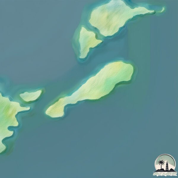
Welcome to Isola San Nicola, a Dry island in the Adriatic Sea, part of the majestic Atlantic Ocean. This guide offers a comprehensive overview of what makes Isola San Nicola unique – from its geography and climate to its population, infrastructure, and beyond. Dive into the details:
Geography and size of Isola San Nicola
Size: 0.502 km²
Coastline: 3.8 km
Ocean: Atlantic Ocean
Sea: Adriatic Sea
Continent: Europe
Isola San Nicola is a Tiny Island spanning 0.502 km² with a coastline of 3.8 km.
Archipel: –
Tectonic Plate: Eurasia – One of the world’s largest tectonic plates, the Eurasian Plate covers a significant portion of Europe and Asia. It’s characterized by diverse geological features, including the Ural Mountains, the European Plain, and the Himalayas formed from its collision with the Indian Plate.
The geographic heart of the island is pinpointed at these coordinates:
Latitude: 42.12412228 / Longitude: 15.5106207
Climate and weather of Isola San Nicola
Climate Zone: Dry
Climate Details: Cold Semi-Arid (Steppe) Climate
Temperature: Cold
Climate Characteristics: Characterized by hot summers and cold winters, this climate is typically found on the edges of continental zones. It receives sufficient precipitation to avoid desert conditions.
Topography and nature of Isola San Nicola
Timezone: UTC+01:00
Timezone places: Europe/Paris
Max. Elevation: 16 m
Mean Elevation: 7 m
Vegetation: Evergreen Needleleaf Forest
Tree Coverage: 0%
The mean elevation is 7 m. The highest elevation on the island reaches approximately 16 meters above sea level. The island is characterized by Plains: Flat, low-lying lands characterized by a maximum elevation of up to 200 meters. On islands, plains are typically coastal lowlands or central flat areas.
Dominating Vegetation: Evergreen Needleleaf Forest
Dominated by evergreen coniferous trees such as pines and firs, which retain their needle-like leaves throughout the year. These forests are often found in cooler climates. Isola San Nicola has a tree cover of 0 %.
Vegetation: 1 vegetation zones – Minimal Diversity Island
These islands exhibit the most basic level of ecological diversity, often characterized by a single dominant vegetation type. This could be due to extreme environmental conditions, limited land area, or significant human impact. They represent unique ecosystems where specific species have adapted to thrive in these singular environments.
Infrastructure and Travelling to Isola San Nicola
Does the island have a public airport? no.
There is no public and scheduled airport on Isola San Nicola. The nearest airport is San Domino Island Heliport, located 1 km away.
Does the island have a major port? no.
There are no major ports on Isola San Nicola. The closest major port is MANFREDONIA, approximately 72 km away.
The mean population of Isola San Nicola is 356 per km². Isola San Nicola is Moderately Inhabited. The island belongs to Croatia.
Continuing your journey, Otok Vis is the next notable island, situated merely km away.
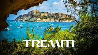
Tremiti Islands: How to Reach them (ferries, boats…), What to see, How and Why Visit the islands
If you are planning to visit Tremiti Islands, in Puglia – south of Italy, here you'll find the best tips on things to do along their coasts, ...Tremiti Islands: How to Reach them (ferries, boats…), What to see, How and Why Visit the islands
If you are planning to visit Tremiti Islands, in Puglia – south of ...
If you are planning to visit Tremiti Islands, in Puglia – south of Italy, here you'll find the best tips on things to do along their coasts, ...
Discover this Secret Italian Island You Have Never Heard of!
Explore a hidden gem in Italy with this video showcasing a secret ...
Explore a hidden gem in Italy with this video showcasing a secret Italian island you've never heard of before. Get ready for a ...
SAN NICOLA ISLAND - Tremiti Islands Italy/cinematic gopro hero 6
Denominata la ''Montecassino in mezzo al mare'' per l'imponente ...
Denominata la ''Montecassino in mezzo al mare'' per l'imponente Abbazia fortificata di Santa Maria a Mare, costruita dai ...
I am sure you have not visited this Italian Island yet!
We travelled with our family for one day to the Tremiti Islands, from ...
We travelled with our family for one day to the Tremiti Islands, from Termoli in Molise. We were surprised by the beauty and ...
We found a secret beach in Tremiti Islands
Our high school took a trip to Italy's incredible Tremiti Islands in ...
Our high school took a trip to Italy's incredible Tremiti Islands in Puglia. We climbed to the top of San Nicola and then took a swim ...
Travel Vlog • Tremiti Island Castle tour • Castle explore and views of the islands • Gargano Region
The rocky top of San Nicola Island, just off the Gargano coast of ...
The rocky top of San Nicola Island, just off the Gargano coast of Italy, gives a fantastic vantage point for the castle, the ancient ...
Tremiti islands, San Nicola, view from the top
Tremiti Islands San Nicola, Italy🇮🇹 (Isole Tremiti)
The Tremiti Islands, Italian Isole Tremiti (also called Diomedes ...
The Tremiti Islands, Italian Isole Tremiti (also called Diomedes Islands) are an archipelago located in the Italian Adriatic in the ...
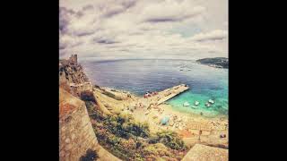
Isola San Nicola
Isola fantastica delle Tremiti, caratterizzata da mare trasparente e ...
Isola fantastica delle Tremiti, caratterizzata da mare trasparente e da una rocca medievale visitabile.
The Hidden Paradise of the Tremiti Islands
Discover the Enchanting Beauty of the Tremiti Islands! 🏝️ Join us on ...
Discover the Enchanting Beauty of the Tremiti Islands! 🏝️ Join us on an unforgettable journey to the Tremiti Islands, a hidden ...
Isola San Nicola - Isole Tremiti
Prima campagna di scavo all'Isola di San Nicola nell'arcipelago delle Tremiti. Maggio 2025.
Un breve video che racconta i primi risultati della prima campagna di ...
Un breve video che racconta i primi risultati della prima campagna di scavo nel maggio 2025 alle Isole Tremiti del progetto ...
20150831 Isola San Nicola
Isola di San Nicola- Tremiti
Isola San Nicola ( Isole Tremiti ) - St. Nicholas ( Tremiti Islands )
Isola San Nicola ( Isole Tremiti ) - St. Nicholas ( Tremiti Islands ) ...
Isola San Nicola ( Isole Tremiti ) - St. Nicholas ( Tremiti Islands ) - Insel San Nicola ( Tremiti Inseln ) - Ile de San Nicola ( Iles ...
MUST GO TO THIS ISLAND IN ITALY🇮🇹 #tremiti #italy #island
Amazing tremiti islands in the south of Italy! A must see, a bit ...
Amazing tremiti islands in the south of Italy! A must see, a bit expensive though .
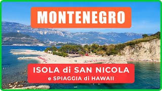
ISOLA di SAN NICOLA e spiaggia di Hawaii con panorama di Budva, Montenegro
L'Isola di San Nicola (Sveti Nikola) e la spiaggia di Hawaii su di ...
L'Isola di San Nicola (Sveti Nikola) e la spiaggia di Hawaii su di essa sono uno dei luoghi migliori sulle rive del Mar Adriatico in ...
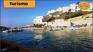
San Nicola - Isole Tremiti - Tremiti Islands
Santa Maria a Mare è un santuario, sito a San Nicola una delle isole ...
Santa Maria a Mare è un santuario, sito a San Nicola una delle isole Tremiti, che nel corso dei secoli è diventato monastero e ...
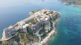
Isola di San Nicola - Tremiti 2025 by Luigi Livi
Il porto dell'isola è dominato dal complesso abbaziale fortificato di ...
Il porto dell'isola è dominato dal complesso abbaziale fortificato di Santa Maria a Mare, risalente all'XI secolo. Dal porticciolo ...
Tremiti Islands San Domino, Italy🇮🇹
The Tremiti Islands, Italian Isole Tremiti (also called Diomedes ...
The Tremiti Islands, Italian Isole Tremiti (also called Diomedes Islands) are an archipelago located in the Italian Adriatic in the ...
SAN DOMINO ISLAND, THE GARDEN OF PARADISE! Tremiti Islands Italy/cinematic gopro hero 6
Un altro breve viaggio……questa volta alla scoperta di San Domino, ...
Un altro breve viaggio……questa volta alla scoperta di San Domino, l'isola delle Tremiti detta ''L'Orto del Paradiso'', per la sua ...
Viaggi_andò? Verso le isole TREMITI, con approdo sull'Isola di San Nicola. 2/11/2024 VIDEO FULL HD
Viaggi_andò? Verso le isole TREMITI, con approdo sull'Isola di San ...
Viaggi_andò? Verso le isole TREMITI, con approdo sull'Isola di San Nicola. 2/11/2024 VIDEO FULL HD Città di Termoli ...
Isole Tremiti (FG) - Isola di San Nicola
L'isola di San Nicola è un'isola dell'Italia appartenente ...
L'isola di San Nicola è un'isola dell'Italia appartenente all'arcipelago delle isole Tremiti (o Diomedee), in Puglia, nel mar Adriatico ...
Le bellezze dell’isola di San Nicola, nelle Tremiti
IN QUESTO VIDEO ⇩ Un concentrato di meraviglie architettoniche e ...
IN QUESTO VIDEO ⇩ Un concentrato di meraviglie architettoniche e paesaggistiche che galleggia nelle acque che bagnano la ...
Tremiti Islands, San Domino Italy🇮🇹
The Tremiti Islands, Italian Isole Tremiti (also called Diomedes ...
The Tremiti Islands, Italian Isole Tremiti (also called Diomedes Islands) are an archipelago located in the Italian Adriatic in the ...
Croatia is classified as Developed region: nonG7: Developed economies outside of the Group of Seven, characterized by high income and advanced economic structures. The level of income is High income: nonOECD.
News – Latest Updates and Headlines from Isola San Nicola
Stay informed with the most recent news and important headlines from Isola San Nicola. Here’s a roundup of the latest developments.
Loading...
Please note: The data used here has been primarily extracted from satellite readings. Deviations from exact values may occur, particularly regarding the height of elevations and population density. Land area and coastline measurements refer to average values at mean high tide.