Isola Sant’Erasmo
Welcome to Isola Sant’Erasmo, a Temperate island in the Adriatic Sea, part of the majestic Atlantic Ocean. This guide offers a comprehensive overview of what makes Isola Sant’Erasmo unique – from its geography and climate to its population, infrastructure, and beyond. Dive into the details:
- Geography and Size: Explore the island’s size and location.
- Climate and Weather: Weather patterns and temperature.
- Topography and Nature: Uncover the natural wonders of the island.
- Infrastructure and Travelling: Insights on reaching, staying, and making the most of your visit.
- News and Headlines: Latest News.
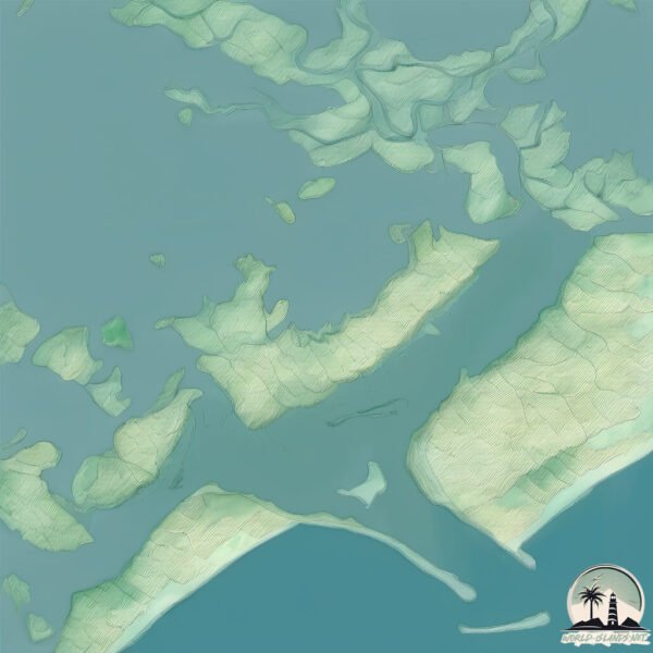
Geography and size of Isola Sant’Erasmo
Size: 4.722 km²
Coastline: 17.9 km
Ocean: Atlantic Ocean
Sea: Adriatic Sea
Continent: Europe
Isola Sant’Erasmo is a Small Island spanning 4.7 km² with a coastline of 17.9 km.
Archipel: –
Tectonic Plate: Eurasia – One of the world’s largest tectonic plates, the Eurasian Plate covers a significant portion of Europe and Asia. It’s characterized by diverse geological features, including the Ural Mountains, the European Plain, and the Himalayas formed from its collision with the Indian Plate.
The geographic heart of the island is pinpointed at these coordinates:
Latitude: 45.45822499 / Longitude: 12.40498859
Climate and weather of Isola Sant’Erasmo
Climate Zone: Temperate
Climate Details: Humid Subtropical Climate
Temperature: Hot Summer
Climate Characteristics: With continuous rainfall and hot summers, this climate is common in some coastal regions, supporting diverse vegetation.
Topography and nature of Isola Sant’Erasmo
Timezone: UTC+01:00
Timezone places: Europe/Paris
Max. Elevation: -1 m
Mean Elevation: -2 m
Vegetation: Urban Area
Tree Coverage: 64%
The mean elevation is -2 m. Remarkably, this unique island barely emerges above the sea level, showcasing nature’s fascinating interplay with the ocean. The island is characterized by Plains: Flat, low-lying lands characterized by a maximum elevation of up to 200 meters. On islands, plains are typically coastal lowlands or central flat areas.
Dominating Vegetation: Urban Area
Regions dominated by human development, including cities and towns, characterized by buildings, roads, and minimal vegetation. Isola Sant’Erasmo has a tree cover of 64 %.
Vegetation: 9 vegetation zones – Very Highly Diverse Island
Islands in this range are ecological powerhouses, showcasing a wide array of vegetation zones. Each zone, from lush rainforests to arid scrublands, coastal mangroves to mountainous regions, contributes to a complex and interdependent ecosystem. These islands are often hotspots of biodiversity, supporting numerous species and intricate ecological processes.
Infrastructure and Travelling to Isola Sant’Erasmo
Does the island have a public airport? no.
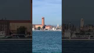
There is no public and scheduled airport on Isola Sant’Erasmo. The nearest airport is Venice Marco Polo Airport, located 6 km away.
Does the island have a major port? no.
There are no major ports on Isola Sant’Erasmo. The closest major port is PORTO DI LIDO-VENEZIA, approximately 5 km away.
The mean population of Isola Sant’Erasmo is 171 per km². Isola Sant’Erasmo is Moderately Inhabited. The island belongs to Italy.
Continuing your journey, Isola di Polesine is the next notable island, situated merely km away.
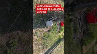
Island Farms & Wine: A Visit to the Island of Sant'Erasmo


Italy is classified as Developed region: G7: Group of Seven – Major advanced economies, including Canada, France, Germany, Italy, Japan, the United Kingdom, and the United States. The level of income is High income: OECD.
News – Latest Updates and Headlines from Isola Sant’Erasmo
Stay informed with the most recent news and important headlines from Isola Sant’Erasmo. Here’s a roundup of the latest developments.
Please note: The data used here has been primarily extracted from satellite readings. Deviations from exact values may occur, particularly regarding the height of elevations and population density. Land area and coastline measurements refer to average values at mean high tide.