Welcome to Jarvis, a Tropical island in the South Pacific Ocean, part of the majestic Pacific Ocean. This guide offers a comprehensive overview of what makes Jarvis unique – from its geography and climate to its population, infrastructure, and beyond. Dive into the details:
Geography and size of Jarvis
Size: 4.554 km²
Coastline: 8.4 km
Ocean: Pacific Ocean
Sea: South Pacific Ocean
Continent: Oceania
Jarvis is a Small Island spanning 4.6 km² with a coastline of 8.4 km.
Archipel: Kiribati – An island nation in the central Pacific Ocean, comprising 33 atolls and reef islands, known for their vibrant culture and significant challenges due to climate change.
Tectonic Plate: South America – A major plate covering the South American continent and part of the Atlantic Ocean, known for the Andes mountain range and significant seismic and volcanic activity.
The geographic heart of the island is pinpointed at these coordinates:
Latitude: -0.37336468 / Longitude: -159.99695255
Climate and weather of Jarvis
Climate Zone: Tropical
Climate Details: Tropical Savanna, Wet
Temperature: Hot
Climate Characteristics: Defined by distinct wet and dry seasons with high temperatures year-round. Pronounced rainfall occurs during the wet season, while the dry season is marked by drought.
Topography and nature of Jarvis
Timezone: UTC-11:00
Timezone places:
Max. Elevation: -104 m
Mean Elevation: -276 m
Vegetation: Herbaceous Cover
Tree Coverage: 27%
The mean elevation is -276 m. Remarkably, this unique island barely emerges above the sea level, showcasing nature’s fascinating interplay with the ocean. The island is characterized by Plains: Flat, low-lying lands characterized by a maximum elevation of up to 200 meters. On islands, plains are typically coastal lowlands or central flat areas.
Dominating Vegetation: Herbaceous Cover
Comprising mainly of grasses, herbs, and ferns, these areas are common in prairies, meadows, and savannas, and can vary widely in species composition. Jarvis has a tree cover of 27 %.
Vegetation: 2 vegetation zones – Low Diversity Island
Islands with two distinct vegetation zones offer slightly more ecological variety. These zones could be due to differences in elevation, moisture, or other environmental factors. While still limited in biodiversity, these islands may offer a contrast between the two zones, such as a coastline with mangroves and an inland area with grassland.
Infrastructure and Travelling to Jarvis
Does the island have a public airport? no.
There is no public and scheduled airport on Jarvis. The nearest airport is Cassidy International Airport, located 393 km away.
Does the island have a major port? no.
There are no major ports on Jarvis. The closest major port is ENGLISH HARBOR, approximately 473 km away.
The mean population of Jarvis is per km². Jarvis is . The island belongs to United States of America.
Continuing your journey, Kiribati is the next notable island, situated merely km away.
Examining America's Most Deserted Island... Jarvis Island
It's been awhile! Today I examine Jarvis Island on Google Maps, old newspapers, and whatever other sources I kind find! Jarvis ...Examining America's Most Deserted Island... Jarvis Island
It's been awhile! Today I examine Jarvis Island on Google Maps, old ...
It's been awhile! Today I examine Jarvis Island on Google Maps, old newspapers, and whatever other sources I kind find! Jarvis ...
Exploration of Jarvis Island
Explore Jarvis Island in the Pacific, featuring its seabird ...
Explore Jarvis Island in the Pacific, featuring its seabird population, coral reefs, and insights on ancient survival skills.
N5J Jarvis Island dxpedition 2024
Background information on Jarvis Island!
OK, before we get to the soap, I thought I'd give you some information ...
OK, before we get to the soap, I thought I'd give you some information on my pick for March for the 2013 Universal Soap ...
#41 iron man's Jarvis⚙️island Google earth.secret places in Google map & Google earth#shorts
ironman #tonystark #jarvis #shorts #trending #googlemap #googleearth ...
ironman #tonystark #jarvis #shorts #trending #googlemap #googleearth #map #planet #nature #photography #travel ...
Breathtaking Biodiversity of Jarvis Island Revisited | Nautilus Live
Enjoy a throwback to our 2019 deep sea expedition near Jarvis Island ...
Enjoy a throwback to our 2019 deep sea expedition near Jarvis Island (NA110) exploring within into Pacific Remote Islands ...
U.S. Territories that most people don’t know about 🇺🇸
Did you know the United States owns more than just the 50 states? ...
Did you know the United States owns more than just the 50 states? Beyond Puerto Rico and Guam, there are smaller, often ...
jarvis island map and flag
Jarvis Island | Wikipedia audio article
This is an audio version of the Wikipedia Article: Jarvis Island ...
This is an audio version of the Wikipedia Article: Jarvis Island Listening is a more natural way of learning, when compared to ...
Under a Jarvis Moon | PBS Hawaiʻi Presents
Under a Jarvis Moon tells the story of 130 young men from Hawaiʻi who ...
Under a Jarvis Moon tells the story of 130 young men from Hawaiʻi who were part of a clandestine mission by the U.S. federal ...
This is the World's Most Remote Island..
The World's Most Remote Islands are the Pitcairn Islands located in ...
The World's Most Remote Islands are the Pitcairn Islands located in the south pacific ocean. The town here is known as ...
Exploring the Uncharted: Mapping Jarvis Island's Hidden Depths | Nautilus Live
For our final mission of 2023, our Corps of Exploration aboard E/V ...
For our final mission of 2023, our Corps of Exploration aboard E/V Nautilus set out to map the seafloor near Jarvis Island inside a ...
Jarvis Island River Cleanup CRC
The Remote Island With A Statue That Nobody Can Explain
This is a bit of a continuation of our first video from this season, ...
This is a bit of a continuation of our first video from this season, but the story was so uniquely its own that I decided to split it off into ......[+] Show More Jarvis Island
Jarvis Island is an uninhabited 1 3⁄4-square-mile coral island located ...
Jarvis Island is an uninhabited 1 3⁄4-square-mile coral island located in the South Pacific Ocean at 0°22′S 160°01′W, about ...
Jarvis Island #usa #us #pacific #island #ocean #adventure #shorts #trending #subscribe #facts #gk
Holothurian @ Jarvis Island
July 3-4, 2019 @ Jarvis Island The #nautiluslive vehicles are ...
July 3-4, 2019 @ Jarvis Island The #nautiluslive vehicles are currently at a depth of 1500m and will begin exploring a ...
The Banjoman of Jarvis Island
Scuba Diving - Jarvis Island
Jarvis Island Underwater Footage 2/17/2001 -
Jarvis Island Underwater Footage 2/17/2001 -
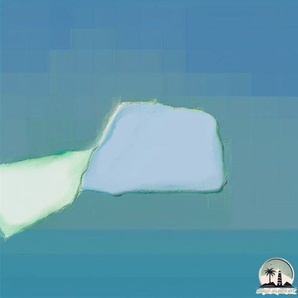
Simple Map of Jarvis Island #mapping
mapping #maps #map #mapper #mappers #lilsimsie #newmexico #mexico ...
mapping #maps #map #mapper #mappers #lilsimsie #newmexico #mexico #world #earth #water #land #painting #paint ...
Zwift’s Jarvis Island Returns!
Zwift resurrects the legendary Jarvis Island to mark its 10th ...
Zwift resurrects the legendary Jarvis Island to mark its 10th anniversary. ---------------------------- FIND SMART BIKE TRAINER HERE ...
Islands On Earth If You Go To, You Will Die! #Shorts
Flag of Jarvis Island
Jarvis Island Is Located South of Hawaii,Surrounded By Kiribati And ...
Jarvis Island Is Located South of Hawaii,Surrounded By Kiribati And North of The Cook Islands (The Flag of The USA Is Used)
United States of America is classified as Developed region: G7: Group of Seven – Major advanced economies, including Canada, France, Germany, Italy, Japan, the United Kingdom, and the United States. The level of income is High income: OECD.
News – Latest Updates and Headlines from Jarvis
Stay informed with the most recent news and important headlines from Jarvis. Here’s a roundup of the latest developments.
Loading...
Please note: The data used here has been primarily extracted from satellite readings. Deviations from exact values may occur, particularly regarding the height of elevations and population density. Land area and coastline measurements refer to average values at mean high tide.