Jazīrat Tīrān
Welcome to Jazīrat Tīrān, a Dry island in the Gulf of Aqaba, part of the majestic Indian Ocean. This guide offers a comprehensive overview of what makes Jazīrat Tīrān unique – from its geography and climate to its population, infrastructure, and beyond. Dive into the details:
- Geography and Size: Explore the island’s size and location.
- Climate and Weather: Weather patterns and temperature.
- Topography and Nature: Uncover the natural wonders of the island.
- Infrastructure and Travelling: Insights on reaching, staying, and making the most of your visit.
- News and Headlines: Latest News.
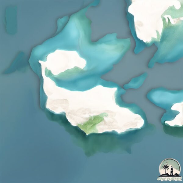
Geography and size of Jazīrat Tīrān
Size: 63.1 km²
Coastline: 55.4 km
Ocean: Indian Ocean
Sea: Gulf of Aqaba
Continent: Africa
Jazīrat Tīrān is a Medium Island spanning 63 km² with a coastline of 55 km.
Archipel: –
Tectonic Plate: Arabia – A major tectonic plate covering the Arabian Peninsula and parts of the Middle East. The plate is primarily continental and known for its collision with the Eurasian Plate, leading to the uplift of the Zagros Mountains.
The geographic heart of the island is pinpointed at these coordinates:
Latitude: 27.95312049 / Longitude: 34.55175908
Climate and weather of Jazīrat Tīrān
Climate Zone: Dry
Climate Details: Hot Deserts Climate
Temperature: Hot
Climate Characteristics: Dominated by extremely hot temperatures, this climate is marked by minimal rainfall and barren landscapes. Nights often experience drastic temperature drops.
Topography and nature of Jazīrat Tīrān
Timezone: UTC+03:00
Timezone places: Asia/Riyadh
Max. Elevation: 410 m
Mean Elevation: 73 m
Vegetation: Rocky Terrain
Tree Coverage: 1%
The mean elevation is 73 m. The highest elevation on the island reaches approximately 410 meters above sea level. The island is characterized by Hills: Gently sloping landforms with rounded tops, having a maximum elevation between 200 and 500 meters. Hills contribute to a varied landscape on islands.
Dominating Vegetation: Rocky Terrain
Landscapes dominated by gravel, rock, and stone, with little to no vegetation. These areas are often found in mountainous regions or deserts. Jazīrat Tīrān has a tree cover of 1 %.
Vegetation: 4 vegetation zones – Diverse Island
Four distinct vegetation zones mark these islands as ecologically diverse. They might feature varied landscapes such as forests, beaches, grasslands, and rocky areas. Such diversity reflects the island’s complex ecological interactions and varied habitats, which can support a rich array of wildlife and plant species.
Infrastructure and Travelling to Jazīrat Tīrān
Does the island have a public airport? no.
There is no public and scheduled airport on Jazīrat Tīrān. The nearest airport is Sharm El Sheikh International Airport, located 11 km away.
Does the island have a major port? no.
There are no major ports on Jazīrat Tīrān. The closest major port is SHARM EL SHEIKH, approximately 27 km away.
The mean population of Jazīrat Tīrān is 52 per km². Jazīrat Tīrān is Gently Populated. The island belongs to Saudi Arabia.
Continuing your journey, Jazīrat Şanāfīr is the next notable island, situated merely km away.
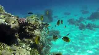
Sharm Cruise Tour | Tiran Island Boat Excursion in Sharm


Saudi Arabia is classified as Emerging region: G20: Group of Twenty – Major economies comprising both developed and emerging countries, representing the world’s largest economies. The level of income is Lower middle income.
News – Latest Updates and Headlines from Jazīrat Tīrān
Stay informed with the most recent news and important headlines from Jazīrat Tīrān. Here’s a roundup of the latest developments.
Please note: The data used here has been primarily extracted from satellite readings. Deviations from exact values may occur, particularly regarding the height of elevations and population density. Land area and coastline measurements refer to average values at mean high tide.