Juan A. Ramirez
Welcome to Juan A. Ramirez, a Tropical island in the Gulf of Mexico, part of the majestic Atlantic Ocean. This guide offers a comprehensive overview of what makes Juan A. Ramirez unique – from its geography and climate to its population, infrastructure, and beyond. Dive into the details:
- Geography and Size: Explore the island’s size and location.
- Climate and Weather: Weather patterns and temperature.
- Topography and Nature: Uncover the natural wonders of the island.
- Infrastructure and Travelling: Insights on reaching, staying, and making the most of your visit.
- News and Headlines: Latest News.
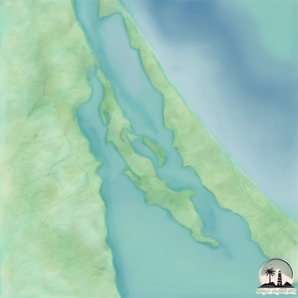
Geography and size of Juan A. Ramirez
Size: 30.2 km²
Coastline: 53.8 km
Ocean: Atlantic Ocean
Sea: Gulf of Mexico
Continent: North America
Juan A. Ramirez is a Medium Island spanning 30 km² with a coastline of 54 km.
Archipel: –
Tectonic Plate: North America – Covers North America and parts of the Atlantic and Arctic Oceans, characterized by diverse geological features and varying levels of seismic activity.
The geographic heart of the island is pinpointed at these coordinates:
Latitude: 21.7814573 / Longitude: -97.65691639
Climate and weather of Juan A. Ramirez
Climate Zone: Tropical
Climate Details: Tropical Savanna, Wet
Temperature: Hot
Climate Characteristics: Defined by distinct wet and dry seasons with high temperatures year-round. Pronounced rainfall occurs during the wet season, while the dry season is marked by drought.
Topography and nature of Juan A. Ramirez
Timezone: UTC-06:00
Timezone places: America/Chicago
Max. Elevation: 25 m
Mean Elevation: 9 m
Vegetation: Cultivated Land
Tree Coverage: 39%
The mean elevation is 9 m. The highest elevation on the island reaches approximately 25 meters above sea level. The island is characterized by Plains: Flat, low-lying lands characterized by a maximum elevation of up to 200 meters. On islands, plains are typically coastal lowlands or central flat areas.
Dominating Vegetation: Cultivated Land
Areas dedicated to agricultural activities, growing crops like grains, vegetables, and fruits. These lands are usually human-modified landscapes. Juan A. Ramirez has a tree cover of 39 %.
Vegetation: 11 vegetation zones – Exceptionally Diverse Island
Islands with more than ten vegetation zones are among the most ecologically rich and varied in the world. These islands are akin to miniature continents, boasting an incredible array of ecosystems. The sheer range of habitats, from high peaks to deep valleys, rainforests to deserts, creates a mosaic of life that is unparalleled. They are crucial for conservation and ecological studies.
Infrastructure and Travelling to Juan A. Ramirez
Does the island have a public airport? no.
There is no public and scheduled airport on Juan A. Ramirez. The nearest airport is General Francisco Javier Mina International Airport, located 50 km away.
Does the island have a major port? no.
There are no major ports on Juan A. Ramirez. The closest major port is TAMPICO, approximately 42 km away.
The mean population of Juan A. Ramirez is 25 per km². Juan A. Ramirez is Gently Populated. The island belongs to Mexico.
Continuing your journey, El Idolo is the next notable island, situated merely km away.
Isla Juan A. Ramirez


Mexico is classified as Emerging region: MIKT: Mexico, Indonesia, South Korea, and Turkey – Economies recognized for their development potential and emerging market status. The level of income is Upper middle income.
News – Latest Updates and Headlines from Juan A. Ramirez
Stay informed with the most recent news and important headlines from Juan A. Ramirez. Here’s a roundup of the latest developments.
Please note: The data used here has been primarily extracted from satellite readings. Deviations from exact values may occur, particularly regarding the height of elevations and population density. Land area and coastline measurements refer to average values at mean high tide.