Welcome to Kagamil, a Polar island in the Bering Sea, part of the majestic Pacific Ocean. This guide offers a comprehensive overview of what makes Kagamil unique – from its geography and climate to its population, infrastructure, and beyond. Dive into the details:
Geography and size of Kagamil
Size: 40.4 km²
Coastline: 51.5 km
Ocean: Pacific Ocean
Sea: Bering Sea
Continent: North America
Kagamil is a Medium Island spanning 40 km² with a coastline of 51 km.
Archipel: Aleutian Islands – A chain of islands stretching from Alaska to Russia, known for their rugged beauty, abundant wildlife, and volcanic activity.
Tectonic Plate: North America – Covers North America and parts of the Atlantic and Arctic Oceans, characterized by diverse geological features and varying levels of seismic activity.
The geographic heart of the island is pinpointed at these coordinates:
Latitude: 52.9920769 / Longitude: -169.71485373
Climate and weather of Kagamil
Climate Zone: Polar
Climate Details: Tundra
Temperature: Cold
Climate Characteristics: The tundra climate features long, extremely cold winters and short, cool summers. Vegetation is limited to mosses, lichens, and small shrubs due to the low temperatures and short growing seasons. Biodiversity is low, but some specialized species thrive.
Topography and nature of Kagamil
Timezone: UTC-10:00
Timezone places: Pacific/Honolulu
Max. Elevation: 784 m
Mean Elevation: 218 m
Vegetation: Herbaceous Cover
Tree Coverage: 39%
The mean elevation is 218 m. The highest elevation on the island reaches approximately 784 meters above sea level. The island is characterized by Plateau: Elevated flatlands rising sharply above the surrounding area, with a maximum elevation over 500 meters but a mean elevation less than 300 meters, forming unique highland areas on islands.
Dominating Vegetation: Herbaceous Cover
Comprising mainly of grasses, herbs, and ferns, these areas are common in prairies, meadows, and savannas, and can vary widely in species composition. Kagamil has a tree cover of 39 %.
Vegetation: 12 vegetation zones – Exceptionally Diverse Island
Islands with more than ten vegetation zones are among the most ecologically rich and varied in the world. These islands are akin to miniature continents, boasting an incredible array of ecosystems. The sheer range of habitats, from high peaks to deep valleys, rainforests to deserts, creates a mosaic of life that is unparalleled. They are crucial for conservation and ecological studies.
Infrastructure and Travelling to Kagamil
Does the island have a public airport? no.
There is no public and scheduled airport on Kagamil. The nearest airport is Tom Madsen (Dutch Harbor) Airport, located 360 km away.
Does the island have a major port? no.
There are no major ports on Kagamil. The closest major port is MAKUSHIN, approximately 309 km away.
The mean population of Kagamil is 0 per km². Kagamil is Uninhabited. The island belongs to United States of America.
Continuing your journey, Chuginadak is the next notable island, situated merely km away.
KL7RRC/P Kagamil Island. From dxnews.com
Yuri, N3QQ and Tim, NL8F will be active as KL7RRC/P from Kagamil Island, Islands of Four Mountains, IOTA NA - 234, 23 - 26 ...KL7RRC/P Kagamil Island. From dxnews.com
Yuri, N3QQ and Tim, NL8F will be active as KL7RRC/P from Kagamil ...
Yuri, N3QQ and Tim, NL8F will be active as KL7RRC/P from Kagamil Island, Islands of Four Mountains, IOTA NA - 234, 23 - 26 ...
Volcano of the Day: 12-31-21 Kagamil, Alaska
shorts #Volcano #Kagamil #Alaska on December 31st, 2021. Don't forget ...
shorts #Volcano #Kagamil #Alaska on December 31st, 2021. Don't forget to subscribe and hit the bell for future updates.
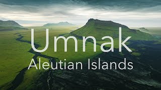
Umnak - Aleutian Islands
40 day long trip across the Umnak Island The Aleutian Islands are an ...
40 day long trip across the Umnak Island The Aleutian Islands are an archipelago of 110 volcanic islands in the North Pacific ...
KL7RRC/P Остров Кагамил. С сайта dxnews.com
Юрий, N3QQ и Тим, NL8F будут активны с острова Кагамил, ...
Юрий, N3QQ и Тим, NL8F будут активны с острова Кагамил, Четырехсопочные острова, IOTA NA - 234, 23 - 26 мая 2018, ...
Video of Mummy from Kagamil Island2
The Aleutian mummies of Kagamil cave
Where am I? #188
Where am I? And I would fly five thousand miles and I would fly five ...
Where am I? And I would fly five thousand miles and I would fly five thousand more just to be the one who flew ten thousand ...
EXPLOSIVE NEW EVIDENCE: Giant Aleutian Caldera's Hidden Threat
EXPLOSIVE NEW EVIDENCE: Giant Aleutian Caldera's Hidden Threat ...
EXPLOSIVE NEW EVIDENCE: Giant Aleutian Caldera's Hidden Threat Discover the fascinating discovery of geologists who found ...
New island in Alaska discovered on satellite
The U.S. state with the most islands in the country can now add one ...
The U.S. state with the most islands in the country can now add one more to the list. Alaska's Prow Knob is a small mountainous ...
This Week in Volcano News; Lascar Alert Level Raised, 6+ Mile Exclusion Zone
It appears that the Lascar volcano is primed for a new eruption. As a ...
It appears that the Lascar volcano is primed for a new eruption. As a result, a 10 kilometer or slightly more than 6 mile exclusion ...
What is Uliaga Island? Explain Uliaga Island, Define Uliaga Island, Meaning of Uliaga Island
UliagaIsland #audioversity ~~~ Uliaga Island ~~~ Title: What is Uliaga ...
UliagaIsland #audioversity ~~~ Uliaga Island ~~~ Title: What is Uliaga Island? Explain Uliaga Island, Define Uliaga Island, ...
A Place Where Time Stands Still: Aleutian Islands
Thank you so much for joining me on this adventure. Please don't ...
Thank you so much for joining me on this adventure. Please don't forget to like this video, and subscribe to my YouTube channel, ...
Alaskas geheimes Supervulkan-Risiko: Noch gefährlicher als Yellowstone?
Hast du schon vom versteckten Supervulkan unter Alaskas Aleuten-Inseln ...
Hast du schon vom versteckten Supervulkan unter Alaskas Aleuten-Inseln gehört? In diesem Video nehmen wir dich mit auf eine ...
How many People LIVE in the Aleutian Islands? #distantelephant #alaska #geography #maps #islands
Bogoslof island is top of an underwater volcano that is protected by the Alaska National wildlife
The Island Where Air Can Kill You!
Discover Miyake-jima, Japan, one of the most dangerous islands in the ...
Discover Miyake-jima, Japan, one of the most dangerous islands in the world. This volcanic island constantly releases toxic gas, ...
Alaska Tanaga Volcano: Earthquake Swarms Started, Every 2-3 Minutes An Earthquake, Aleutian Islands
This is an archive material, not new. I am a geologist by profession ...
This is an archive material, not new. I am a geologist by profession and training. This is an educational channel devoted mostly to ...
Magnitude 5.6 Earthquake Depth 10 km Strikes Kodiak Island Region, Alaska on 1st Sept 2025
Earthquake Subject To Change The Kodiak Island region of Alaska, also ...
Earthquake Subject To Change The Kodiak Island region of Alaska, also known as "Alaska's Emerald Isle," is a mountainous, ...
Koniuji Island Top # 6 Facts
Koniuji Island Top # 6 Facts.
Koniuji Island Top # 6 Facts.
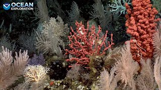
EX2304 Dive 07 Uliaga Mound July 23 2023
Another spectacular dive, strongly recommended. ROV reaches bottom at ...
Another spectacular dive, strongly recommended. ROV reaches bottom at 01:11:34 ...
Amukta Island, Alaska Earthquake August 25th, 2018
Shorts #Shorts #Shorts #Shorts #Shorts #Shorts This is my video ...
Shorts #Shorts #Shorts #Shorts #Shorts #Shorts This is my video recorded with DU Recorder. It's easy to record your screen and ...
Atherosclerosis in the ancient world Video 3: 1/4
Published: 11 March 2013 Three-dimensional (3D) volume rendered ...
Published: 11 March 2013 Three-dimensional (3D) volume rendered mvi.movie CT reconstruction of four mummies with ...
Atherosclerosis in the ancient world Video 1: 2/2
Published: 11 March 2013 Three-dimensional (3D) volume rendered ...
Published: 11 March 2013 Three-dimensional (3D) volume rendered mvi.movie CT reconstructions of two mummies with coronary ...
Jeff Wraley Carlisle Island
My uncle Jeff Wraley's video documentation of his discovery of an ...
My uncle Jeff Wraley's video documentation of his discovery of an Aleut burial site in the Aleutian Island chain in 1988.
United States of America is classified as Developed region: G7: Group of Seven – Major advanced economies, including Canada, France, Germany, Italy, Japan, the United Kingdom, and the United States. The level of income is High income: OECD.
News – Latest Updates and Headlines from Kagamil
Stay informed with the most recent news and important headlines from Kagamil. Here’s a roundup of the latest developments.
Loading...
Please note: The data used here has been primarily extracted from satellite readings. Deviations from exact values may occur, particularly regarding the height of elevations and population density. Land area and coastline measurements refer to average values at mean high tide.