Kālubhār Tāpu
Welcome to Kālubhār Tāpu, a Dry island in the Arabian Sea, part of the majestic Indian Ocean. This guide offers a comprehensive overview of what makes Kālubhār Tāpu unique – from its geography and climate to its population, infrastructure, and beyond. Dive into the details:
- Geography and Size: Explore the island’s size and location.
- Climate and Weather: Weather patterns and temperature.
- Topography and Nature: Uncover the natural wonders of the island.
- Infrastructure and Travelling: Insights on reaching, staying, and making the most of your visit.
- News and Headlines: Latest News.
Geography and size of Kālubhār Tāpu
Size: 29.6 km²
Coastline: 34.8 km
Ocean: Indian Ocean
Sea: Arabian Sea
Continent: Asia
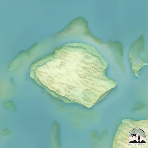
Kālubhār Tāpu is a Medium Island spanning 30 km² with a coastline of 35 km.
Archipel: –
Tectonic Plate: India – A major tectonic plate that initially moved northward at a rapid pace before colliding with the Eurasian Plate. This collision is responsible for the uplift of the Himalayas and the Tibetan Plateau.
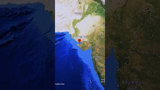
The geographic heart of the island is pinpointed at these coordinates:
Latitude: 22.43511484 / Longitude: 69.62199182
Climate and weather of Kālubhār Tāpu
Climate Zone: Dry
Climate Details: Hot Semi-Arid (Steppe) Climate
Temperature: Hot
Climate Characteristics: Features hot summers and mild to warm winters. Receives more rainfall than hot deserts but less than tropical savannas, leading to a somewhat more varied landscape.
Topography and nature of Kālubhār Tāpu
Timezone: UTC+05:30
Timezone places: Asia/Kolkata
Max. Elevation: 6 m
Mean Elevation: 3 m
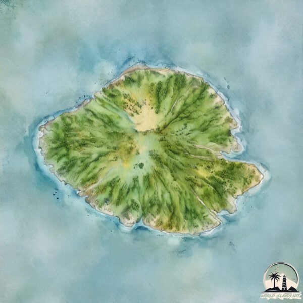
Vegetation: Sparse Vegetation
Tree Coverage: 46%
The mean elevation is 3 m. The highest elevation on the island reaches approximately 6 meters above sea level. The island is characterized by Plains: Flat, low-lying lands characterized by a maximum elevation of up to 200 meters. On islands, plains are typically coastal lowlands or central flat areas.
Dominating Vegetation: Sparse Vegetation
These regions have limited plant growth, typically due to extreme conditions like aridity or poor soils. Vegetation is scattered and consists of hardy plant species. Kālubhār Tāpu has a tree cover of 46 %.
Vegetation: 7 vegetation zones – Very Highly Diverse Island
Islands in this range are ecological powerhouses, showcasing a wide array of vegetation zones. Each zone, from lush rainforests to arid scrublands, coastal mangroves to mountainous regions, contributes to a complex and interdependent ecosystem. These islands are often hotspots of biodiversity, supporting numerous species and intricate ecological processes.
Infrastructure and Travelling to Kālubhār Tāpu
Does the island have a public airport? no.
There is no public and scheduled airport on Kālubhār Tāpu. The nearest airport is Jamnagar Airport, located 40 km away.
Does the island have a major port? no.
There are no major ports on Kālubhār Tāpu. The closest major port is VADINAR TERMINAL, approximately 9 km away.
The mean population of Kālubhār Tāpu is 754 per km². Kālubhār Tāpu is Densely Populated. The island belongs to India.
Continuing your journey, Dēra is the next notable island, situated merely km away.
Gujarat Unhabitable island Kalubhar Island #shorts #island

India is classified as Emerging region: BRIC: Brazil, Russia, India, and China – Economies noted for their rapid growth and increasing influence on global affairs. The level of income is Lower middle income.
News – Latest Updates and Headlines from Kālubhār Tāpu
Stay informed with the most recent news and important headlines from Kālubhār Tāpu. Here’s a roundup of the latest developments.
Please note: The data used here has been primarily extracted from satellite readings. Deviations from exact values may occur, particularly regarding the height of elevations and population density. Land area and coastline measurements refer to average values at mean high tide.