Kanuyak
Welcome to Kanuyak, a Continental island in the The Northwestern Passages, part of the majestic Arctic Ocean. This guide offers a comprehensive overview of what makes Kanuyak unique – from its geography and climate to its population, infrastructure, and beyond. Dive into the details:
- Geography and Size: Explore the island’s size and location.
- Climate and Weather: Weather patterns and temperature.
- Topography and Nature: Uncover the natural wonders of the island.
- Infrastructure and Travelling: Insights on reaching, staying, and making the most of your visit.
- News and Headlines: Latest News.
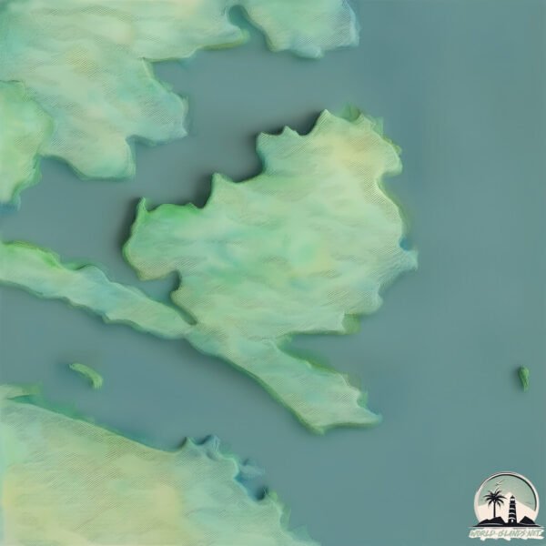
Geography and size of Kanuyak
Size: 76.9 km²
Coastline: 95.8 km
Ocean: Arctic Ocean
Sea: The Northwestern Passages
Continent: North America
Kanuyak is a Medium Island spanning 77 km² with a coastline of 96 km.
Archipel: –
Tectonic Plate: North America – Covers North America and parts of the Atlantic and Arctic Oceans, characterized by diverse geological features and varying levels of seismic activity.
The geographic heart of the island is pinpointed at these coordinates:
Latitude: 67.41252684 / Longitude: -107.94318863
Climate and weather of Kanuyak
Climate Zone: Continental
Climate Details: Subarctic Climate
Temperature: Cold Summer
Climate Characteristics: Characterized by long, extremely cold winters and short, cool summers, often found in northern latitudes of North America and Eurasia.
Topography and nature of Kanuyak
Timezone: UTC-07:00
Timezone places: America/Denver
Max. Elevation: 252 m
Mean Elevation: 25 m
Vegetation: Herbaceous Cover
Tree Coverage: 14%
The mean elevation is 25 m. The highest elevation on the island reaches approximately 252 meters above sea level. The island is characterized by Hills: Gently sloping landforms with rounded tops, having a maximum elevation between 200 and 500 meters. Hills contribute to a varied landscape on islands.
Dominating Vegetation: Herbaceous Cover
Comprising mainly of grasses, herbs, and ferns, these areas are common in prairies, meadows, and savannas, and can vary widely in species composition. Kanuyak has a tree cover of 14 %.
Vegetation: 5 vegetation zones – Highly Diverse Island
With five different vegetation zones, these islands offer a rich tapestry of ecosystems. The variety could include dense forests, open meadows, wetlands, coastal zones, and more. This level of diversity supports an intricate web of life, with each zone playing a vital role in the overall ecological health and balance of the island.
Infrastructure and Travelling to Kanuyak
Does the island have a public airport? no.
There is no public and scheduled airport on Kanuyak. The nearest airport is Cambridge Bay Airport, located 354 km away.
Does the island have a major port? no.
There are no major ports on Kanuyak. The closest major port is CAMBRIDGE BAY, approximately 361 km away.
The mean population of Kanuyak is 0 per km². Kanuyak is Uninhabited. The island belongs to Canada.
Continuing your journey, Ekululia is the next notable island, situated merely km away.
Canada is classified as Developed region: G7: Group of Seven – Major advanced economies, including Canada, France, Germany, Italy, Japan, the United Kingdom, and the United States. The level of income is High income: OECD.
News – Latest Updates and Headlines from Kanuyak
Stay informed with the most recent news and important headlines from Kanuyak. Here’s a roundup of the latest developments.
Please note: The data used here has been primarily extracted from satellite readings. Deviations from exact values may occur, particularly regarding the height of elevations and population density. Land area and coastline measurements refer to average values at mean high tide.