Kaôh Kândal
Welcome to Kaôh Kândal, a Tropical island in the South China Sea, part of the majestic Pacific Ocean. This guide offers a comprehensive overview of what makes Kaôh Kândal unique – from its geography and climate to its population, infrastructure, and beyond. Dive into the details:
- Geography and Size: Explore the island’s size and location.
- Climate and Weather: Weather patterns and temperature.
- Topography and Nature: Uncover the natural wonders of the island.
- Infrastructure and Travelling: Insights on reaching, staying, and making the most of your visit.
- News and Headlines: Latest News.
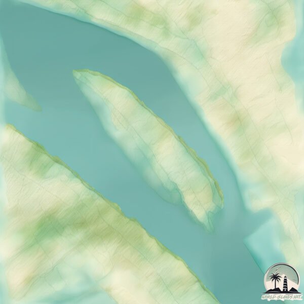
Geography and size of Kaôh Kândal
Size: 1.302 km²
Coastline: 7.9 km
Ocean: Pacific Ocean
Sea: South China Sea
Continent: Asia
Kaôh Kândal is a Small Island spanning 1.3 km² with a coastline of 7.9 km.
Archipel: –
Tectonic Plate: Sunda – Extends across Southeast Asia, encompassing parts of the Sunda Shelf, known for its interaction with the Australian Plate, contributing to volcanic activity in Indonesia.
The geographic heart of the island is pinpointed at these coordinates:
Latitude: 11.42115278 / Longitude: 105.2343619
Climate and weather of Kaôh Kândal
Climate Zone: Tropical
Climate Details: Tropical Savanna, Wet
Temperature: Hot
Climate Characteristics: Defined by distinct wet and dry seasons with high temperatures year-round. Pronounced rainfall occurs during the wet season, while the dry season is marked by drought.
Topography and nature of Kaôh Kândal
Timezone: UTC+07:00
Timezone places: Asia/Jakarta
Max. Elevation: 5 m
Mean Elevation: 5 m
Vegetation: Rice Paddy
Tree Coverage: 38%
The mean elevation is 5 m. The highest elevation on the island reaches approximately 5 meters above sea level. The island is characterized by Plains: Flat, low-lying lands characterized by a maximum elevation of up to 200 meters. On islands, plains are typically coastal lowlands or central flat areas.
Dominating Vegetation: Rice Paddy
Specifically designed for rice cultivation, these fields are flooded with water during the growing season. Paddy fields are a common sight in many parts of Asia. Kaôh Kândal has a tree cover of 38 %.
Vegetation: 1 vegetation zones – Minimal Diversity Island
These islands exhibit the most basic level of ecological diversity, often characterized by a single dominant vegetation type. This could be due to extreme environmental conditions, limited land area, or significant human impact. They represent unique ecosystems where specific species have adapted to thrive in these singular environments.
Infrastructure and Travelling to Kaôh Kândal
Does the island have a public airport? no.
There is no public and scheduled airport on Kaôh Kândal. The nearest airport is Phnom Penh International Airport, located 44 km away.
Does the island have a major port? no.
There are no major ports on Kaôh Kândal. The closest major port is THANH HO CHI MINH, approximately 179 km away.
The mean population of Kaôh Kândal is 359 per km². Kaôh Kândal is Moderately Inhabited. The island belongs to Cambodia.
Continuing your journey, Cù Lao Long Khành is the next notable island, situated merely km away.
Asian Travel | Visit Prek Ta Meak Bridge - Phnom Penh - Cambodia - Part3 | Top 10s
Cambodia is classified as Least developed region: Countries that exhibit the lowest indicators of socioeconomic development, with the lowest Human Development Index ratings. The level of income is Low income.
News – Latest Updates and Headlines from Kaôh Kândal
Stay informed with the most recent news and important headlines from Kaôh Kândal. Here’s a roundup of the latest developments.
Please note: The data used here has been primarily extracted from satellite readings. Deviations from exact values may occur, particularly regarding the height of elevations and population density. Land area and coastline measurements refer to average values at mean high tide.