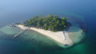
Karimata
Welcome to Karimata, a Tropical island in the South China Sea, part of the majestic Pacific Ocean. This guide offers a comprehensive overview of what makes Karimata unique – from its geography and climate to its population, infrastructure, and beyond. Dive into the details:
- Geography and Size: Explore the island’s size and location.
- Climate and Weather: Weather patterns and temperature.
- Topography and Nature: Uncover the natural wonders of the island.
- Infrastructure and Travelling: Insights on reaching, staying, and making the most of your visit.
- News and Headlines: Latest News.
Geography and size of Karimata
Size: 185.2 km²
Coastline: 85.8 km
Ocean: Pacific Ocean
Sea: South China Sea
Continent: Asia
Karimata is a Large Island spanning 185 km² with a coastline of 86 km.
Archipel: Greater Sunda Islands – A group of large islands in Southeast Asia, including Borneo, Sumatra, Java, and Sulawesi, known for their rich biodiversity and cultural diversity.
Tectonic Plate: North America – Covers North America and parts of the Atlantic and Arctic Oceans, characterized by diverse geological features and varying levels of seismic activity.
The geographic heart of the island is pinpointed at these coordinates:
Latitude: -1.60794352 / Longitude: 108.89229515
Climate and weather of Karimata
Climate Zone: Tropical
Climate Details: Tropical Rainforest Climate
Temperature: Hot
Climate Characteristics: This climate is typified by heavy rainfall throughout the year, high humidity, and consistently high temperatures, leading to lush rainforests and rich biodiversity. Seasonal temperature variations are minimal.
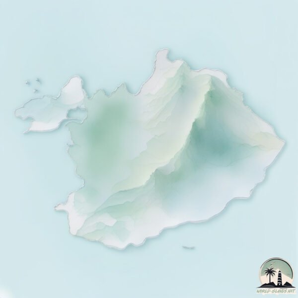
Topography and nature of Karimata
Timezone: UTC+07:00
Timezone places: Asia/Jakarta
Max. Elevation: 895 m
Mean Elevation: 209 m
Vegetation: Evergreen Broadleaf Forest
Tree Coverage: 74%
The mean elevation is 209 m. The highest elevation on the island reaches approximately 895 meters above sea level. The island is characterized by Plateau: Elevated flatlands rising sharply above the surrounding area, with a maximum elevation over 500 meters but a mean elevation less than 300 meters, forming unique highland areas on islands.
Dominating Vegetation: Evergreen Broadleaf Forest
Characterized by dense, lush canopies of broadleaf trees that retain their leaves year-round. These forests are typically found in tropical and subtropical regions and are known for their high biodiversity. Karimata has a tree cover of 74 %.
Vegetation: 10 vegetation zones – Very Highly Diverse Island
Islands in this range are ecological powerhouses, showcasing a wide array of vegetation zones. Each zone, from lush rainforests to arid scrublands, coastal mangroves to mountainous regions, contributes to a complex and interdependent ecosystem. These islands are often hotspots of biodiversity, supporting numerous species and intricate ecological processes.
Infrastructure and Travelling to Karimata
Does the island have a public airport? no.
There is no public and scheduled airport on Karimata. The nearest airport is Rahadi Osman Airport, located 112 km away.
Does the island have a major port? no.
There are no major ports on Karimata. The closest major port is PONTIANAK, approximately 175 km away.
The mean population of Karimata is 25 per km². Karimata is Gently Populated. The island belongs to Indonesia.
Continuing your journey, Serutu is the next notable island, situated merely km away.
A VISUAL JOURNEY OF KARIMATA ISLAND


Indonesia is classified as Emerging region: MIKT: Mexico, Indonesia, South Korea, and Turkey – Economies recognized for their development potential and emerging market status. The level of income is Lower middle income.
News – Latest Updates and Headlines from Karimata
Stay informed with the most recent news and important headlines from Karimata. Here’s a roundup of the latest developments.
Please note: The data used here has been primarily extracted from satellite readings. Deviations from exact values may occur, particularly regarding the height of elevations and population density. Land area and coastline measurements refer to average values at mean high tide.