Welcome to Kaunissaari, a Continental island in the Gulf of Finland, part of the majestic Atlantic Ocean. This guide offers a comprehensive overview of what makes Kaunissaari unique – from its geography and climate to its population, infrastructure, and beyond. Dive into the details:
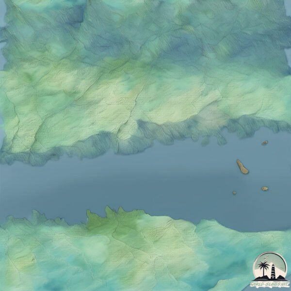
Geography and size of Kaunissaari
Size: 4.156 km²
Coastline: 10.6 km
Ocean: Atlantic Ocean
Sea: Gulf of Finland
Continent: Europe
Kaunissaari is a Small Island spanning 4.2 km² with a coastline of 10.6 km.
Archipel: –
Tectonic Plate: Eurasia – One of the world’s largest tectonic plates, the Eurasian Plate covers a significant portion of Europe and Asia. It’s characterized by diverse geological features, including the Ural Mountains, the European Plain, and the Himalayas formed from its collision with the Indian Plate.
The geographic heart of the island is pinpointed at these coordinates:
Latitude: 60.31939392 / Longitude: 26.4705222
Climate and weather of Kaunissaari
Climate Zone: Continental
Climate Details: Warm-Summer Humid Continental Climate
Temperature: Warm Summer
Climate Characteristics: Features warm summers and cold winters with consistent precipitation, common in higher latitudes.
Topography and nature of Kaunissaari
Timezone: UTC+02:00
Timezone places: Europe/Helsinki
Max. Elevation: 42 m
Mean Elevation: 32 m
Vegetation: Evergreen Needleleaf Forest
Tree Coverage: 78%
The mean elevation is 32 m. The highest elevation on the island reaches approximately 42 meters above sea level. The island is characterized by Plains: Flat, low-lying lands characterized by a maximum elevation of up to 200 meters. On islands, plains are typically coastal lowlands or central flat areas.
Dominating Vegetation: Evergreen Needleleaf Forest
Dominated by evergreen coniferous trees such as pines and firs, which retain their needle-like leaves throughout the year. These forests are often found in cooler climates. Kaunissaari has a tree cover of 78 %.
Vegetation: 6 vegetation zones – Very Highly Diverse Island
Islands in this range are ecological powerhouses, showcasing a wide array of vegetation zones. Each zone, from lush rainforests to arid scrublands, coastal mangroves to mountainous regions, contributes to a complex and interdependent ecosystem. These islands are often hotspots of biodiversity, supporting numerous species and intricate ecological processes.
Infrastructure and Travelling to Kaunissaari
Does the island have a public airport? no.
There is no public and scheduled airport on Kaunissaari. The nearest airport is Helsinki Vantaa Airport, located 43 km away.
Does the island have a major port? no.
There are no major ports on Kaunissaari. The closest major port is KOTKA, approximately 23 km away.
The mean population of Kaunissaari is 26 per km². Kaunissaari is Gently Populated. The island belongs to Finland.
Continuing your journey, Emsalö is the next notable island, situated merely km away.
EP. 47 พาชมเกาะสวย Kaunissaari Sipoo Finland 🇫🇮
One day trip in Kaunissaari Island. Kaunissaari lies about 22 km last from Helsinki in Sipoo, almost out in the open sea. The island ...EP. 47 พาชมเกาะสวย Kaunissaari Sipoo Finland 🇫🇮
One day trip in Kaunissaari Island. Kaunissaari lies about 22 km last ...
One day trip in Kaunissaari Island. Kaunissaari lies about 22 km last from Helsinki in Sipoo, almost out in the open sea. The island ...
Baltic Sailing #17 - Beautiful island - Kaunissaari (2), Finland
There are many pretty islands in Finland but we know 2 of the same ...
There are many pretty islands in Finland but we know 2 of the same name Kaunissaari which means Beutiful Island. This one is ...
Kaunissaari, Sipoo
Sipoon Kaunissaari on itäisin Helsingin kaupungin isännöimistä ...
Sipoon Kaunissaari on itäisin Helsingin kaupungin isännöimistä ulkoilusaarista. Saarelta löytyy kaikkea keittokatoksista ...
Awesome Kaunissaari (Beauty island) front of Helsinki Finland
Beautiful island. Lacation is in Sipoo. ...
KAUNISSAARI island day trip | Kaunissaari – päiväretki paratiisisaarelle | FINLAND
(EN) Welcome to Kaunissaari, a beautiful island in Finland. It is the ...
(EN) Welcome to Kaunissaari, a beautiful island in Finland. It is the perfect place to enjoy the peace of nature. In this video, I will ...
Itäisen Suomenlahden saaristo - Kaunissaari
Kaunissaari Pyhtäällä on legendaarinen kesän lomailuparatiisi. Saarea ...
Kaunissaari Pyhtäällä on legendaarinen kesän lomailuparatiisi. Saarea reunustavat ihanat, punaiset ranta-aitat ja venevajat.
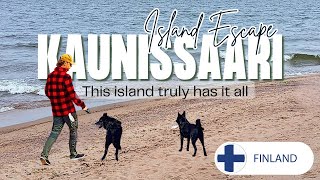
The Beautiful Island Kaunissaari 🇫🇮 : Unforgettable Island Escape
I love this island escape experience. We went on the boat and spent a ...
I love this island escape experience. We went on the boat and spent a day on this beautiful island. We wandered the beach and ...
s/y Family Pot Sailing Noobs, Jakso 2: Kaunissaari - Svartholm
Noviisiseilaajien ensimmäinen, Kotkasta aloitettu purjehdusviikko ...
Noviisiseilaajien ensimmäinen, Kotkasta aloitettu purjehdusviikko omalla perheellä jatkuu Pyhtään Kaunissaaresta. Tuntuma ...
Pyhtään Kaunissaari Itäisen Suomenlahden saaristossa
Suomenlahden helmi Pyhtään Kaunissaari on ihastuttava kesäparatiisi! ...
Suomenlahden helmi Pyhtään Kaunissaari on ihastuttava kesäparatiisi! Kilometreittäin hiekkarantoja, tunnelmointia aidossa ...
s/y Family Pot Sailing Noobs, Jakso 1: Kotka - Kaunissaari
Ihastuimme Itämereen ensin moottoriveneellä. Kokeilimme sitten ...
Ihastuimme Itämereen ensin moottoriveneellä. Kokeilimme sitten purjehtimista parin vuokraveneen kautta. Puhtaasti luonnon ...
Kaunissaari Kesäkuu - June 2019
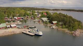
Kaunissaari, FInland, June 2019 Harbour view from above in summertime ...
Kaunissaari, FInland, June 2019 Harbour view from above in summertime at Kaunissaari, Finland. The island is located 100 km ...
Visit to the Kaunissaari .....(a beautiful island)
EP05 Day Trip to Kaunissaari ,#Helsinki FINLAND
Baltic sailing #15 - Beautiful island - Kaunissaari (1), Finland
Kaunissaari means beautiful island in Finnish. This is Kaunissaari ...
Kaunissaari means beautiful island in Finnish. This is Kaunissaari near Kotka. We have not explored the island but the harbour ...
Ne Tammelat - Kaunissaari is a harbour of peace in Helsinki archipelago - Finland
Kaunissaari is a trekkers dream place. It is a beautiful recreation ...
Kaunissaari is a trekkers dream place. It is a beautiful recreation area owned by the city of Helsinki. You can get there by boat from ...
Kaunissaari - Pohjoispää 6.6.2019
Kaunissaari, Finland, June 2019 Northern point lighthouse and beach at ...
Kaunissaari, Finland, June 2019 Northern point lighthouse and beach at Kaunissaari, Finland. The island is located 100 km east ...
Kaunissaari Island in the Gulf of Finland
Kaunisaari island is located at southeastern Gulf of Finland near ...
Kaunisaari island is located at southeastern Gulf of Finland near Russia. It used to be wealthy fishing community but those days ...
Kaunissaari ilmasta käsin
Boating in Finnish bay and the nature of it. Thousands of islands, ...
Kaunissaari 01082020
Kaunissaari, Finland, August 2020 Harbour view from above in ...
Kaunissaari, Finland, August 2020 Harbour view from above in summertime at Kaunissaari, Finland. The island is located 100 km ...
Kaunissaari 2021
Luokkaretki Kaunissaareen 2021 Ruotsinsalmen poikalyseo vm.-73.
Luokkaretki Kaunissaareen 2021 Ruotsinsalmen poikalyseo vm.-73.
Kaunissaari huhtikuussa 2022 - Kaunissaari April2022
Kuvia Kaunissaaresta kiirastorstaina 2022. Meri on auki ja viimeiset ...
Kuvia Kaunissaaresta kiirastorstaina 2022. Meri on auki ja viimeiset jäänrippeet lahdenpohjukassa. Music by: ...
Kaunissaari 18012021
January 2021 views from Kaunissaari, Pyhtää Just a few days earlier ...
January 2021 views from Kaunissaari, Pyhtää Just a few days earlier there was a very cold weather and that gave the scenery the ...
Napsun matkassa. Kaunissaari, Kuussaari
Napsun matkassa Kotkan ja Pyhtään saaristossa. Kaunissaaren kautta ...
Napsun matkassa Kotkan ja Pyhtään saaristossa. Kaunissaaren kautta Kuussaareen. #kotka #pyhtää #kaunissaari #kuussaari ...
Kaunissaari May 2019
Kaunissaari, FInland, May 2019 Harbour construction and springtime in ...
Kaunissaari, FInland, May 2019 Harbour construction and springtime in Kaunissaari, Finland. The island is located 100 km east of ...
Pyhtään Kaunissaareen omalla veneellä, yhteysaluksella tai venekyydillä
Vieraile Pyhtään Kaunissaaressa omalla aikataululla omalla veneellä ...
Vieraile Pyhtään Kaunissaaressa omalla aikataululla omalla veneellä tai tilausajolla. Kätevästi pääset myös saareen ilmaisella ...
Finland is classified as Developed region: nonG7: Developed economies outside of the Group of Seven, characterized by high income and advanced economic structures. The level of income is High income: OECD.
News – Latest Updates and Headlines from Kaunissaari
Stay informed with the most recent news and important headlines from Kaunissaari. Here’s a roundup of the latest developments.
Loading...
Please note: The data used here has been primarily extracted from satellite readings. Deviations from exact values may occur, particularly regarding the height of elevations and population density. Land area and coastline measurements refer to average values at mean high tide.