Ko Lu Du
Welcome to Ko Lu Du, a Tropical island in the Malacca Strait, part of the majestic Pacific Ocean. This guide offers a comprehensive overview of what makes Ko Lu Du unique – from its geography and climate to its population, infrastructure, and beyond. Dive into the details:
- Geography and Size: Explore the island’s size and location.
- Climate and Weather: Weather patterns and temperature.
- Topography and Nature: Uncover the natural wonders of the island.
- Infrastructure and Travelling: Insights on reaching, staying, and making the most of your visit.
- News and Headlines: Latest News.
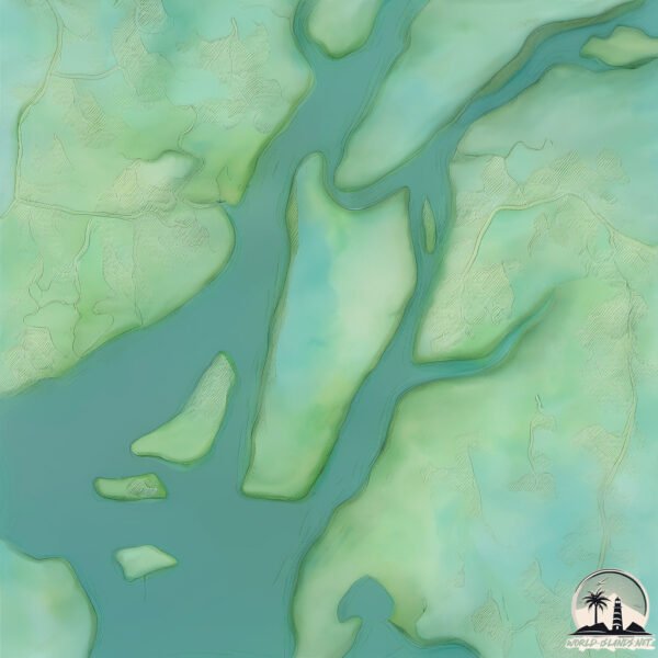
Geography and size of Ko Lu Du
Size: 6.547 km²
Coastline: 13.5 km
Ocean: Pacific Ocean
Sea: Malacca Strait
Continent: Asia
Ko Lu Du is a Small Island spanning 6.5 km² with a coastline of 13.5 km.
Archipel: –
Tectonic Plate: Sunda – Extends across Southeast Asia, encompassing parts of the Sunda Shelf, known for its interaction with the Australian Plate, contributing to volcanic activity in Indonesia.
The geographic heart of the island is pinpointed at these coordinates:
Latitude: 7.89853784 / Longitude: 99.06941924
Climate and weather of Ko Lu Du
Climate Zone: Tropical
Climate Details: Tropical Monsoon Climate
Temperature: Hot
Climate Characteristics: Characterized by heavy rainfall, high humidity, and uniformly high temperatures, but with a distinct short dry season. It features a seasonal reversal of prevailing wind directions.
Topography and nature of Ko Lu Du
Timezone: UTC+07:00
Timezone places: Asia/Jakarta
Max. Elevation: 11 m
Mean Elevation: 8 m
Vegetation: Mangrove Forest
Tree Coverage: 95%
The mean elevation is 8 m. The highest elevation on the island reaches approximately 11 meters above sea level. The island is characterized by Plains: Flat, low-lying lands characterized by a maximum elevation of up to 200 meters. On islands, plains are typically coastal lowlands or central flat areas.
Dominating Vegetation: Mangrove Forest
Found in coastal areas and river deltas, these unique wetland ecosystems are adapted to saline conditions and are crucial for coastal protection and biodiversity. Ko Lu Du has a tree cover of 95 %.
Vegetation: 3 vegetation zones – Moderately Diverse Island
These islands start to show a broader range of ecological niches. With three vegetation zones, they may offer a mix of ecosystems like coastal areas, inland woods, and perhaps a distinct wetland or dry area. This diversity supports a wider range of flora and fauna, making these islands more ecologically complex than those with minimal diversity.
Infrastructure and Travelling to Ko Lu Du
Does the island have a public airport? no.
There is no public and scheduled airport on Ko Lu Du. The nearest airport is Krabi Airport, located 22 km away.
Does the island have a major port? no.
There are no major ports on Ko Lu Du. The closest major port is KRABI, approximately 23 km away.
The mean population of Ko Lu Du is 116 per km². Ko Lu Du is Moderately Inhabited. The island belongs to Thailand.
Continuing your journey, Ko Hang is the next notable island, situated merely km away.
IM PEPPA PIG 🐷🐽


Thailand is classified as Emerging region: G20: Group of Twenty – Major economies comprising both developed and emerging countries, representing the world’s largest economies. The level of income is Upper middle income.
News – Latest Updates and Headlines from Ko Lu Du
Stay informed with the most recent news and important headlines from Ko Lu Du. Here’s a roundup of the latest developments.
Please note: The data used here has been primarily extracted from satellite readings. Deviations from exact values may occur, particularly regarding the height of elevations and population density. Land area and coastline measurements refer to average values at mean high tide.