Welcome to Ko Phi Phi Lee, a Tropical island in the Malacca Strait, part of the majestic Pacific Ocean. This guide offers a comprehensive overview of what makes Ko Phi Phi Lee unique – from its geography and climate to its population, infrastructure, and beyond. Dive into the details:
Geography and size of Ko Phi Phi Lee
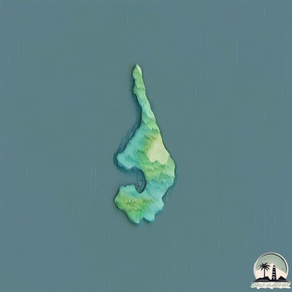
Size: 1.213 km²
Coastline: 10.4 km
Ocean: Pacific Ocean
Sea: Malacca Strait
Continent: Asia
Ko Phi Phi Lee is a Small Island spanning 1.2 km² with a coastline of 10.4 km.
Archipel: –
Tectonic Plate: Sunda – Extends across Southeast Asia, encompassing parts of the Sunda Shelf, known for its interaction with the Australian Plate, contributing to volcanic activity in Indonesia.
The geographic heart of the island is pinpointed at these coordinates:
Latitude: 7.6820631 / Longitude: 98.76641221
Climate and weather of Ko Phi Phi Lee
Climate Zone: Tropical
Climate Details: Tropical Monsoon Climate
Temperature: Hot
Climate Characteristics: Characterized by heavy rainfall, high humidity, and uniformly high temperatures, but with a distinct short dry season. It features a seasonal reversal of prevailing wind directions.
Topography and nature of Ko Phi Phi Lee
Timezone: UTC+07:00
Timezone places: Asia/Jakarta
Max. Elevation: 14 m
Mean Elevation: -12 m
Vegetation: Evergreen Needleleaf Forest
Tree Coverage: 70%
The mean elevation is -12 m. The highest elevation on the island reaches approximately 14 meters above sea level. The island is characterized by Plains: Flat, low-lying lands characterized by a maximum elevation of up to 200 meters. On islands, plains are typically coastal lowlands or central flat areas.
Dominating Vegetation: Evergreen Needleleaf Forest
Dominated by evergreen coniferous trees such as pines and firs, which retain their needle-like leaves throughout the year. These forests are often found in cooler climates. Ko Phi Phi Lee has a tree cover of 70 %.
Vegetation: 2 vegetation zones – Low Diversity Island
Islands with two distinct vegetation zones offer slightly more ecological variety. These zones could be due to differences in elevation, moisture, or other environmental factors. While still limited in biodiversity, these islands may offer a contrast between the two zones, such as a coastline with mangroves and an inland area with grassland.
Infrastructure and Travelling to Ko Phi Phi Lee
Does the island have a public airport? no.
There is no public and scheduled airport on Ko Phi Phi Lee. The nearest airport is Krabi Airport, located 51 km away.
Does the island have a major port? no.
There are no major ports on Ko Phi Phi Lee. The closest major port is PHUKET, approximately 43 km away.
The mean population of Ko Phi Phi Lee is 129 per km². Ko Phi Phi Lee is Moderately Inhabited. The island belongs to Thailand.
Continuing your journey, Ko Pu is the next notable island, situated merely km away.
The ONLY Phi Phi Island Itinerary you will EVER Need!
Start planning your EPIC Thailand trip NOW! ...
[PhiPhi island / Phuket] One of the most stunning beaches in the world. Mayabay 1day trip /4K UHD
This is a video of a one-day trip to PhiPhi Islands from Phuket, a ...
This is a video of a one-day trip to PhiPhi Islands from Phuket, a beautiful tourist spot located in Krabi Province, Thailand, which ...
Phi Phi Islands - The Best Things To Do!
There is lots to experience on the Phi Phi Islands, so we're listing ...
There is lots to experience on the Phi Phi Islands, so we're listing our top 5 must do's on Koh Phi Phi Don. If you like to relax or get ......[+] Show More Ko Phi Phi Le Island, Thailand | Phi Phi Island, Maya Bay, Pileh Lagoon, Viking Cave | Phuket, Krabi
This review is for those travelers looking to check out Ko Phi Phi Le ...
This review is for those travelers looking to check out Ko Phi Phi Le (including Maya Bay and Pileh Lagoon), just outside Phi Phi ...
Phi Phi Islands Travel Guide 2026: Best Places & When To Go
Trip recommendations below! Is Phi Phi Islands overrated? I went back ...
Trip recommendations below! Is Phi Phi Islands overrated? I went back to see, and this time not just for a quick stop, but to really ...
Maya Bay & Phi Phi Island Hopping from Krabi - Bamboo Beach, Pileh Lagoon, Phi Phi Don, Thailand 4K
You can book this trip right here with a discount: from Krabi with ...
Phi Phi Islands - BEST Place in the World | Krabi, Thailand 2023
Thank you for choosing Thailand for your vacation.
Thank you for choosing Thailand for your vacation.
4K HDR // Walking Phi Phi Island in Krabi | BEST Place in the World | Thailand 2023 - With Captions
The Ultimate Koh Phi Phi islands travel itinerary (2 day trip). In ...
The Ultimate Koh Phi Phi islands travel itinerary (2 day trip). In today's virtual walking tour we will walk on Phi Phi Don island (Koh ...
Discover LONG BEACH Koh Phi Phi Thailand travel vlog 7
Long beach Koh phi phi is such an incredible place which I recommend ...
Long beach Koh phi phi is such an incredible place which I recommend you to visit! We have been in long beach last year when ...
Ko Phi Phi & Railey, Thailand [Amazing Places 4K]
The beaches of Ko Phi Phi Islands and the Railey peninsula are framed ...
The beaches of Ko Phi Phi Islands and the Railey peninsula are framed by stunning limestone cliffs. They are regularly listed ...
4K 🇹🇭 Walking Phi Phi Island in Krabi. Thailand 2023
Walking around Koh Phi Phi in Krabi, Thailand 4K 60fps Filmed by ...
Walking around Koh Phi Phi in Krabi, Thailand 4K 60fps Filmed by ...
Phi Phi Islands 4K - Crystal Clear Waters & Thailand’s Tropical Paradise with Relaxing Music
Phi Phi Islands 4K - Crystal Clear Waters & Thailand's Tropical ...
Phi Phi Islands 4K - Crystal Clear Waters & Thailand's Tropical Paradise with Relaxing Music ▻ In this video, join me on a ...
SAii Phi Phi Island Village ***** 4K / Ko Phi Phi
SAii Phi Phi Island Village ***** / Ko Phi Phi - Thailand our channel: ...
SAii Phi Phi Island Village ***** / Ko Phi Phi - Thailand our channel: @wakacjezniemiec #saiiphiphi #saii #hoteltour #saiihotels ...
Top 5 Hotel Resorts in the PHI PHI Islands | Ko Phi Phi Don | Thailand Phuket Krabi Maya Bay
Things to do and best hotels and resorts in THAILAND Location: Phi Phi ...
Things to do and best hotels and resorts in THAILAND Location: Phi Phi Islands, Ko Phi Phi Don, Ko Phi Phi Leh, Maya Bay, ...
Maya Bay, Koh Phi Phi at Sunrise 🇹🇭 Paradise in Thailand?
The REALITY of Koh Phi Phi, Thailand 🇹🇭 *WATCH BEFORE COMING*
Is Koh Phi Phi, Thailand Worth Visiting? In this video I will talk to ...
Is Koh Phi Phi, Thailand Worth Visiting? In this video I will talk to you about Koh Phi Phi and how to visit this beautiful island ...
BEST Phi Phi Island Tour | Top 5 Tips & A BIG SURPRISE! #MayaBay
Come with us as we check out the BEST Phi Phi Island Tour by speedboat ...
Come with us as we check out the BEST Phi Phi Island Tour by speedboat where we also got a BIG surprise! #mayabay Starting ...
Getting Robbed in Monkey Beach, Ko Phi Phi Island | Monkey Attack l Thailand Travel Video
Don't bring your stuff on monkey beach and if you do , make sure not ...
Don't bring your stuff on monkey beach and if you do , make sure not leaving them unattended because monkeys will steal your ...
Phi Phi Island Tour Phuket | Thailand Phi Phi Island Tour
phiphiislands #phuket Join With me on an unforgettable journey to the ...
phiphiislands #phuket Join With me on an unforgettable journey to the breathtaking Phi Phi Island, as we explore its stunning ...
4K Phi Phi island. Favorite island of young people from all over the world 🌴 Thailand 🌴 [sub]
Hi, travelers! ✌️ In the footsteps of ThaiWalk ...
4K HDR // Walking Maya Bay in Krabi | BEST Beach in the World | Thailand 2023 - With Captions
The Ultimate Ko Phi Phi Leh island travel itinerary (1 day trip). In ...
The Ultimate Ko Phi Phi Leh island travel itinerary (1 day trip). In today's virtual walking tour we will walking Maya Bay on Phi Phi ...
[4K] KOH PHI PHI WALKING TOUR- Thailand‘s BEST Island 2024
Welcome back to ASIFYOUWHERETHERE Walking Tours. A beautiful Walking ...
Welcome back to ASIFYOUWHERETHERE Walking Tours. A beautiful Walking Tour of Koh Phi Phi Island, Thailand. Time: 07:30 ...
Phi Phi CoCo Beach Resort | March 2024 | Koh Phi Phi, Thailand
Attention: Despite the calm and relaxed nature of this video, there ...
Attention: Despite the calm and relaxed nature of this video, there are high noise levels (loud music) during the night. 00:00 Intro ...
Thailand is classified as Emerging region: G20: Group of Twenty – Major economies comprising both developed and emerging countries, representing the world’s largest economies. The level of income is Upper middle income.
News – Latest Updates and Headlines from Ko Phi Phi Lee
Stay informed with the most recent news and important headlines from Ko Phi Phi Lee. Here’s a roundup of the latest developments.
Loading...
Please note: The data used here has been primarily extracted from satellite readings. Deviations from exact values may occur, particularly regarding the height of elevations and population density. Land area and coastline measurements refer to average values at mean high tide.

![[PhiPhi island / Phuket] One of the most stunning beaches in the world. Mayabay 1day trip /4K UHD](https://i.ytimg.com/vi/-N2DfshLjJM/mqdefault.jpg)


![Ko Phi Phi & Railey, Thailand [Amazing Places 4K]](https://i.ytimg.com/vi/IlXhywbggFY/mqdefault.jpg)


![4K Phi Phi island. Favorite island of young people from all over the world 🌴 Thailand 🌴 [sub]](https://i.ytimg.com/vi/ON7mIpt2C1U/mqdefault.jpg)

![[4K] KOH PHI PHI WALKING TOUR- Thailand‘s BEST Island 2024](https://i.ytimg.com/vi/rHneXTNa1lA/mqdefault.jpg)