Kolguyev
Welcome to Kolguyev, a Polar island in the Barentsz Sea, part of the majestic Arctic Ocean. This guide offers a comprehensive overview of what makes Kolguyev unique – from its geography and climate to its population, infrastructure, and beyond. Dive into the details:
- Geography and Size: Explore the island’s size and location.
- Climate and Weather: Weather patterns and temperature.
- Topography and Nature: Uncover the natural wonders of the island.
- Infrastructure and Travelling: Insights on reaching, staying, and making the most of your visit.
- News and Headlines: Latest News.
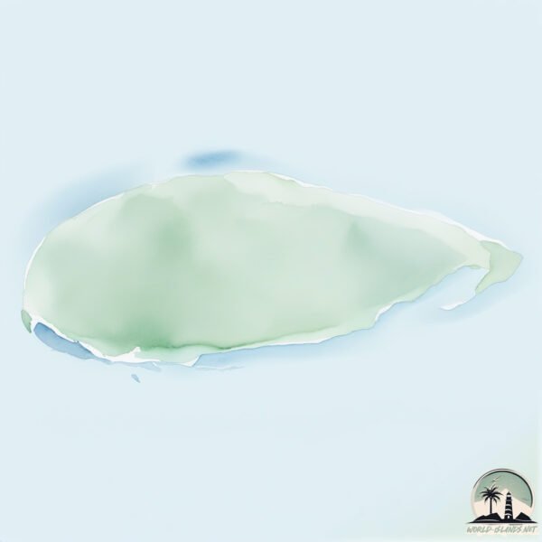
Geography and size of Kolguyev
Size: 5071 km²
Coastline: 592 km
Ocean: Arctic Ocean
Sea: Barentsz Sea
Continent: Europe
Kolguyev is a Very Large Island spanning 5071 km² with a coastline of 592 km.
Archipel: –
Tectonic Plate: Eurasia – One of the world’s largest tectonic plates, the Eurasian Plate covers a significant portion of Europe and Asia. It’s characterized by diverse geological features, including the Ural Mountains, the European Plain, and the Himalayas formed from its collision with the Indian Plate.
The geographic heart of the island is pinpointed at these coordinates:
Latitude: 69.10083192 / Longitude: 49.1165814
Climate and weather of Kolguyev
Climate Zone: Polar
Climate Details: Tundra
Temperature: Cold
Climate Characteristics: The tundra climate features long, extremely cold winters and short, cool summers. Vegetation is limited to mosses, lichens, and small shrubs due to the low temperatures and short growing seasons. Biodiversity is low, but some specialized species thrive.
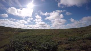
Topography and nature of Kolguyev
Timezone: UTC+04:00
Timezone places: Europe/Moscow
Max. Elevation: 404 m
Mean Elevation: 48 m
Vegetation: Herbaceous Cover
Tree Coverage: 12%
The mean elevation is 48 m. The highest elevation on the island reaches approximately 404 meters above sea level. The island is characterized by Hills: Gently sloping landforms with rounded tops, having a maximum elevation between 200 and 500 meters. Hills contribute to a varied landscape on islands.
Dominating Vegetation: Herbaceous Cover
Comprising mainly of grasses, herbs, and ferns, these areas are common in prairies, meadows, and savannas, and can vary widely in species composition. Kolguyev has a tree cover of 12 %.
Vegetation: 8 vegetation zones – Very Highly Diverse Island
Islands in this range are ecological powerhouses, showcasing a wide array of vegetation zones. Each zone, from lush rainforests to arid scrublands, coastal mangroves to mountainous regions, contributes to a complex and interdependent ecosystem. These islands are often hotspots of biodiversity, supporting numerous species and intricate ecological processes.
Infrastructure and Travelling to Kolguyev
Does the island have a public airport? no.
There is no public and scheduled airport on Kolguyev. The nearest airport is Naryan Mar Airport, located 352 km away.
Does the island have a major port? no.
There are no major ports on Kolguyev. The closest major port is MEZEN, approximately 558 km away.
The mean population of Kolguyev is 0 per km². Kolguyev is Uninhabited. The island belongs to Russia.
The name of the island resonates across different cultures and languages. Here is how it is known around the world: Arabic: جزيرة كولغوييف; German: Kolgujew; Spanish: Isla Kolgúyev; French: Kolgouïev; Portuguese: Kolguyev; Russian: Колгуев; Chinese: 科尔古耶夫岛
Continuing your journey, Mezhdusharskiy is the next notable island, situated merely km away.
Kolguyev Island, Russia | #shorts


Russia is classified as Emerging region: BRIC: Brazil, Russia, India, and China – Economies noted for their rapid growth and increasing influence on global affairs. The level of income is Upper middle income.
News – Latest Updates and Headlines from Kolguyev
Stay informed with the most recent news and important headlines from Kolguyev. Here’s a roundup of the latest developments.
Social Media Posts about Kolguyev
Please note: The data used here has been primarily extracted from satellite readings. Deviations from exact values may occur, particularly regarding the height of elevations and population density. Land area and coastline measurements refer to average values at mean high tide.