Kouru To
Welcome to Kouru To, a Temperate island in the Yellow Sea, part of the majestic Pacific Ocean. This guide offers a comprehensive overview of what makes Kouru To unique – from its geography and climate to its population, infrastructure, and beyond. Dive into the details:
- Geography and Size: Explore the island’s size and location.
- Climate and Weather: Weather patterns and temperature.
- Topography and Nature: Uncover the natural wonders of the island.
- Infrastructure and Travelling: Insights on reaching, staying, and making the most of your visit.
- News and Headlines: Latest News.
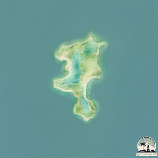
Geography and size of Kouru To
Size: 1.314 km²
Coastline: 7.8 km
Ocean: Pacific Ocean
Sea: Yellow Sea
Continent: Asia
Kouru To is a Small Island spanning 1.3 km² with a coastline of 7.8 km.
Archipel: –
Tectonic Plate: Amur – A minor tectonic plate in the region of the Amur River at the border of Russia and China, involved in complex interactions with the Pacific and Eurasian plates.
The geographic heart of the island is pinpointed at these coordinates:
Latitude: 36.60004186 / Longitude: 126.24088179
Climate and weather of Kouru To
Climate Zone: Temperate
Climate Details: Monsoon-Influenced Humid Subtropical Climate
Temperature: Hot Summer
Climate Characteristics: Known for hot, humid summers with significant monsoon rains, contrasted by mild, drier winters.
Topography and nature of Kouru To
Timezone: UTC+09:00
Timezone places: Asia/Tokyo
Max. Elevation: 15 m
Mean Elevation: 12 m
Vegetation: Evergreen Needleleaf Forest
Tree Coverage: 7%
The mean elevation is 12 m. The highest elevation on the island reaches approximately 15 meters above sea level. The island is characterized by Plains: Flat, low-lying lands characterized by a maximum elevation of up to 200 meters. On islands, plains are typically coastal lowlands or central flat areas.
Dominating Vegetation: Evergreen Needleleaf Forest
Dominated by evergreen coniferous trees such as pines and firs, which retain their needle-like leaves throughout the year. These forests are often found in cooler climates. Kouru To has a tree cover of 7 %.
Vegetation: 3 vegetation zones – Moderately Diverse Island
These islands start to show a broader range of ecological niches. With three vegetation zones, they may offer a mix of ecosystems like coastal areas, inland woods, and perhaps a distinct wetland or dry area. This diversity supports a wider range of flora and fauna, making these islands more ecologically complex than those with minimal diversity.
Infrastructure and Travelling to Kouru To
Does the island have a public airport? no.
There is no public and scheduled airport on Kouru To. The nearest airport is Kunsan Air Base, located 87 km away.
Does the island have a major port? no.
There are no major ports on Kouru To. The closest major port is DAESAN HANG, approximately 49 km away.
The mean population of Kouru To is 81 per km². Kouru To is Gently Populated. The island belongs to South Korea.
Continuing your journey, Lindsay Island is the next notable island, situated merely km away.
Top 5 Things to Do in Kourou, French Guiana!


South Korea is classified as Emerging region: MIKT: Mexico, Indonesia, South Korea, and Turkey – Economies recognized for their development potential and emerging market status. The level of income is High income: OECD.
News – Latest Updates and Headlines from Kouru To
Stay informed with the most recent news and important headlines from Kouru To. Here’s a roundup of the latest developments.
Please note: The data used here has been primarily extracted from satellite readings. Deviations from exact values may occur, particularly regarding the height of elevations and population density. Land area and coastline measurements refer to average values at mean high tide.