Kumlik
Welcome to Kumlik, a Continental island in the Gulf of Alaska, part of the majestic Pacific Ocean. This guide offers a comprehensive overview of what makes Kumlik unique – from its geography and climate to its population, infrastructure, and beyond. Dive into the details:
- Geography and Size: Explore the island’s size and location.
- Climate and Weather: Weather patterns and temperature.
- Topography and Nature: Uncover the natural wonders of the island.
- Infrastructure and Travelling: Insights on reaching, staying, and making the most of your visit.
- News and Headlines: Latest News.
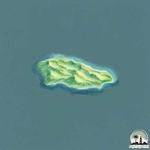
Geography and size of Kumlik
Size: 2.388 km²
Coastline: 10.5 km
Ocean: Pacific Ocean
Sea: Gulf of Alaska
Continent: North America
Kumlik is a Small Island spanning 2.4 km² with a coastline of 10.5 km.
Archipel: –
Tectonic Plate: North America – Covers North America and parts of the Atlantic and Arctic Oceans, characterized by diverse geological features and varying levels of seismic activity.
The geographic heart of the island is pinpointed at these coordinates:
Latitude: 56.64033058 / Longitude: -157.41322004
Climate and weather of Kumlik
Climate Zone: Continental
Climate Details: Subarctic Climate
Temperature: Cold Summer
Climate Characteristics: Characterized by long, extremely cold winters and short, cool summers, often found in northern latitudes of North America and Eurasia.
Topography and nature of Kumlik
Timezone: UTC-09:00
Timezone places: America/Anchorage
Max. Elevation: 239 m
Mean Elevation: 132 m
Vegetation: Wetland
Tree Coverage: 77%
The mean elevation is 132 m. The highest elevation on the island reaches approximately 239 meters above sea level. The island is characterized by Hills: Gently sloping landforms with rounded tops, having a maximum elevation between 200 and 500 meters. Hills contribute to a varied landscape on islands.
Dominating Vegetation: Wetland
These areas are saturated with water, either permanently or seasonally, and support aquatic plants. Wetlands are important for biodiversity and water filtration. Kumlik has a tree cover of 77 %.
Vegetation: 4 vegetation zones – Diverse Island
Four distinct vegetation zones mark these islands as ecologically diverse. They might feature varied landscapes such as forests, beaches, grasslands, and rocky areas. Such diversity reflects the island’s complex ecological interactions and varied habitats, which can support a rich array of wildlife and plant species.
Infrastructure and Travelling to Kumlik
Does the island have a public airport? no.
There is no public and scheduled airport on Kumlik. The nearest airport is Chignik Lake Airport, located 155 km away.
Does the island have a major port? no.
There are no major ports on Kumlik. The closest major port is UGASHIK, approximately 98 km away.
The mean population of Kumlik is 0 per km². Kumlik is Uninhabited. The island belongs to United States of America.
Continuing your journey, Sutwik is the next notable island, situated merely km away.
敗家丈夫輸光家底還把女兒拿去抵債,豈料看似邋遢的放羊妻子竟是賭神之女!骰盅一開就讓賭徒們輸的傾家蕩產,對家直接嚇尿下跪磕頭求她收起神通!#被背叛后我露出赌神真面目


United States of America is classified as Developed region: G7: Group of Seven – Major advanced economies, including Canada, France, Germany, Italy, Japan, the United Kingdom, and the United States. The level of income is High income: OECD.
News – Latest Updates and Headlines from Kumlik
Stay informed with the most recent news and important headlines from Kumlik. Here’s a roundup of the latest developments.
Please note: The data used here has been primarily extracted from satellite readings. Deviations from exact values may occur, particularly regarding the height of elevations and population density. Land area and coastline measurements refer to average values at mean high tide.