Welcome to Kwajalein, a Tropical island in the North Pacific Ocean, part of the majestic Pacific Ocean. This guide offers a comprehensive overview of what makes Kwajalein unique – from its geography and climate to its population, infrastructure, and beyond. Dive into the details:
Geography and size of Kwajalein
Size: 3.133 km²
Coastline: 11.9 km
Ocean: Pacific Ocean
Sea: North Pacific Ocean
Continent: Oceania
Kwajalein is a Small Island spanning 3.1 km² with a coastline of 11.9 km.
Archipel: Micronesia – A region in the western Pacific Ocean comprising thousands of small islands, known for their unique cultures, languages, and marine ecosystems.
Tectonic Plate: Sunda – Extends across Southeast Asia, encompassing parts of the Sunda Shelf, known for its interaction with the Australian Plate, contributing to volcanic activity in Indonesia.
The geographic heart of the island is pinpointed at these coordinates:
Latitude: 8.72592496 / Longitude: 167.73159917
Climate and weather of Kwajalein
Climate Zone: Tropical
Climate Details: Tropical Rainforest Climate
Temperature: Hot
Climate Characteristics: This climate is typified by heavy rainfall throughout the year, high humidity, and consistently high temperatures, leading to lush rainforests and rich biodiversity. Seasonal temperature variations are minimal.
Topography and nature of Kwajalein
Timezone: UTC+12:00
Timezone places: Pacific/Auckland
Max. Elevation: 3 m
Mean Elevation: -28 m
Vegetation: Evergreen Needleleaf Forest
Tree Coverage: 100%
The mean elevation is -28 m. The highest elevation on the island reaches approximately 3 meters above sea level. The island is characterized by Plains: Flat, low-lying lands characterized by a maximum elevation of up to 200 meters. On islands, plains are typically coastal lowlands or central flat areas.
Dominating Vegetation: Evergreen Needleleaf Forest
Dominated by evergreen coniferous trees such as pines and firs, which retain their needle-like leaves throughout the year. These forests are often found in cooler climates. Kwajalein has a tree cover of 100 %.
Vegetation: 7 vegetation zones – Very Highly Diverse Island
Islands in this range are ecological powerhouses, showcasing a wide array of vegetation zones. Each zone, from lush rainforests to arid scrublands, coastal mangroves to mountainous regions, contributes to a complex and interdependent ecosystem. These islands are often hotspots of biodiversity, supporting numerous species and intricate ecological processes.
Infrastructure and Travelling to Kwajalein
Does the island have a public airport? yes.
Kwajalein has a public and scheduled airport. The following airports are located on this island: Bucholz Army Air Field.
Does the island have a major port? yes.
Kwajalein is home to a major port. The following ports are situated on the island: .
The mean population of Kwajalein is 399 per km². Kwajalein is Moderately Inhabited. The island belongs to Marshall Islands.
Continuing your journey, Majuro is the next notable island, situated merely km away.
Battle of Kwajalein 1944 - Applying Lessons Learned
From January 31st until February 4th, 1944, men of the 4th Marine and the 7th Infantry Division fought the battle to take the islands ...Battle of Kwajalein 1944 - Applying Lessons Learned
From January 31st until February 4th, 1944, men of the 4th Marine and ...
From January 31st until February 4th, 1944, men of the 4th Marine and the 7th Infantry Division fought the battle to take the islands ...
11,000 Japanese Soldiers Lost in 4 Days — Fall of Kwajalein 1944
On January 31, 1944, the Battle of Kwajalein became one of the ...
On January 31, 1944, the Battle of Kwajalein became one of the bloodiest moments of WW2 in the Pacific. In just 4 days, more ...
World War II in HD: Kwajalein | History
Five-Night Event Premieres November 15 at 9/8c. US Forces invade with ...
Five-Night Event Premieres November 15 at 9/8c. US Forces invade with heavy arms and 42000 men on January 31, 1944.
Reagan Test Site Kwajalein Atoll.mpg
The Silent Wrecks of Kwajalein Atoll | Full Military Documentary
For the first time, the U.S. military has granted permission to an ...
For the first time, the U.S. military has granted permission to an outside film crew to document the wrecks of Kwajalein Atoll -- a ...
Extreme waves hit US Army base in the Marshall Islands
The Army is assessing the destruction caused by the waves, saying ...
The Army is assessing the destruction caused by the waves, saying extensive damage was caused to Roi-Namur's infrastructure.
Welcome Video - U.S. Army Garrison - Kwajalein Atoll 2020
The Full Battle of Kwajalein: Rare WW2 Footage of the Marshall Islands Invasion | WW2 Documentary
Kwajalein — a ring of coral in the Marshall Islands, scorched by sun ...
Kwajalein — a ring of coral in the Marshall Islands, scorched by sun and hammered by waves. Yet in January 1944, it became the ...
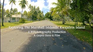
Exploring The Marshall Islands: Kwajalein Island
Join me on a video tour of the housing area of the island of Kwajalein ...
Join me on a video tour of the housing area of the island of Kwajalein in the Marshall Islands. A BTFphotography Production ...
Kwajalein Atoll Marshall Islands Homecoming December 2024
Aiden, Felix, and Mitchell return to Kwaj for Christmas.
Aiden, Felix, and Mitchell return to Kwaj for Christmas.
Top 5 Spots to Visit in Kwajalein Atoll (Marshall Islands)
"Welcome to TravelBytes, your go-to destination for bite-sized travel ...
"Welcome to TravelBytes, your go-to destination for bite-sized travel tips and recommendations! Whether you're an avid traveler or ...
ISLAND HOPPING in KWAJALEIN MARSHALL ISLAND!!mapapaWow ka talaga#youtubevideo #adventure #fyp
Exploring the Hidden Paradise: Kwajalein Atoll, Marshall Islands | Tour in 2.7k superview gopro 8
Welcome to our virtual journey through the mesmerizing Kwajalein Atoll ...
Welcome to our virtual journey through the mesmerizing Kwajalein Atoll in the Marshall Islands! Join us on this captivating ...
The Kwaj Current - Episode 1
This is the first episode of the new television news program, The Kwaj ...
This is the first episode of the new television news program, The Kwaj Current, serving the U.S. Army Garrison Kwajalein Atoll ...
Kwajalein Atoll, Marshall Islands - Part 1
How Americanized are the Marshall Islands?
IAKWE (HELLO) FROM THE MARSHALL ISLANDS Life is wonderful out here in ...
IAKWE (HELLO) FROM THE MARSHALL ISLANDS Life is wonderful out here in country #157! It was already expected that ...
The Kwaj Current - Episode 2
The Kwaj Current is a bi-weekly television show produced by the U.S. ...
The Kwaj Current is a bi-weekly television show produced by the U.S. Army Garrison Kwajalein Atoll Public Affairs Office in the ...
Kwajalein February 2020 Full Length Version
Angelo and Eleanor Prevete's visit to Kwajalein, Marshall Islands ...
Angelo and Eleanor Prevete's visit to Kwajalein, Marshall Islands February 4-11, 2020. What an adventure after 47 years away!!
Huge Waves Break Down Doors of Army Base in Marshall Islands (All Survived)
A series of large waves fueled by an offshore storm flooded the ...
A series of large waves fueled by an offshore storm flooded the northern portions of the island of Roi-Namur, Kwajalein Atoll, ...
U.S. Military Kwaj Kwajalein Island Atoll Marshall Islands Pacific Ocean Missile Defense Site Tour
A U.S. military report "The Kwaj" from the 1990s offering an inside ...
A U.S. military report "The Kwaj" from the 1990s offering an inside look at the U.S. military remote missile defense site and support ...
The Coolest Places to Hang Out on Kwajalein
Exploring Kwajalein Atoll
Exploring Kwajalein Atoll I spent 10 days in Kwajalein for work. It is ...
Exploring Kwajalein Atoll I spent 10 days in Kwajalein for work. It is a tiny island in the Marshall Islands. There wasnt a whole lot to ...
DAY TOUR IN KWAJALEIN | EXPLORING MARSHALL ISLAND
Hello everyone! Karena Gracia here! Welcome to my YouTube channel In ...
Hello everyone! Karena Gracia here! Welcome to my YouTube channel In this video I am going to show you the beautiful place ...
USAG Kwajalein Atoll - A Place Like No Other || Aerial Highlights
USAG-KA is located in the Marshall Islands in the middle of the ...
USAG-KA is located in the Marshall Islands in the middle of the Pacific Ocean. While being key for US national security, ...
Dangerous wave rips through restaurant on Army base in the Marshall Islands
No serious injuries were reported after a huge wave slammed into a ...
No serious injuries were reported after a huge wave slammed into a restaurant on a U.S. Army base in the Marshall Islands.
Marshall Islands is classified as Developing region: Regions characterized by lower income levels, with economies in the process of industrialization and modernization. The level of income is Lower middle income.
News – Latest Updates and Headlines from Kwajalein
Stay informed with the most recent news and important headlines from Kwajalein. Here’s a roundup of the latest developments.
Loading...
Please note: The data used here has been primarily extracted from satellite readings. Deviations from exact values may occur, particularly regarding the height of elevations and population density. Land area and coastline measurements refer to average values at mean high tide.