La Mula
Welcome to La Mula, a Dry island in the Gulf of Mexico, part of the majestic Atlantic Ocean. This guide offers a comprehensive overview of what makes La Mula unique – from its geography and climate to its population, infrastructure, and beyond. Dive into the details:
- Geography and Size: Explore the island’s size and location.
- Climate and Weather: Weather patterns and temperature.
- Topography and Nature: Uncover the natural wonders of the island.
- Infrastructure and Travelling: Insights on reaching, staying, and making the most of your visit.
- News and Headlines: Latest News.
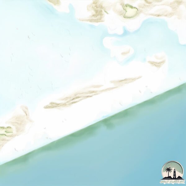
Geography and size of La Mula
Size: 1.371 km²
Coastline: 14.9 km
Ocean: Atlantic Ocean
Sea: Gulf of Mexico
Continent: North America
La Mula is a Small Island spanning 1.4 km² with a coastline of 14.9 km.
Archipel: –
Tectonic Plate: Pacific – The world’s largest tectonic plate, covering much of the Pacific Ocean, known for the Pacific Ring of Fire with extensive seismic and volcanic activity.
The geographic heart of the island is pinpointed at these coordinates:
Latitude: 25.26687376 / Longitude: -97.63098154
Climate and weather of La Mula
Climate Zone: Dry
Climate Details: Hot Semi-Arid (Steppe) Climate
Temperature: Hot
Climate Characteristics: Features hot summers and mild to warm winters. Receives more rainfall than hot deserts but less than tropical savannas, leading to a somewhat more varied landscape.
Topography and nature of La Mula
Timezone: UTC-06:00
Timezone places: America/Chicago
Max. Elevation: 0 m
Mean Elevation: -1 m
Vegetation: Shrubland
Tree Coverage: 64%
The mean elevation is -1 m. The highest elevation on the island reaches approximately 0 meters above sea level. The island is characterized by Plains: Flat, low-lying lands characterized by a maximum elevation of up to 200 meters. On islands, plains are typically coastal lowlands or central flat areas.
Dominating Vegetation: Shrubland
Dominated by shrubs and small bushes, these areas are typical in dry, rocky, or sandy environments, as well as in regions with poor soil fertility. La Mula has a tree cover of 64 %.
Vegetation: 1 vegetation zones – Minimal Diversity Island
These islands exhibit the most basic level of ecological diversity, often characterized by a single dominant vegetation type. This could be due to extreme environmental conditions, limited land area, or significant human impact. They represent unique ecosystems where specific species have adapted to thrive in these singular environments.
Infrastructure and Travelling to La Mula
Does the island have a public airport? no.
There is no public and scheduled airport on La Mula. The nearest airport is General Servando Canales International Airport, located 55 km away.
Does the island have a major port? no.
There are no major ports on La Mula. The closest major port is BROWNSVILLE, approximately 78 km away.
The mean population of La Mula is 36 per km². La Mula is Gently Populated. The island belongs to Mexico.
Continuing your journey, Santa Marie is the next notable island, situated merely km away.
Hero Helps Reclaim Island From Pirates! Female Chief Honors Him With A Temple!


Mexico is classified as Emerging region: MIKT: Mexico, Indonesia, South Korea, and Turkey – Economies recognized for their development potential and emerging market status. The level of income is Upper middle income.
News – Latest Updates and Headlines from La Mula
Stay informed with the most recent news and important headlines from La Mula. Here’s a roundup of the latest developments.
Please note: The data used here has been primarily extracted from satellite readings. Deviations from exact values may occur, particularly regarding the height of elevations and population density. Land area and coastline measurements refer to average values at mean high tide.