Welcome to Lanai, a Tropical island in the North Pacific Ocean, part of the majestic Pacific Ocean. This guide offers a comprehensive overview of what makes Lanai unique – from its geography and climate to its population, infrastructure, and beyond. Dive into the details:
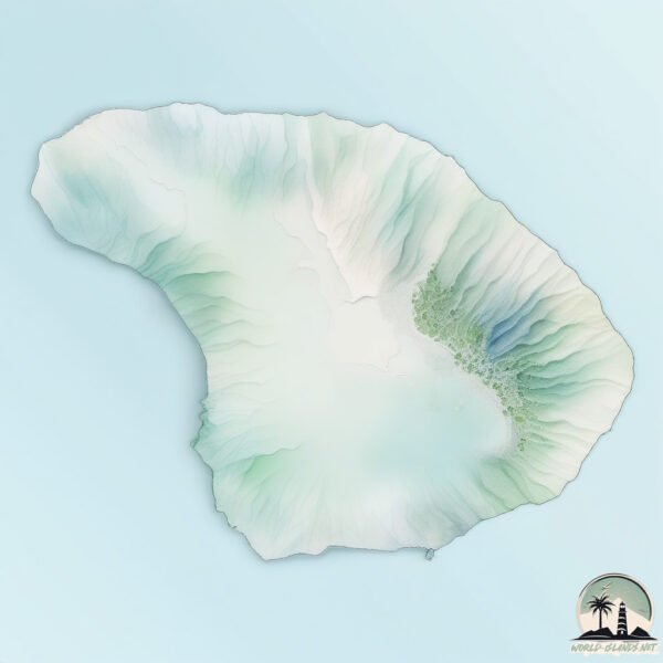
Geography and size of Lanai
Size: 366.5 km²
Coastline: 84.2 km
Ocean: Pacific Ocean
Sea: North Pacific Ocean
Continent: Oceania
Lanai is a Large Island spanning 366 km² with a coastline of 84 km.
Archipel: Polynesia – A region of more than 1,000 islands in the central and southern Pacific Ocean, known for their diverse Polynesian cultures, stunning landscapes, and marine biodiversity.
Tectonic Plate: Pacific – The world’s largest tectonic plate, covering much of the Pacific Ocean, known for the Pacific Ring of Fire with extensive seismic and volcanic activity.
The geographic heart of the island is pinpointed at these coordinates:
Latitude: 20.83523403 / Longitude: -156.92681385
Climate and weather of Lanai
Climate Zone: Tropical
Climate Details: Tropical Savanna, Wet
Temperature: Hot
Climate Characteristics: Defined by distinct wet and dry seasons with high temperatures year-round. Pronounced rainfall occurs during the wet season, while the dry season is marked by drought.
Topography and nature of Lanai
Timezone: UTC-10:00
Timezone places: Pacific/Honolulu
Max. Elevation: 963 m
Mean Elevation: 316 m
Vegetation: Shrubland
Tree Coverage: 14%
The mean elevation is 316 m. The highest elevation on the island reaches approximately 963 meters above sea level. The island is characterized by Mountains: High, steeply elevated landforms. Characterized by both a high maximum elevation (over 500 meters) and a high mean elevation, creating rugged, mountainous terrains on islands.
Dominating Vegetation: Shrubland
Dominated by shrubs and small bushes, these areas are typical in dry, rocky, or sandy environments, as well as in regions with poor soil fertility. Lanai has a tree cover of 14 %.
Vegetation: 13 vegetation zones – Exceptionally Diverse Island
Islands with more than ten vegetation zones are among the most ecologically rich and varied in the world. These islands are akin to miniature continents, boasting an incredible array of ecosystems. The sheer range of habitats, from high peaks to deep valleys, rainforests to deserts, creates a mosaic of life that is unparalleled. They are crucial for conservation and ecological studies.
Infrastructure and Travelling to Lanai
Does the island have a public airport? yes.
Lanai has a public and scheduled airport. The following airports are located on this island: Lanai Airport, Manele Heliport.
Does the island have a major port? no.
There are no major ports on Lanai. The closest major port is KAUMALAPAU HARBOR, approximately 1 km away.
The mean population of Lanai is 10 per km². Lanai is Gently Populated. The island belongs to United States of America.
The name of the island resonates across different cultures and languages. Here is how it is known around the world: Arabic: لاناي; German: Lānaʻi; Spanish: Lanai; French: Lanai; Portuguese: Lanai; Russian: Ланаи; Chinese: 拉奈島
Continuing your journey, Molokai is the next notable island, situated merely km away.
Discover Lanai: The $500 Million Private Island Paradise!
Lanai Island – The World's Most Expensive Private Island Explore the breathtaking beauty of Lanai Island, Hawaii's hidden gem ...Discover Lanai: The $500 Million Private Island Paradise!
Lanai Island – The World's Most Expensive Private Island Explore the ...
Lanai Island – The World's Most Expensive Private Island Explore the breathtaking beauty of Lanai Island, Hawaii's hidden gem ...
Billionaire Larry Ellison's 364 square kilometer island
this is a $300 million Island purchased in 2012 by billionaire Larry ...
this is a $300 million Island purchased in 2012 by billionaire Larry Ellison Larry Ellison owns 98% of the island of laai Hawaii with ...
Inside Larry Ellison Private Hawaii Island | Exclusive Look | Larry Ellison Island
Oracle billionaire Larry Ellison has relocated to Lanai, the Hawaiian ...
Oracle billionaire Larry Ellison has relocated to Lanai, the Hawaiian island he has spent $500 million developing. Ellison has ...
Exploring LANAI - Hawaii's LEAST TRAVELED ISLAND
Most people have never even heard of Lanai, Hawaii. So, we decided to ...
Most people have never even heard of Lanai, Hawaii. So, we decided to discover it for ourselves... & share it with you! Our time on ...
The $610 Million Island: Lanai Island in Hawaii - Davon knows(EP103)
Discover the world's most expensive island: Lanai Island in Hawaii! ...
Discover the world's most expensive island: Lanai Island in Hawaii! Valued at approximately $610 million in 2017, this luxurious ...
LANAI | Hawaii's Least Populated Island
The Island of Lanai is a mysterious place. Why are two Four Seasons ...
The Island of Lanai is a mysterious place. Why are two Four Seasons Resorts here lol. This is my day trip guide for your Lanai ...
Lanai Bliss: 2025 Discovering the Serenity of Hawaii's Hidden Gem!
Lanai is a small island located in the central Pacific Ocean, part of ...
Lanai is a small island located in the central Pacific Ocean, part of the Hawaiian archipelago. It is also known as the "Pineapple ...
This is Why Lanai is Worth a Day Trip from Maui! Ferry info and things to do on Lanai
Have a fantastic trip to the island of Lana'i! Grab our FREE Lana'i ...
Have a fantastic trip to the island of Lana'i! Grab our FREE Lana'i Itinerary & Guide here (it is a direct download link): ...
Lanai, Hawaii #island #islandlife #ocean #hawa #travel
The Hawaiian Island That's Overrun By Deer
Joe Rogan Reveals The Hawaiian Island That's Overrun By Deer Called ...
Joe Rogan Reveals The Hawaiian Island That's Overrun By Deer Called Lanai Island #joerogan #joeroganexperience #funny ...
Larry Ellison’s $300 Million Private Island: A Paradise Only for Billionaires!
Larry Ellison's $300 Million Private Island – Lānaʻi, Hawaii In this ...
Larry Ellison's $300 Million Private Island – Lānaʻi, Hawaii In this cinematic deep dive, we explore the incredible story of how ...
Inside Sensei Lānaʻi, the Luxurious Wellness Retreat in the Heart of Paradise | Walk With T+L
Sensei Lānaʻi, A Four Seasons Resort, is a luxurious wellness retreat ...
Sensei Lānaʻi, A Four Seasons Resort, is a luxurious wellness retreat in the heart of paradise. The experience weaves together ...
Inside the Private Paradise Larry Ellison's Unrivaled Reign over Lanai Island
Ever dreamt of owning an island? Dive into our latest video where we ...
Ever dreamt of owning an island? Dive into our latest video where we tour the 5 most expensive private islands owned by ...
Hawaii Lanai island Most beautiful island in the world
Inside Lanai: Hawaii’s Most Exclusive Island | Luxury Homes, Four Seasons & Hidden Gems
Discover the untouched beauty of Lanai, Hawaii's most private island ...
Discover the untouched beauty of Lanai, Hawaii's most private island retreat. In this cinematic journey, we explore luxury homes ...
IS A DAY TRIP TO LANAI WORTH IT? SEE FOR YOURSELF!
We woke up earlier today than we have in a LONG time to catch a ride ...
We woke up earlier today than we have in a LONG time to catch a ride out to the Hawaiian island of Lanai! Is a day trip to Lanai ...
The Billionaire Who is Taking Over a Hawaii Island
Back in 2012 Larry Ellison spent $300 million dollars to acquire the ...
Back in 2012 Larry Ellison spent $300 million dollars to acquire the island of Lanai, which is one of Hawaii's 8 main islands.
Rent Your Own 4x4 To Explore The Island of Lanai at Four Seasons Resort
Lanai's stunning beaches, secluded hideaways, lava-cliff overlooks and ...
Lanai's stunning beaches, secluded hideaways, lava-cliff overlooks and rainforested peaks are dreamy discoveries for any ...
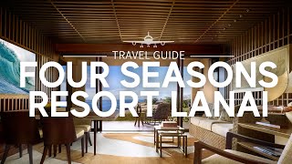
Four Seasons Resort Lanai: Uncovering Paradise | Travel Guide
Four Seasons Resort Lanai is a luxury resort located on the island of ...
Four Seasons Resort Lanai is a luxury resort located on the island of Lanai in Hawaii. The resort is set on a picturesque ...
Larry Ellison was stopped for speeding on the island he owns
Body camera video obtained by Hawaii News Now shows Ellison in his ...
Body camera video obtained by Hawaii News Now shows Ellison in his orange Corvette on Manele Road. For more Local News ...
Lanai, Hawaii: Where Luxury Meets Seclusion
Lanai, Hawaii: Where Luxury Meets Seclusion Escape to Lanai, Hawaii, ...
Lanai, Hawaii: Where Luxury Meets Seclusion Escape to Lanai, Hawaii, where luxury meets seclusion . Known for its pristine ...
Lanai Islands | Edge Mansion Walk-through
Explore one of Lanai Islands' edge mansions through this immersive ...
Explore one of Lanai Islands' edge mansions through this immersive walkthrough. Opulent and distinctive, Lanai Islands is the ...
Larry Ellison Owns a Hawaiian Island?! 🏝️💸🌺
While most billionaires buy homes, Larry Ellison bought an entire ...
While most billionaires buy homes, Larry Ellison bought an entire island. In June 2012, he purchased 98% of Lanai, Hawaii, for an ...
Island-Hopping: The Lanai Cat Sanctuary
Welcome to "Purr-adise." Cats on the small Hawaiian island of Lanai ...
Welcome to "Purr-adise." Cats on the small Hawaiian island of Lanai have got it made – amazing weather, meals served in their ...
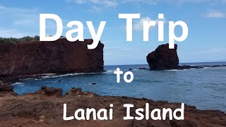
Day Trip to Lanai Island
Day Trip To Lanai Island from Lahaina, Maui, Hawaii This is a video of ...
Day Trip To Lanai Island from Lahaina, Maui, Hawaii This is a video of my day trip to Lanai Island from Lahaina, Maui. To make ...
United States of America is classified as Developed region: G7: Group of Seven – Major advanced economies, including Canada, France, Germany, Italy, Japan, the United Kingdom, and the United States. The level of income is High income: OECD.
News – Latest Updates and Headlines from Lanai
Stay informed with the most recent news and important headlines from Lanai. Here’s a roundup of the latest developments.
Loading...
Please note: The data used here has been primarily extracted from satellite readings. Deviations from exact values may occur, particularly regarding the height of elevations and population density. Land area and coastline measurements refer to average values at mean high tide.