Welcome to Landslip Island, a Polar island in the The Northwestern Passages, part of the majestic Arctic Ocean. This guide offers a comprehensive overview of what makes Landslip Island unique – from its geography and climate to its population, infrastructure, and beyond. Dive into the details:
Geography and size of Landslip Island
Size: 33.8 km²
Coastline: 45.8 km
Ocean: Arctic Ocean
Sea: The Northwestern Passages
Continent: North America
Landslip Island is a Medium Island spanning 34 km² with a coastline of 46 km.
Archipel: Queen Elizabeth Islands – The northernmost part of the Canadian Arctic Archipelago, the Queen Elizabeth Islands are a collection of about 35 major islands. This remote and sparsely populated region is characterized by its polar climate, ice caps, and glaciers. The islands are named in honor of Queen Elizabeth II and are home to diverse Arctic wildlife, including polar bears and seals, and are important for climate research.
Tectonic Plate: North America – Covers North America and parts of the Atlantic and Arctic Oceans, characterized by diverse geological features and varying levels of seismic activity.
The geographic heart of the island is pinpointed at these coordinates:
Latitude: 76.46642856 / Longitude: -84.03487787
Climate and weather of Landslip Island
Climate Zone: Polar
Climate Details: Tundra
Temperature: Cold
Climate Characteristics: The tundra climate features long, extremely cold winters and short, cool summers. Vegetation is limited to mosses, lichens, and small shrubs due to the low temperatures and short growing seasons. Biodiversity is low, but some specialized species thrive.
Topography and nature of Landslip Island
Timezone: UTC-05:00
Timezone places: America/New_York
Max. Elevation: 584 m
Mean Elevation: 270 m
Vegetation: Sparse Vegetation
Tree Coverage: 45%
The mean elevation is 270 m. The highest elevation on the island reaches approximately 584 meters above sea level. The island is characterized by Plateau: Elevated flatlands rising sharply above the surrounding area, with a maximum elevation over 500 meters but a mean elevation less than 300 meters, forming unique highland areas on islands.
Dominating Vegetation: Sparse Vegetation
These regions have limited plant growth, typically due to extreme conditions like aridity or poor soils. Vegetation is scattered and consists of hardy plant species. Landslip Island has a tree cover of 45 %.
Vegetation: 4 vegetation zones – Diverse Island
Four distinct vegetation zones mark these islands as ecologically diverse. They might feature varied landscapes such as forests, beaches, grasslands, and rocky areas. Such diversity reflects the island’s complex ecological interactions and varied habitats, which can support a rich array of wildlife and plant species.
Infrastructure and Travelling to Landslip Island
Does the island have a public airport? no.
There is no public and scheduled airport on Landslip Island. The nearest airport is Grise Fiord Airport, located 110 km away.
Does the island have a major port? no.
There are no major ports on Landslip Island. The closest major port is POND INLET, approximately 895 km away.
The mean population of Landslip Island is 0 per km². Landslip Island is Uninhabited. The island belongs to Canada.
The name of the island resonates across different cultures and languages. Here is how it is known around the world: Arabic: جزيرة إليسمير; German: Ellesmere Island; Spanish: Isla de Ellesmere; French: île d’Ellesmere; Portuguese: Ilha Ellesmere; Russian: Элсмир; Chinese: 埃尔斯米尔岛
Continuing your journey, Hoved is the next notable island, situated merely km away.
8 rescued after landslide traps vehicles in northern Vancouver Island
Eight people were rescued after their vehicles became trapped in a landslide on northern Vancouver Island on Thursday evening.8 rescued after landslide traps vehicles in northern Vancouver Island
Eight people were rescued after their vehicles became trapped in a ...
Eight people were rescued after their vehicles became trapped in a landslide on northern Vancouver Island on Thursday evening.
Indonesia Landslide: Landslides in Java Island Leave at Least 2 Dead, 21 Missing | WION
Landslides triggered by torrential rains in Indonesia 's Java island ...
Landslides triggered by torrential rains in Indonesia 's Java island killed two people and left 21 others missing, officials said Friday ...
Landslide Kills Seven in French Pacific Island of Tahiti | WION Shorts
Landslide Kills Seven in French Pacific Island of Tahiti | WION Shorts ...
Landslide Kills Seven in French Pacific Island of Tahiti | WION Shorts #landslide #taihi #wion About Channel: WION The World is ...
Landslide cuts power, access to northern Vancouver Island communities
Subscribe to CTV News to watch more videos: ...
Landslide Wipes Out Orchards, Crumbles Roads
Heavy rainfall triggered a massive landslide that swallowed roadways, ...
Heavy rainfall triggered a massive landslide that swallowed roadways, trees and orchards.
Landslide leaves Italian island in ruins
A cascade of mud trigged by heavy rain engulfed everything in its path ...
A cascade of mud trigged by heavy rain engulfed everything in its path and left an idyllic Italian island in ruins. Caryn Ceolin with ...
Italian rescuers search for missing in island landslide
(27 Nov 2022) Rescuers dug through mud for a second dayin the search ...
(27 Nov 2022) Rescuers dug through mud for a second dayin the search for people believed lost in landslide Subscribe for more ...
Ground on scenic island still moving, day after massive landslide
(29 Mar 2013) SHOTLIST 1. Various of edge of landslide 2. SOUNDBITE ...
(29 Mar 2013) SHOTLIST 1. Various of edge of landslide 2. SOUNDBITE (English) Terry Swanson, University of Washington ...
Landslide sweeps through Italian island of Ischia
A woman was found dead and roughly 10 people were still missing on the ...
A woman was found dead and roughly 10 people were still missing on the southern Italian holiday island of Ischia after a ...
Fleetwood Mac - Landslide (Live) (Official Video) [HD]
Fleetwood Mac perform Stevie Nicks' "Landslide" at Warner Bros. ...
Fleetwood Mac perform Stevie Nicks' "Landslide" at Warner Bros. Studios in Burbank, CA in May 1997 - remastered in HD.
Italy: Holiday island Ischia hit by landslide, engulfs buildings during heavy rain | Latest | WION
The heavy rains triggered landslides in Southern Italian Holiday ...
The heavy rains triggered landslides in Southern Italian Holiday Island of Ischia. At least about 10 people at this point of time are ...
At least 1 killed in landslide on Italian resort island
At least one person was killed, and up to a dozen more were missing, ...
At least one person was killed, and up to a dozen more were missing, after heavy rainfall triggered a landslide on the southern ...
Deadly landslide hits Philippine island
http://www.euronews.net/ At least 25 people have been killed and dozens more injured by a landslide on a southern Philippine ...
Landslide in Forest
Landslides in forests are a significant natural disaster, especially ...
Landslides in forests are a significant natural disaster, especially in mountainous regions, and are often triggered by heavy rainfall ...
Landslide sweeps through Italian island of Ischia
A woman was found dead and roughly 10 people were still missing on the ...
A woman was found dead and roughly 10 people were still missing on the southern Italian holiday island of Ischia after a ...
Small landslip at Forelands, Bembridge - Island Echo
The Chicks - Landslide (Official Video)
Watch the official video for "Landslide" by The Chicks Listen to The ...
Landslide on The Italian Island of Ischia
A landslide hit the Italian island of Ischia on November 26, killing ...
A landslide hit the Italian island of Ischia on November 26, killing at least eight people and leaving five people missing.
15 are dead and dozens missing after a landslide on one of Indonesia's outermost islands
Whidbey Island Landslide Tour
I toured the site of the Whidbey Island landslide. Here are some ...
I toured the site of the Whidbey Island landslide. Here are some photos of that visit and an interview I did with KOMO Radio about ...
Landslide sweeps through Italian island of Ischia
A woman was found dead and roughly 10 people were still missing on the ...
A woman was found dead and roughly 10 people were still missing on the southern Italian holiday island of Ischia after a ...
Watch: Rescue Operations Continue After Deadly Landslide On Italian Island
Search and rescue operations commenced on the Italian island Ischia on ...
Search and rescue operations commenced on the Italian island Ischia on Monday following Saturday's landslide that has killed at ...
Dashcam footage of Penang landslide shows tonnes of earth narrowly missing vehicles
Dashcam footage shows the moment a hillside gave way along Jalan Tun ...
Dashcam footage shows the moment a hillside gave way along Jalan Tun Sardon on Oct 23, a major road in Penang, Malaysia, ...
Big Island officials urge caution on cracking lava lands
The Department of Land and Natural Resources is urging caution near ...
The Department of Land and Natural Resources is urging caution near lava lands in coastal areas on Hawaii Island. Hawaii News ...
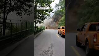
Truck reverses to escape mountainside landslide collapse in southern China
A dramatic landslide hit southern China, bringing a cascade of ...
A dramatic landslide hit southern China, bringing a cascade of mountain rocks crashing down and resulting in a complete halt to ...
Canada is classified as Developed region: G7: Group of Seven – Major advanced economies, including Canada, France, Germany, Italy, Japan, the United Kingdom, and the United States. The level of income is High income: OECD.
News – Latest Updates and Headlines from Landslip Island
Stay informed with the most recent news and important headlines from Landslip Island. Here’s a roundup of the latest developments.
Loading...
Please note: The data used here has been primarily extracted from satellite readings. Deviations from exact values may occur, particularly regarding the height of elevations and population density. Land area and coastline measurements refer to average values at mean high tide.


![Fleetwood Mac - Landslide (Live) (Official Video) [HD]](https://i.ytimg.com/vi/WM7-PYtXtJM/mqdefault.jpg)