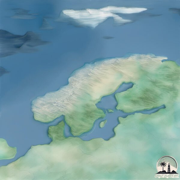
Welcome to Langoya, a Continental island in the Norwegian Sea, part of the majestic Atlantic Ocean. This guide offers a comprehensive overview of what makes Langoya unique – from its geography and climate to its population, infrastructure, and beyond. Dive into the details:
Geography and size of Langoya
Size: 2.234 km²
Coastline: 12.8 km
Ocean: Atlantic Ocean
Sea: Norwegian Sea
Continent: Europe
Langoya is a Small Island spanning 2.2 km² with a coastline of 12.8 km.
Archipel: Vesterålen – A district and archipelago in Norway, north of the Lofoten, known for its stunning landscapes, fishing culture, and whale watching.
Tectonic Plate: Eurasia – One of the world’s largest tectonic plates, the Eurasian Plate covers a significant portion of Europe and Asia. It’s characterized by diverse geological features, including the Ural Mountains, the European Plain, and the Himalayas formed from its collision with the Indian Plate.
The geographic heart of the island is pinpointed at these coordinates:
Latitude: 68.72402858 / Longitude: 14.96284017
Climate and weather of Langoya
Climate Zone: Continental
Climate Details: Subarctic Climate
Temperature: Cold Summer
Climate Characteristics: Characterized by long, extremely cold winters and short, cool summers, often found in northern latitudes of North America and Eurasia.
Topography and nature of Langoya
Timezone: UTC+01:00
Timezone places: Europe/Paris
Max. Elevation: 611 m
Mean Elevation: 172 m
Vegetation: Open Woodland
Tree Coverage: 37%
The mean elevation is 172 m. The highest elevation on the island reaches approximately 611 meters above sea level. The island is characterized by Plateau: Elevated flatlands rising sharply above the surrounding area, with a maximum elevation over 500 meters but a mean elevation less than 300 meters, forming unique highland areas on islands.
Dominating Vegetation: Open Woodland
Characterized by sparsely distributed trees with open canopy allowing sunlight to penetrate, supporting grasses and shrubs underneath. Often found in drier or transitional environments. Langoya has a tree cover of 37 %.
Vegetation: 11 vegetation zones – Exceptionally Diverse Island
Islands with more than ten vegetation zones are among the most ecologically rich and varied in the world. These islands are akin to miniature continents, boasting an incredible array of ecosystems. The sheer range of habitats, from high peaks to deep valleys, rainforests to deserts, creates a mosaic of life that is unparalleled. They are crucial for conservation and ecological studies.
Infrastructure and Travelling to Langoya
Does the island have a public airport? yes.
Langoya has a public and scheduled airport. The following airports are located on this island: Stokmarknes Airport, Skagen.
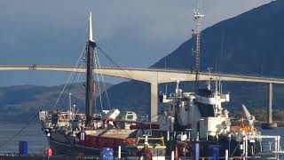
Does the island have a major port? yes.
Langoya is home to a major port. The following ports are situated on the island: SORTLAND.
The mean population of Langoya is 14 per km². Langoya is Gently Populated. The island belongs to Norway.
The name of the island resonates across different cultures and languages. Here is how it is known around the world: Arabic: فيستريلان; German: Vesterålen; Spanish: Vesterålen; French: Vesterålen; Portuguese: Vesterålen; Russian: Вестеролен; Chinese: 西奧倫群島
Continuing your journey, Helgbustadoya is the next notable island, situated merely km away.
Langøya island views.
There is a small island in the southern part of Norway. Its name is Langøya. Here is some not so professional drone footage to ...Langøya island views.
There is a small island in the southern part of Norway. Its name is ...
There is a small island in the southern part of Norway. Its name is Langøya. Here is some not so professional drone footage to ...
It looks like Wisconsin but it's Langoya island Norway
Nykvåg Pueblo pescadores Langoya Islas Vesteralen
Gran Canaria Un Paisaje por Descubrir Pagina Web de fotos de Gran ...
Auroras Fjordcamp krakberget Langoya Islas Vesteralen
Gran Canaria Un Paisaje por Descubrir Pagina Web de fotos de Gran ...
Pretty nice sea at Oslo Fjord’s Langøya island
080 Norwegia wyspy Langoya Andoya Senja Norway Islands
Po Lofotach, czas na kolejne wyspy, równie urokliwe Langoya, Andoya i ...
Po Lofotach, czas na kolejne wyspy, równie urokliwe Langoya, Andoya i świetna Senja.
#Shorts, we’re here in Langøya island by the Oslo fjords!
📍 Lofoten, Norway by @luigichiurchi
lofoten #aroundtheworldpix #lofotenisland #norway #voyaged #mystopover ...
lofoten #aroundtheworldpix #lofotenisland #norway #voyaged #mystopover #roamtheplanet #dreamchasersnorway ...
Top 10 Places To Visit in Lofoten & Northern Norway
I recently returned from exploring Lofoten & Northern Norway and I ...
I recently returned from exploring Lofoten & Northern Norway and I can't wait to share this video with you. Enjoy this travel guide ...
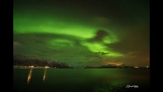
Chasing the northern lights in arctic Norway (part 1) | Langøya | A Nightscape Journal
The first part of our Winter Arctic adventure in northern Norway in ...
The first part of our Winter Arctic adventure in northern Norway in early 2023, chasing the northern lights on the island of Langøya.
Kjækholmen og Langnes (Øksnes / Langøya / Vesterålen) - dronevideo - 2017.10.08 - 4k
Dronevideo fra en fin høstdag. Video: Raymond T. Knudsen Musikk: ...
Dronevideo fra en fin høstdag. Video: Raymond T. Knudsen Musikk: Jahzzar - Maresia Drone: DJI Mavic Pro.
Nyksund en pleno invierno con nevada isla de Langøya archipiélago de Vesterålen
Gran Canaria Un Paisaje por Descubrir Pagina Web de fotos de Gran ...
A BOAT Trip around LANGØYA ISLAND in NORWAY with a bit of Fishing
i took a boat trip around Langøya looking from a distance #boattrip ...
i took a boat trip around Langøya looking from a distance #boattrip #fishing #newvideo.
Ep5: Whale watching in a motorhome on the Vesterålen Islands, Norway. Sept 2023
In this vlog we explore the beautiful Vesterålen Islands in Nordland, ...
In this vlog we explore the beautiful Vesterålen Islands in Nordland, Norway. We start off our travels at Evenes and Harstad on ...
TimeLapse Langøya / Norway
Testing the time interval settings on my Nikon D7200.
Testing the time interval settings on my Nikon D7200.
Norway Trip 2023 - Part 4 / Langøya
[English below] In diesem Video nun geht die Fahrt von Andøya weiter ...
[English below] In diesem Video nun geht die Fahrt von Andøya weiter auf die Nachbarinsel Langøya. Zunächst über Myre hoch ...
Chasing the northern lights in arctic Norway (part 3) | Langøya | A Nightscape Journal
The final part of our Winter Arctic adventure in northern Norway in ...
The final part of our Winter Arctic adventure in northern Norway in early 2023, chasing the northern lights on the island of Langøya ...
Playa de Hovden en invierno nevado isla de Langøya
Gran Canaria Un Paisaje por Descubrir Pagina Web de fotos de Gran ...
cinematic vlog Langøya to Lofoten, Norway winter by camper 2026
traveling the winter months past Scandinavia, christmas and new year ...
traveling the winter months past Scandinavia, christmas and new year on Langøya 2025 to 2026 from Holland with basset pup, ...
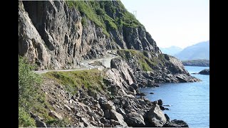
Magnificent Coastal Road to Nyksund, Vesteralen, NORWAY
Nyksund is a coastal fishing village on the northern part of the ...
Nyksund is a coastal fishing village on the northern part of the island of Langøya in the Vesterålen archipelago. It is part of the ...
Fjelltur Bollvågtuva 588 moh - (Øksnes / Langøya) - 2021.09.11 - 4k
Gikk Stavdalen - Rundfjellet - Bollvågtuva Video: Raymond T. Knudsen ...
Gikk Stavdalen - Rundfjellet - Bollvågtuva Video: Raymond T. Knudsen Music: Twin Musicom - Talky Beat Flere fjellturer: ...
Norway trip | Scenic Drive | Northbound: Part 28 - Trolldalsvatnet to Sortland (Langøya).
Join me on an unforgettable segment of my epic Norwegian Arctic road ...
Join me on an unforgettable segment of my epic Norwegian Arctic road trip adventure: from Nordkapp through Senja to the ...
Langøya
Circumnavigation of Svalbard aboard Atlas Ocean Voyages' yacht World ...
Circumnavigation of Svalbard aboard Atlas Ocean Voyages' yacht World Voyager on 20 - 31 July 2025. How do you follow-up a ...
Chasing the northern lights in arctic Norway (part 2) | Langøya | A Nightscape Journal
The second part of our Winter Arctic adventure in northern Norway in ...
The second part of our Winter Arctic adventure in northern Norway in early 2023, chasing the northern lights on the island of ...
Norway is classified as Developed region: nonG7: Developed economies outside of the Group of Seven, characterized by high income and advanced economic structures. The level of income is High income: OECD.
News – Latest Updates and Headlines from Langoya
Stay informed with the most recent news and important headlines from Langoya. Here’s a roundup of the latest developments.
Loading...
Please note: The data used here has been primarily extracted from satellite readings. Deviations from exact values may occur, particularly regarding the height of elevations and population density. Land area and coastline measurements refer to average values at mean high tide.