Las Aves archipelago
Welcome to Las Aves archipelago, a Dry island in the Caribbean Sea, part of the majestic Atlantic Ocean. This guide offers a comprehensive overview of what makes Las Aves archipelago unique – from its geography and climate to its population, infrastructure, and beyond. Dive into the details:
- Geography and Size: Explore the island’s size and location.
- Climate and Weather: Weather patterns and temperature.
- Topography and Nature: Uncover the natural wonders of the island.
- Infrastructure and Travelling: Insights on reaching, staying, and making the most of your visit.
- News and Headlines: Latest News.
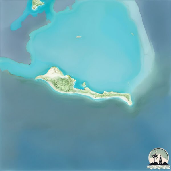
Geography and size of Las Aves archipelago
Size: 1.823 km²
Coastline: 14.5 km
Ocean: Atlantic Ocean
Sea: Caribbean Sea
Continent: North America
Las Aves archipelago is a Small Island spanning 1.8 km² with a coastline of 14.5 km.
Archipel: Lesser Antilles – A long arc of small islands in the Caribbean Sea, stretching from the Virgin Islands to Trinidad, known for their distinct cultures and tropical landscapes.
Tectonic Plate: Africa – One of the world’s largest tectonic plates, covering the African continent and parts of the surrounding oceans, known for its stability with some active rift zones.
The geographic heart of the island is pinpointed at these coordinates:
Latitude: 11.97902217 / Longitude: -67.66084209
Climate and weather of Las Aves archipelago
Climate Zone: Dry
Climate Details: Hot Semi-Arid (Steppe) Climate
Temperature: Hot
Climate Characteristics: Features hot summers and mild to warm winters. Receives more rainfall than hot deserts but less than tropical savannas, leading to a somewhat more varied landscape.
Topography and nature of Las Aves archipelago
Timezone: UTC-04:30
Timezone places: America/Caracas
Max. Elevation: 1 m
Mean Elevation: -19 m
Vegetation: Herbaceous Cover
Tree Coverage: 22%
The mean elevation is -19 m. The highest elevation on the island reaches approximately 1 meters above sea level. The island is characterized by Plains: Flat, low-lying lands characterized by a maximum elevation of up to 200 meters. On islands, plains are typically coastal lowlands or central flat areas.
Dominating Vegetation: Herbaceous Cover
Comprising mainly of grasses, herbs, and ferns, these areas are common in prairies, meadows, and savannas, and can vary widely in species composition. Las Aves archipelago has a tree cover of 22 %.
Vegetation: 3 vegetation zones – Moderately Diverse Island
These islands start to show a broader range of ecological niches. With three vegetation zones, they may offer a mix of ecosystems like coastal areas, inland woods, and perhaps a distinct wetland or dry area. This diversity supports a wider range of flora and fauna, making these islands more ecologically complex than those with minimal diversity.
Infrastructure and Travelling to Las Aves archipelago
Does the island have a public airport? no.
There is no public and scheduled airport on Las Aves archipelago. The nearest airport is Flamingo International Airport, located 68 km away.
Does the island have a major port? no.
There are no major ports on Las Aves archipelago. The closest major port is SALINA, approximately 68 km away.
The mean population of Las Aves archipelago is per km². Las Aves archipelago is . The island belongs to Venezuela.
Continuing your journey, Bonaire Island is the next notable island, situated merely km away.
DESTINO PARADISÍACO PERO DESHABITADO: Archipiélago de Las Aves (Venezuela)


Venezuela is classified as Emerging region: G20: Group of Twenty – Major economies comprising both developed and emerging countries, representing the world’s largest economies. The level of income is Upper middle income.
News – Latest Updates and Headlines from Las Aves archipelago
Stay informed with the most recent news and important headlines from Las Aves archipelago. Here’s a roundup of the latest developments.
Please note: The data used here has been primarily extracted from satellite readings. Deviations from exact values may occur, particularly regarding the height of elevations and population density. Land area and coastline measurements refer to average values at mean high tide.