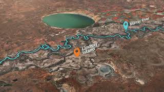
Lindsay Island
Welcome to Lindsay Island, a Temperate island in the Yellow Sea, part of the majestic Pacific Ocean. This guide offers a comprehensive overview of what makes Lindsay Island unique – from its geography and climate to its population, infrastructure, and beyond. Dive into the details:
- Geography and Size: Explore the island’s size and location.
- Climate and Weather: Weather patterns and temperature.
- Topography and Nature: Uncover the natural wonders of the island.
- Infrastructure and Travelling: Insights on reaching, staying, and making the most of your visit.
- News and Headlines: Latest News.
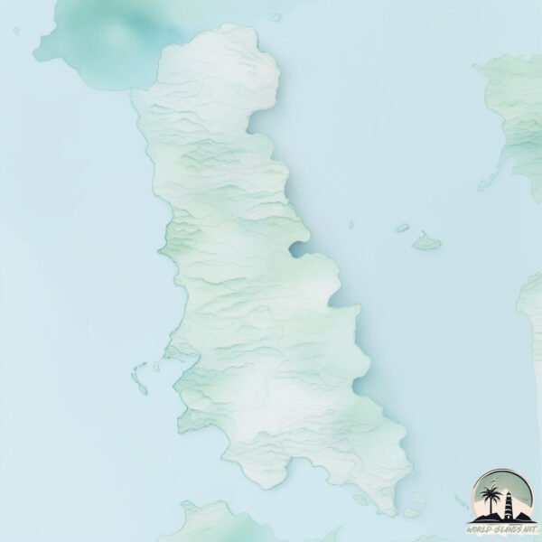
Geography and size of Lindsay Island
Size: 125.6 km²
Coastline: 94.6 km
Ocean: Pacific Ocean
Sea: Yellow Sea
Continent: Asia
Lindsay Island is a Large Island spanning 126 km² with a coastline of 95 km.
Archipel: –
Tectonic Plate: Eurasia – One of the world’s largest tectonic plates, the Eurasian Plate covers a significant portion of Europe and Asia. It’s characterized by diverse geological features, including the Ural Mountains, the European Plain, and the Himalayas formed from its collision with the Indian Plate.
The geographic heart of the island is pinpointed at these coordinates:
Latitude: 36.50125282 / Longitude: 126.36588923
Climate and weather of Lindsay Island
Climate Zone: Temperate
Climate Details: Monsoon-Influenced Humid Subtropical Climate
Temperature: Hot Summer
Climate Characteristics: Known for hot, humid summers with significant monsoon rains, contrasted by mild, drier winters.
Topography and nature of Lindsay Island
Timezone: UTC+09:00
Timezone places: Asia/Tokyo
Max. Elevation: 55 m
Mean Elevation: 18 m
Vegetation: Agricultural Mosaic
Tree Coverage: 35%
The mean elevation is 18 m. The highest elevation on the island reaches approximately 55 meters above sea level. The island is characterized by Plains: Flat, low-lying lands characterized by a maximum elevation of up to 200 meters. On islands, plains are typically coastal lowlands or central flat areas.
Dominating Vegetation: Agricultural Mosaic
A mix of cropland and natural vegetation, often seen in rural landscapes where agricultural fields are interspersed with patches of natural habitats. Lindsay Island has a tree cover of 35 %.
Vegetation: 13 vegetation zones – Exceptionally Diverse Island
Islands with more than ten vegetation zones are among the most ecologically rich and varied in the world. These islands are akin to miniature continents, boasting an incredible array of ecosystems. The sheer range of habitats, from high peaks to deep valleys, rainforests to deserts, creates a mosaic of life that is unparalleled. They are crucial for conservation and ecological studies.
Infrastructure and Travelling to Lindsay Island
Does the island have a public airport? no.
There is no public and scheduled airport on Lindsay Island. The nearest airport is Kunsan Air Base, located 59 km away.
Does the island have a major port? no.
There are no major ports on Lindsay Island. The closest major port is DAESAN HANG, approximately 45 km away.
The mean population of Lindsay Island is 81 per km². Lindsay Island is Gently Populated. The island belongs to South Korea.
Continuing your journey, Sindo is the next notable island, situated merely km away.
Lindsay Island and Wallpolla Island Floodplain Restoration Projects


South Korea is classified as Emerging region: MIKT: Mexico, Indonesia, South Korea, and Turkey – Economies recognized for their development potential and emerging market status. The level of income is High income: OECD.
News – Latest Updates and Headlines from Lindsay Island
Stay informed with the most recent news and important headlines from Lindsay Island. Here’s a roundup of the latest developments.
Please note: The data used here has been primarily extracted from satellite readings. Deviations from exact values may occur, particularly regarding the height of elevations and population density. Land area and coastline measurements refer to average values at mean high tide.