Los Mogotones
Welcome to Los Mogotones, a Dry island in the Gulf of California, part of the majestic Pacific Ocean. This guide offers a comprehensive overview of what makes Los Mogotones unique – from its geography and climate to its population, infrastructure, and beyond. Dive into the details:
- Geography and Size: Explore the island’s size and location.
- Climate and Weather: Weather patterns and temperature.
- Topography and Nature: Uncover the natural wonders of the island.
- Infrastructure and Travelling: Insights on reaching, staying, and making the most of your visit.
- News and Headlines: Latest News.
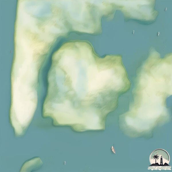
Geography and size of Los Mogotones
Size: 1.554 km²
Coastline: 5.8 km
Ocean: Pacific Ocean
Sea: Gulf of California
Continent: North America
Los Mogotones is a Small Island spanning 1.6 km² with a coastline of 5.8 km.
Archipel: –
Tectonic Plate: North America – Covers North America and parts of the Atlantic and Arctic Oceans, characterized by diverse geological features and varying levels of seismic activity.
The geographic heart of the island is pinpointed at these coordinates:
Latitude: 27.44685861 / Longitude: -110.57984188
Climate and weather of Los Mogotones
Climate Zone: Dry
Climate Details: Hot Deserts Climate
Temperature: Hot
Climate Characteristics: Dominated by extremely hot temperatures, this climate is marked by minimal rainfall and barren landscapes. Nights often experience drastic temperature drops.
Topography and nature of Los Mogotones
Timezone: UTC-07:00
Timezone places: America/Denver
Max. Elevation: -2 m
Mean Elevation: -3 m
Vegetation: Wetland
Tree Coverage: 32%
The mean elevation is -3 m. Remarkably, this unique island barely emerges above the sea level, showcasing nature’s fascinating interplay with the ocean. The island is characterized by Plains: Flat, low-lying lands characterized by a maximum elevation of up to 200 meters. On islands, plains are typically coastal lowlands or central flat areas.
Dominating Vegetation: Wetland
These areas are saturated with water, either permanently or seasonally, and support aquatic plants. Wetlands are important for biodiversity and water filtration. Los Mogotones has a tree cover of 32 %.
Vegetation: 4 vegetation zones – Diverse Island
Four distinct vegetation zones mark these islands as ecologically diverse. They might feature varied landscapes such as forests, beaches, grasslands, and rocky areas. Such diversity reflects the island’s complex ecological interactions and varied habitats, which can support a rich array of wildlife and plant species.
Infrastructure and Travelling to Los Mogotones
Does the island have a public airport? no.
There is no public and scheduled airport on Los Mogotones. The nearest airport is General José María Yáñez International Airport, located 69 km away.
Does the island have a major port? no.
There are no major ports on Los Mogotones. The closest major port is GUAYMAS, approximately 63 km away.
The mean population of Los Mogotones is 2 per km². Los Mogotones is Gently Populated. The island belongs to Mexico.
Continuing your journey, Lobos is the next notable island, situated merely km away.
Mexico is classified as Emerging region: MIKT: Mexico, Indonesia, South Korea, and Turkey – Economies recognized for their development potential and emerging market status. The level of income is Upper middle income.
News – Latest Updates and Headlines from Los Mogotones
Stay informed with the most recent news and important headlines from Los Mogotones. Here’s a roundup of the latest developments.
Please note: The data used here has been primarily extracted from satellite readings. Deviations from exact values may occur, particularly regarding the height of elevations and population density. Land area and coastline measurements refer to average values at mean high tide.