Welcome to Lunga, a Temperate island in the Inner Seas off the West Coast of Scotland, part of the majestic Atlantic Ocean. This guide offers a comprehensive overview of what makes Lunga unique – from its geography and climate to its population, infrastructure, and beyond. Dive into the details:
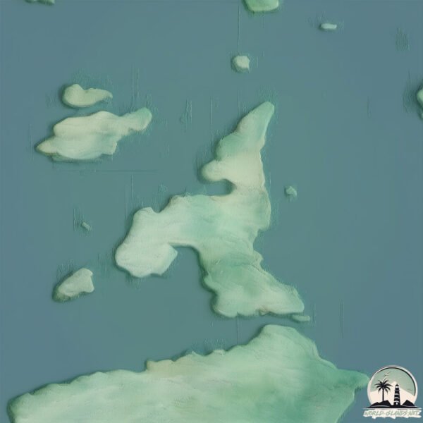
Geography and size of Lunga
Size: 2.902 km²
Coastline: 12.1 km
Ocean: Atlantic Ocean
Sea: Inner Seas off the West Coast of Scotland
Continent: Europe
Lunga is a Small Island spanning 2.9 km² with a coastline of 12.1 km.
Archipel: British Isles – A group of islands off the northwest coast of mainland Europe, including Great Britain, Ireland, and over 6,000 smaller islands, known for their rich history and cultural diversity.
Tectonic Plate: Eurasia – One of the world’s largest tectonic plates, the Eurasian Plate covers a significant portion of Europe and Asia. It’s characterized by diverse geological features, including the Ural Mountains, the European Plain, and the Himalayas formed from its collision with the Indian Plate.
The geographic heart of the island is pinpointed at these coordinates:
Latitude: 56.2159704 / Longitude: -5.69891207
Climate and weather of Lunga
Climate Zone: Temperate
Climate Details: Temperate Oceanic Climate
Temperature: Warm Summer
Climate Characteristics: Known for its moderate year-round temperatures with ample rainfall and no dry season. Warm summers are characteristic.
Topography and nature of Lunga
Timezone: UTC±00:00
Timezone places: Europe/London
Max. Elevation: 26 m
Mean Elevation: 12 m
Vegetation: Evergreen Needleleaf Forest
Tree Coverage: 92%
The mean elevation is 12 m. The highest elevation on the island reaches approximately 26 meters above sea level. The island is characterized by Plains: Flat, low-lying lands characterized by a maximum elevation of up to 200 meters. On islands, plains are typically coastal lowlands or central flat areas.
Dominating Vegetation: Evergreen Needleleaf Forest
Dominated by evergreen coniferous trees such as pines and firs, which retain their needle-like leaves throughout the year. These forests are often found in cooler climates. Lunga has a tree cover of 92 %.
Vegetation: 4 vegetation zones – Diverse Island
Four distinct vegetation zones mark these islands as ecologically diverse. They might feature varied landscapes such as forests, beaches, grasslands, and rocky areas. Such diversity reflects the island’s complex ecological interactions and varied habitats, which can support a rich array of wildlife and plant species.
Infrastructure and Travelling to Lunga
Does the island have a public airport? no.
There is no public and scheduled airport on Lunga. The nearest airport is Islay Airport, located 84 km away.
Does the island have a major port? no.
There are no major ports on Lunga. The closest major port is CRINAN (CANAL), approximately 19 km away.
The mean population of Lunga is 0 per km². Lunga is Uninhabited. The island belongs to United Kingdom.
The name of the island resonates across different cultures and languages. Here is how it is known around the world: Arabic: بريطانيا العظمى; German: Großbritannien; Spanish: Gran Bretaña; French: Grande-Bretagne; Portuguese: Grã-Bretanha; Russian: Великобритания; Chinese: 大不列顛島
Continuing your journey, Scarba is the next notable island, situated merely km away.
Lunga Island Huge Guillemot colony.
Friday 6th June 1024. On the Western side of the island is an outcrop of rock that serves as a huge Guillemot colony. Noisy and ...Lunga Island Huge Guillemot colony.
Friday 6th June 1024. On the Western side of the island is an outcrop ...
Friday 6th June 1024. On the Western side of the island is an outcrop of rock that serves as a huge Guillemot colony. Noisy and ...
Abandoned Cottages Island Of Lunga On History Visit To Treshnish Isles In Argyll and Bute Scotland
Tour Scotland 4K travel video, with Scottish music, of abandoned ...
Tour Scotland 4K travel video, with Scottish music, of abandoned crofters cottages on the Island of Lunga on ancestry, genealogy, ...
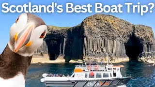
Puffins Don't Get Closer Than This! A Remarkable Boat Trip to The Scottish Isles (Staffa and Lunga)
If you fancy getting up close to unique caves and incredible wildlife, ...
If you fancy getting up close to unique caves and incredible wildlife, I cannot think of a more perfect tour - welcome to our day ...
Puffins on Lunga Island Scotland
Abandoned Cottages Island Of Lunga On History Visit To Treshnish Isles In Argyll and Bute Scotland
Tour Scotland short 4K travel video clip, with Scottish music, of ...
Tour Scotland short 4K travel video clip, with Scottish music, of abandoned crofters cottages on the Island of Lunga on ancestry, ...
On route to Isle of Lunga , full of puffins ! #birdingparadise #wildbird #oystercatcher #birdguides
Blue Clipper schooner tall ship, July 4 to July 9 2025 , sailing ...
Blue Clipper schooner tall ship, July 4 to July 9 2025 , sailing around the Isle of Mull, Hebrides, Scotland.
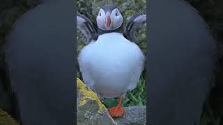
Lunga island puffins
Lunga island tour to see the puffins in Scotland!
Lunga island tour to see the puffins in Scotland!
Puffin Island - The Isle of Lunga
Up close and personal with puffins on the Treshnish Isles.
Up close and personal with puffins on the Treshnish Isles.
I Visited Scotland's Puffin Paradise #treshnishisles #puffins #isleoflunga
Join us on a boat tour from Tobermory, Isle of Mull - Staffa Tours - ...
Join us on a boat tour from Tobermory, Isle of Mull - Staffa Tours - to the Treshnish Isle of Lunga for a puffin paradise in Scotland!
Puffins of Lunga Island
oin me on the wild and beautiful Isle of Lunga, part of the Treshnish ...
oin me on the wild and beautiful Isle of Lunga, part of the Treshnish Isles off the west coast of Scotland, as I spend time filming and ...
Island Of Lunga On Visit To Treshnish Isles In Argyll and Bute Scotland
Tour Scotland travel video, with Scottish music, of the Island of ...
Tour Scotland travel video, with Scottish music, of the Island of Lunga on visit to Treshnish Isles In Argyll and Bute. Of volcanic ...
Island Of Lunga On Visit To Treshnish Isles In Argyll and Bute Scotland
Tour Scotland travel video clip, with Scottish music, of the Island of ...
Tour Scotland travel video clip, with Scottish music, of the Island of Lunga on visit to Treshnish Isles in Argyll and Bute. Of volcanic ...
Summit panorama of uninhabited Lunga island, Treshnish Islands off Mull, Scotland UK
The view from the summit of the island of Lunga, Treshnish Isles, off ...
The view from the summit of the island of Lunga, Treshnish Isles, off Mull, Scotland. A fantastic panorama including Mull, Rum, ...
Puffin on Lunga Island, Scotland 🏴
Tara & Indy's Travel Vlog.
Tara & Indy's Travel Vlog.
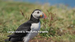
LUNGA Island & Helpful Staffa Tours Staff
LUNGA is a small Island where a large colony of puffins nest. Visiting ...
LUNGA is a small Island where a large colony of puffins nest. Visiting the Island is part of a Tour operated by Staffa Tours. Access ...
Scotsman Walking Wearing Kilt On Coast Of Lunga Island On History Visit To Argyll And Bute Scotland
Tour Scotland short 4K travel video clip of a Scotsman wearing a kilt ...
Tour Scotland short 4K travel video clip of a Scotsman wearing a kilt and sporran and walking on by cliffs on the coast of Lunga ...
Isle of Lunga / Puffin Island Mull
Here is some video and stills that I shot while on a visit to the Isle ...
Here is some video and stills that I shot while on a visit to the Isle of Mull on the west Coast of Scotland. I took a boat to the ...Isle of ...[+] Show More Puffin Paradise on Lunga Island | A Magical Wildlife Encounter!
Our last chance to see puffins up close—and wow, did Lunga deliver! ✨ ...
Our last chance to see puffins up close—and wow, did Lunga deliver! ✨ We set off with Turus Mara, hoping for a glimpse of ...
Puffin Therapy taking place on Island of Lunga Treshnish Islands Off Mull Scotland UK Birds
Puffins on Lunga, Treshnish Islands, Scotland, filmed in 2012.
Puffins on Lunga, Treshnish Islands, Scotland, filmed in 2012.
Puffins, Lunga Island (Treshnish Isles, Inner Hebrides, Scotland)
Short video showing the Puffins at Lunga Island, also known as Puffin ...
Short video showing the Puffins at Lunga Island, also known as Puffin Island. Recorded 6th July 2021.
The Puffins of the Island of Lunga
This is a little excerpt from our video of the Treshnish isles ...
This is a little excerpt from our video of the Treshnish isles Featuring the Puffins on the island of Lunga off the West Coast of ...
Lunga Island : Birds Paradise
Lunga Island, Inner Hebrides, Scotland.
Lunga Island, Inner Hebrides, Scotland.
Lunga Island- 27th June 2016
Lunga Island residents celebrate the hand over of medical equipment by ...
Lunga Island residents celebrate the hand over of medical equipment by Save the Children and the Lunga Community ...
Puffin on Lunga Island
Puffin on Lunga Island, Inner Hebrides, June 2011. Taken with the wide ...
Puffin on Lunga Island, Inner Hebrides, June 2011. Taken with the wide angle setting on a Sony Handycam full Hi Definition.
United Kingdom is classified as Developed region: G7: Group of Seven – Major advanced economies, including Canada, France, Germany, Italy, Japan, the United Kingdom, and the United States. The level of income is High income: OECD.
News – Latest Updates and Headlines from Lunga
Stay informed with the most recent news and important headlines from Lunga. Here’s a roundup of the latest developments.
Loading...
Please note: The data used here has been primarily extracted from satellite readings. Deviations from exact values may occur, particularly regarding the height of elevations and population density. Land area and coastline measurements refer to average values at mean high tide.