Madagascar
Welcome to Madagascar, a Tropical island in the Mozambique Channel, part of the majestic Indian Ocean. This guide offers a comprehensive overview of what makes Madagascar unique – from its geography and climate to its population, infrastructure, and beyond. Dive into the details:
- Geography and Size: Explore the island’s size and location.
- Climate and Weather: Weather patterns and temperature.
- Topography and Nature: Uncover the natural wonders of the island.
- Infrastructure and Travelling: Insights on reaching, staying, and making the most of your visit.
- News and Headlines: Latest News.
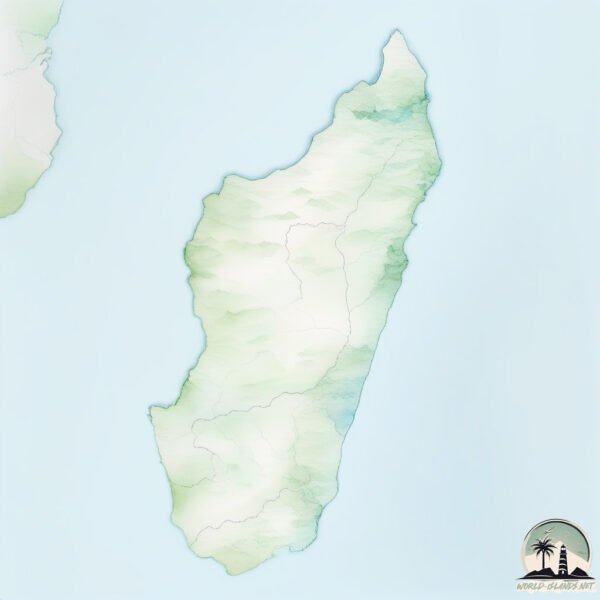
Geography and size of Madagascar
Size: 592521 km²
Coastline: 13378 km
Ocean: Indian Ocean
Sea: Mozambique Channel
Continent: Africa
Madagascar is a Colossal Island spanning 592521 km² with a coastline of 13378 km.
Archipel: –
Tectonic Plate: Somalia – A large tectonic plate covering the Horn of Africa and parts of the Indian Ocean, known for the East African Rift where it’s splitting away from the African Plate.
The geographic heart of the island is pinpointed at these coordinates:
Latitude: -19.38781411 / Longitude: 46.69556223
Climate and weather of Madagascar
Climate Zone: Tropical
Climate Details: Tropical Savanna, Wet
Temperature: Hot
Climate Characteristics: Defined by distinct wet and dry seasons with high temperatures year-round. Pronounced rainfall occurs during the wet season, while the dry season is marked by drought.
Topography and nature of Madagascar
Timezone: UTC+03:00
Timezone places: Asia/Riyadh
Max. Elevation: 2876 m Maromokotro
Mean Elevation: 543 m
Vegetation: Open Woodland
Tree Coverage: 26%
The mean elevation is 543 m. Dominating the island’s landscape, the majestic “Maromokotro ” rises as the highest peak, soaring to impressive heights. The island is characterized by Mountains: High, steeply elevated landforms. Characterized by both a high maximum elevation (over 500 meters) and a high mean elevation, creating rugged, mountainous terrains on islands.
Dominating Vegetation: Open Woodland
Characterized by sparsely distributed trees with open canopy allowing sunlight to penetrate, supporting grasses and shrubs underneath. Often found in drier or transitional environments. Madagascar has a tree cover of 26 %.
Vegetation: 16 vegetation zones – Exceptionally Diverse Island
Islands with more than ten vegetation zones are among the most ecologically rich and varied in the world. These islands are akin to miniature continents, boasting an incredible array of ecosystems. The sheer range of habitats, from high peaks to deep valleys, rainforests to deserts, creates a mosaic of life that is unparalleled. They are crucial for conservation and ecological studies.
Infrastructure and Travelling to Madagascar
Does the island have a public airport? yes.
Madagascar has a public and scheduled airport. The following airports are located on this island: Antsalova Airport, Ivato Airport, Ankavandra Airport, Belo sur Tsiribihina Airport, Miandrivazo Airport, Maintirano Airport, Morafenobe Airport, Toamasina Ambalamanasy Airport, Tambohorano Airport, Morondava Airport, Tsiroanomandidy Airport, Ambatondrazaka Airport, Arrachart Airport, Mananara Nord Airport, Port Bergé Airport, Antsirabe Airport, Analalava Airport, Amborovy Airport, Soalala Airport, Mampikony Airport, Besalampy Airport, Maroantsetra Airport, Sambava Airport, Tsaratanana Airport, Vohemar Airport, Ambalabe Airport, Mandritsara Airport, Tôlanaro Airport, Fianarantsoa Airport, Farafangana Airport, Manja Airport, Manakara Airport, Mananjary Airport, Morombe Airport, Toliara Airport.
Does the island have a major port? yes.
Madagascar is home to a major port. The following ports are situated on the island: MORONDAVA, MAHAJANGA, MAINTIRANO, ANTSOHIM BONDRONA.
The mean population of Madagascar is 47 per km². Madagascar is Gently Populated. The island belongs to Madagascar.
The name of the island resonates across different cultures and languages. Here is how it is known around the world: Arabic: مدغشقر; German: Madagaskar; Spanish: MADAGASCAR; French: Madagascar; Portuguese: Ilha de Madagascar; Russian: Мадагаскар; Chinese: 马达加斯加岛
Continuing your journey, Nosy Faly is the next notable island, situated merely km away.
MADAGASCAR: The World's Strangest Island


Madagascar is classified as Least developed region: Countries that exhibit the lowest indicators of socioeconomic development, with the lowest Human Development Index ratings. The level of income is Low income.
News – Latest Updates and Headlines from Madagascar
Stay informed with the most recent news and important headlines from Madagascar. Here’s a roundup of the latest developments.
Social Media Posts about Madagascar
Please note: The data used here has been primarily extracted from satellite readings. Deviations from exact values may occur, particularly regarding the height of elevations and population density. Land area and coastline measurements refer to average values at mean high tide.