Welcome to Mage Shima, a Temperate island in the Eastern China Sea, part of the majestic Pacific Ocean. This guide offers a comprehensive overview of what makes Mage Shima unique – from its geography and climate to its population, infrastructure, and beyond. Dive into the details:
Geography and size of Mage Shima
Size: 8.406 km²
Coastline: 14.8 km
Ocean: Pacific Ocean
Sea: Eastern China Sea
Continent: Asia
Mage Shima is a Small Island spanning 8.4 km² with a coastline of 14.8 km.
Archipel: Ryukyu Islands – A chain of Japanese islands stretching southwest from Kyushu to Taiwan, known for their unique Okinawan culture and subtropical climate.
Tectonic Plate: Yangtze – A minor tectonic plate in East Asia, often considered a part of the Eurasian Plate. It’s primarily continental and covers the Yangtze River area in China, playing a significant role in the region’s geological stability.
The geographic heart of the island is pinpointed at these coordinates:
Latitude: 30.74213029 / Longitude: 130.85293621
Climate and weather of Mage Shima
Climate Zone: Temperate
Climate Details: Humid Subtropical Climate
Temperature: Hot Summer
Climate Characteristics: With continuous rainfall and hot summers, this climate is common in some coastal regions, supporting diverse vegetation.
Topography and nature of Mage Shima
Timezone: UTC+09:00
Timezone places: Asia/Tokyo
Max. Elevation: 34 m
Mean Elevation: 16 m
Vegetation: Agricultural Mosaic
Tree Coverage: 63%
The mean elevation is 16 m. The highest elevation on the island reaches approximately 34 meters above sea level. The island is characterized by Plains: Flat, low-lying lands characterized by a maximum elevation of up to 200 meters. On islands, plains are typically coastal lowlands or central flat areas.
Dominating Vegetation: Agricultural Mosaic
A mix of cropland and natural vegetation, often seen in rural landscapes where agricultural fields are interspersed with patches of natural habitats. Mage Shima has a tree cover of 63 %.
Vegetation: 9 vegetation zones – Very Highly Diverse Island
Islands in this range are ecological powerhouses, showcasing a wide array of vegetation zones. Each zone, from lush rainforests to arid scrublands, coastal mangroves to mountainous regions, contributes to a complex and interdependent ecosystem. These islands are often hotspots of biodiversity, supporting numerous species and intricate ecological processes.
Infrastructure and Travelling to Mage Shima
Does the island have a public airport? no.
There is no public and scheduled airport on Mage Shima. The nearest airport is New Tanegashima Airport, located 20 km away.
Does the island have a major port? no.
There are no major ports on Mage Shima. The closest major port is KIIRE, approximately 77 km away.
The mean population of Mage Shima is 77 per km². Mage Shima is Gently Populated. The island belongs to Japan.
Continuing your journey, Tanega Shima is the next notable island, situated merely km away.
【Japan accelerates base construction on Amami and Mage islands in strategic southwest islands】
Japan is intensifying construction of military bases on Amami Island and Mage Island, key points in the strategic Southwest ...【Japan accelerates base construction on Amami and Mage islands in strategic southwest islands】
Japan is intensifying construction of military bases on Amami Island ...
Japan is intensifying construction of military bases on Amami Island and Mage Island, key points in the strategic Southwest ...
Mageshima Island Will Become Home To The Largest US Military Base Near The South China Sea!
Mageshima Island Will Become Home To The Largest US Military Base Near ...
Mageshima Island Will Become Home To The Largest US Military Base Near The South China Sea! On this channel we bring you ...
Satellite Images Reveal Japan’s Secret Island Base Construction
New satellite images released by Chinese state media appear to show ...
New satellite images released by Chinese state media appear to show rapid military construction on Japan's Mageshima Island ...
Japan buys island for $146 mn to conduct military drills with US
Japan agreed to buy uninhabited Mageshima island, around 30 kilometres ...
Japan agreed to buy uninhabited Mageshima island, around 30 kilometres off southwestern coast, for $146 million from a ...
Japan begins construction of new defense base in southwestern Japan
Japan's Defense Ministry begins construction of a new base on ...
Japan's Defense Ministry begins construction of a new base on Mageshima, an island in southwestern Japan, that will also be ...
Mageshima Island Explosive Revelations Unveil Americas Startling Military Strategy
China Shocked: US Successfully Change Mageshima Island into the Largest US Military Base in Near SCS
Three square miles of volcanic rock on the edge of the East China Sea ...
Three square miles of volcanic rock on the edge of the East China Sea may one day be used as an unsinkable aircraft carrier for ...
Documentary Mageshima+Protect the Island
The Island That Could Trap China | Zoom In with Sandeep Unnithan
Why has a small, uninhabited volcanic island at the southern tip of ...
Why has a small, uninhabited volcanic island at the southern tip of Japan suddenly become a major point of tension in East Asia?
militarization of magashima island
This Japanese Island Broke Google Maps…
Nishinoshima is the newest Japanese Island, in the Volcano Island Arc. ...
Nishinoshima is the newest Japanese Island, in the Volcano Island Arc. I talk about the progression of the island on Google Earth, ...
Secret Military Base Takes Shape on Japans Mysterious Volcanic Island
A secret military base is being constructed on a remote volcanic ...
A secret military base is being constructed on a remote volcanic island in Japan. The island, shrouded in mystery, has become the ...
The ORIGINAL Delicious in Dungeon Anime Adaptation #shorts #anime #dungeonmeshi
The title is a little hyperbolic but you get the point Socials: ...
The title is a little hyperbolic but you get the point Socials: ------------- ~Main Channel: ...
Runways, F-35s, US Jets - China Slams Japan’s Mageshima Military Base Amid Taiwan Tensions | VERTEX
Tensions in the Western Pacific are escalating fast. Japan's rapid ...
Tensions in the Western Pacific are escalating fast. Japan's rapid military expansion, toughened stance on Taiwan, and the ...
Tanega shima(island),here is first place arrived gun from Portugal.ポルトガルから日本で最初に鉄砲が伝来した種子島
Tanega shima(island),Japan.H3 rocket No.3 was launched successfully ...
Tanega shima(island),Japan.H3 rocket No.3 was launched successfully from this island,and here is first place arrived gun from ...
Japan and US Spearhead Joint Military Base in Secret Island Oasis
There's a small volcanic island off the southern coast of Japan called ...
There's a small volcanic island off the southern coast of Japan called Mageshima But here's footage from January 2023 of ...
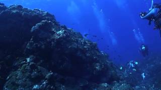
Diving in Mageshima, Part 2, AQUA Tanegashima diving tour 2015
馬毛島、種子島、鹿児島県.
馬毛島、種子島、鹿児島県.
Voices from Okinawa: Tanegashima & Mageshima
Voices from Okinawa: Tanegashima & Mageshima , Kaori Wada (和田香穂里) ...
Voices from Okinawa: Tanegashima & Mageshima , Kaori Wada (和田香穂里) Japanese with English subtitles March 4, 2023 ...
250211 ( Tanega-shima Island 2)
種子島シーカヤック seakayak in mage island
種子島のシーカヤック会社ランドアースのシゲです。皆さんに是非、種子島沖15kmにある馬毛島未映像を紹介します。
種子島のシーカヤック会社ランドアースのシゲです。皆さんに是非、種子島沖15kmにある馬毛島未映像を紹介します。
Ada yang masih bingung? #anime #manhua #manhua #manga #viralvideo #viralshorts #fypシ゚viral #fyp
Dukung channel ini biar makin semangat bikin konten seru buat kalian! ...
Dukung channel ini biar makin semangat bikin konten seru buat kalian! Kalau mau support, cek link donasi di bio ya. Terima kasih ...
#1Secret Military Base Unveiled on Mageshima Island: Game-Changer in Naval Operations
馬毛島(種子島) 2024年5月15日(14日) 朝日2
今日の馬毛島ではありません。 すみません。 撮影を失念してしまいました。 代わりと言ってはなんなのですが、昨日の朝撮影 ...
今日の馬毛島ではありません。 すみません。 撮影を失念してしまいました。 代わりと言ってはなんなのですが、昨日の朝撮影 ...
Diving in Mageshima, Part 1, AQUA Tanegashima diving tour 2015
馬毛島、種子島、鹿児島県.
馬毛島、種子島、鹿児島県.
250211 ( Tanega-shima Island 1)
Japan is classified as Developed region: G7: Group of Seven – Major advanced economies, including Canada, France, Germany, Italy, Japan, the United Kingdom, and the United States. The level of income is High income: OECD.
News – Latest Updates and Headlines from Mage Shima
Stay informed with the most recent news and important headlines from Mage Shima. Here’s a roundup of the latest developments.
Loading...
Please note: The data used here has been primarily extracted from satellite readings. Deviations from exact values may occur, particularly regarding the height of elevations and population density. Land area and coastline measurements refer to average values at mean high tide.