Mahe
Welcome to Mahe, a Tropical island in the Indian Ocean, part of the majestic Indian Ocean. This guide offers a comprehensive overview of what makes Mahe unique – from its geography and climate to its population, infrastructure, and beyond. Dive into the details:
- Geography and Size: Explore the island’s size and location.
- Climate and Weather: Weather patterns and temperature.
- Topography and Nature: Uncover the natural wonders of the island.
- Infrastructure and Travelling: Insights on reaching, staying, and making the most of your visit.
- News and Headlines: Latest News.
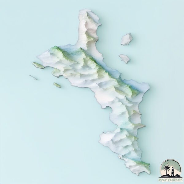
Geography and size of Mahe
Size: 155.5 km²
Coastline: 118.9 km
Ocean: Indian Ocean
Sea: Indian Ocean
Continent: Seven seas (open ocean)
Mahe is a Large Island spanning 156 km² with a coastline of 119 km.
Archipel: Seychelles – An archipelago of 115 islands in the Indian Ocean, known for their stunning natural beauty, unique flora and fauna, and as a luxury travel destination.
Tectonic Plate: Caribbean – Covering the Caribbean Sea and surrounding regions, this plate is bordered by the North American Plate and the South American Plate. Known for seismic activity, including earthquakes and volcanic eruptions, and features like the Puerto Rico Trench.
The geographic heart of the island is pinpointed at these coordinates:
Latitude: -4.67787331 / Longitude: 55.46799602
Climate and weather of Mahe
Climate Zone: Tropical
Climate Details: Tropical Rainforest Climate
Temperature: Hot
Climate Characteristics: This climate is typified by heavy rainfall throughout the year, high humidity, and consistently high temperatures, leading to lush rainforests and rich biodiversity. Seasonal temperature variations are minimal.
Topography and nature of Mahe
Timezone: UTC+04:00
Timezone places: Asia/Dubai
Max. Elevation: 745 m
Mean Elevation: 199 m
Vegetation: Evergreen Broadleaf Forest
Tree Coverage: 66%
The mean elevation is 199 m. The highest elevation on the island reaches approximately 745 meters above sea level. The island is characterized by Plateau: Elevated flatlands rising sharply above the surrounding area, with a maximum elevation over 500 meters but a mean elevation less than 300 meters, forming unique highland areas on islands.
Dominating Vegetation: Evergreen Broadleaf Forest
Characterized by dense, lush canopies of broadleaf trees that retain their leaves year-round. These forests are typically found in tropical and subtropical regions and are known for their high biodiversity. Mahe has a tree cover of 66 %.
Vegetation: 9 vegetation zones – Very Highly Diverse Island
Islands in this range are ecological powerhouses, showcasing a wide array of vegetation zones. Each zone, from lush rainforests to arid scrublands, coastal mangroves to mountainous regions, contributes to a complex and interdependent ecosystem. These islands are often hotspots of biodiversity, supporting numerous species and intricate ecological processes.
Infrastructure and Travelling to Mahe
Does the island have a public airport? yes.
Mahe has a public and scheduled airport. The following airports are located on this island: Seychelles International Airport.
Does the island have a major port? yes.
Mahe is home to a major port. The following ports are situated on the island: VICTORIA.
The mean population of Mahe is 520 per km². Mahe is Densely Populated. The island belongs to Seychelles.
The name of the island resonates across different cultures and languages. Here is how it is known around the world: Arabic: ماهيه; German: Mahé; Spanish: Mahé; French: Mahé; Portuguese: Ilha de Mahé; Russian: Маэ; Chinese: 马埃岛
Continuing your journey, Silhouette is the next notable island, situated merely km away.
The Seychelles Island Mahé - Island Tour & Travel Tips


Seychelles is classified as Developing region: Regions characterized by lower income levels, with economies in the process of industrialization and modernization. The level of income is Upper middle income.
News – Latest Updates and Headlines from Mahe
Stay informed with the most recent news and important headlines from Mahe. Here’s a roundup of the latest developments.
Please note: The data used here has been primarily extracted from satellite readings. Deviations from exact values may occur, particularly regarding the height of elevations and population density. Land area and coastline measurements refer to average values at mean high tide.