Majorca
Welcome to Majorca, a Dry island in the Balearic (Iberian Sea), part of the majestic Atlantic Ocean. This guide offers a comprehensive overview of what makes Majorca unique – from its geography and climate to its population, infrastructure, and beyond. Dive into the details:
- Geography and Size: Explore the island’s size and location.
- Climate and Weather: Weather patterns and temperature.
- Topography and Nature: Uncover the natural wonders of the island.
- Infrastructure and Travelling: Insights on reaching, staying, and making the most of your visit.
- News and Headlines: Latest News.
Geography and size of Majorca
Size: 3630 km²
Coastline: 511 km
Ocean: Atlantic Ocean
Sea: Balearic (Iberian Sea)
Continent: Europe
Majorca is a Very Large Island spanning 3630 km² with a coastline of 511 km.
Archipel: Balearic Islands – An archipelago off eastern Spain in the Mediterranean Sea, known for their vibrant culture, beautiful beaches, and popular tourist destinations like Mallorca and Ibiza.
Tectonic Plate: Eurasia – One of the world’s largest tectonic plates, the Eurasian Plate covers a significant portion of Europe and Asia. It’s characterized by diverse geological features, including the Ural Mountains, the European Plain, and the Himalayas formed from its collision with the Indian Plate.
The geographic heart of the island is pinpointed at these coordinates:
Latitude: 39.6132294 / Longitude: 2.95678487
Climate and weather of Majorca
Climate Zone: Dry
Climate Details: Cold Semi-Arid (Steppe) Climate
Temperature: Cold
Climate Characteristics: Characterized by hot summers and cold winters, this climate is typically found on the edges of continental zones. It receives sufficient precipitation to avoid desert conditions.
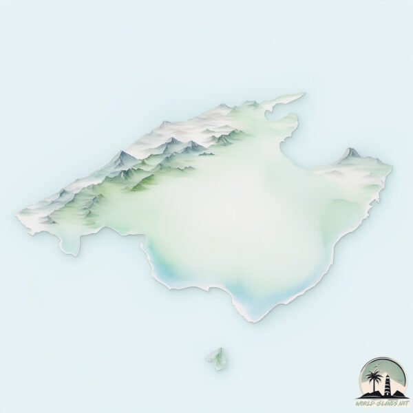
Topography and nature of Majorca
Timezone: UTC+01:00
Timezone places: Europe/Paris
Max. Elevation: 1209 m
Mean Elevation: 158 m
Vegetation: Agricultural Mosaic
Tree Coverage: 20%
The mean elevation is 158 m. The highest elevation on the island reaches approximately 1209 meters above sea level. The island is characterized by Plateau: Elevated flatlands rising sharply above the surrounding area, with a maximum elevation over 500 meters but a mean elevation less than 300 meters, forming unique highland areas on islands.
Dominating Vegetation: Agricultural Mosaic
A mix of cropland and natural vegetation, often seen in rural landscapes where agricultural fields are interspersed with patches of natural habitats. Majorca has a tree cover of 20 %.
Vegetation: 13 vegetation zones – Exceptionally Diverse Island
Islands with more than ten vegetation zones are among the most ecologically rich and varied in the world. These islands are akin to miniature continents, boasting an incredible array of ecosystems. The sheer range of habitats, from high peaks to deep valleys, rainforests to deserts, creates a mosaic of life that is unparalleled. They are crucial for conservation and ecological studies.
Infrastructure and Travelling to Majorca
Does the island have a public airport? yes.
Majorca has a public and scheduled airport. The following airports are located on this island: Palma de Mallorca Airport.
Does the island have a major port? yes.
Majorca is home to a major port. The following ports are situated on the island: PALMA DE MALLORCA.
The mean population of Majorca is 292 per km². Majorca is Moderately Inhabited. The island belongs to Spain.
The name of the island resonates across different cultures and languages. Here is how it is known around the world: Arabic: ميورقة; German: Mallorca; Spanish: Mallorca; French: Majorque; Portuguese: Maiorca; Russian: Мальорка; Chinese: 馬略卡島
Continuing your journey, Illa de Cabrera is the next notable island, situated merely km away.
The BEST beaches in Mallorca 😍 #mallorca #spain #travel


Spain is classified as Developed region: nonG7: Developed economies outside of the Group of Seven, characterized by high income and advanced economic structures. The level of income is High income: OECD.
News – Latest Updates and Headlines from Majorca
Stay informed with the most recent news and important headlines from Majorca. Here’s a roundup of the latest developments.
Social Media Posts about Majorca
Please note: The data used here has been primarily extracted from satellite readings. Deviations from exact values may occur, particularly regarding the height of elevations and population density. Land area and coastline measurements refer to average values at mean high tide.