Manano Delta
Welcome to Manano Delta, a Tropical island in the Caribbean Sea, part of the majestic Atlantic Ocean. This guide offers a comprehensive overview of what makes Manano Delta unique – from its geography and climate to its population, infrastructure, and beyond. Dive into the details:
- Geography and Size: Explore the island’s size and location.
- Climate and Weather: Weather patterns and temperature.
- Topography and Nature: Uncover the natural wonders of the island.
- Infrastructure and Travelling: Insights on reaching, staying, and making the most of your visit.
Geography and size of Manano Delta
Size: 10.823 km²
Coastline: 20.5 km
Ocean: Atlantic Ocean
Sea: Caribbean Sea
Continent: South America
Manano Delta is a Medium Island spanning 10.8 km² with a coastline of 20.5 km.
Archipel: –
Tectonic Plate: Africa – One of the world’s largest tectonic plates, covering the African continent and parts of the surrounding oceans, known for its stability with some active rift zones.
The geographic heart of the island is pinpointed at these coordinates:
Latitude: 9.86369987 / Longitude: -62.33684448
Climate and weather of Manano Delta
Climate Zone: Tropical
Climate Details: Tropical Savanna, Wet
Temperature: Hot
Climate Characteristics: Defined by distinct wet and dry seasons with high temperatures year-round. Pronounced rainfall occurs during the wet season, while the dry season is marked by drought.
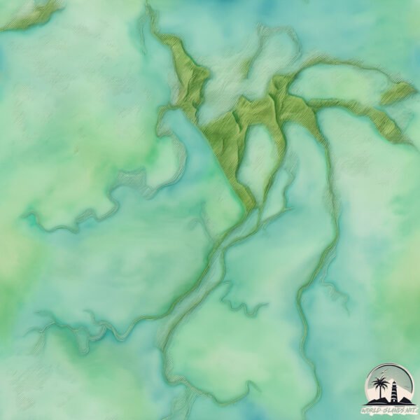
Topography and nature of Manano Delta
Timezone: UTC-04:30
Timezone places: America/Caracas
Max. Elevation: 32 m
Mean Elevation: 20 m
Vegetation: Wetland
Tree Coverage: 94%
The mean elevation is 20 m. The highest elevation on the island reaches approximately 32 meters above sea level. The island is characterized by Plains: Flat, low-lying lands characterized by a maximum elevation of up to 200 meters.
Dominating Vegetation: Wetland
Saturated with water, either permanently or seasonally, supports aquatic plants. Wetlands are important for biodiversity and water filtration. Manano Delta has a tree cover of 94 %.
Vegetation: 6 vegetation zones – Very Highly Diverse Island
This island is an ecological powerhouse, with a wide array of vegetation zones ranging from lush rainforests to arid scrublands. Its varied ecosystems contribute to a complex web of biodiversity.
Infrastructure and Travelling to Manano Delta
The mean population of Manano Delta is 7 per km². Manano Delta is Gently Populated. The island belongs to Venezuela.
Venezuela is classified as Emerging region: G20: Group of Twenty – Major economies comprising both developed and emerging countries, representing the world’s largest economies. The level of income is Upper middle income.
Continuing your journey, is the next notable island, situated merely km away.
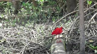
Scarlet Ibis - Cano Manano Delta Orinoco Venezuela - Thore Noernberg Birdwatching


Does the island have a public airport with scheduled flights? no.
There is no public and scheduled airport on Manano Delta. The nearest airport is Maturín Airport, located 87 km away.
Does the island have a major port? no.
There are no major ports on Manano Delta. The closest major port is GUIRIA, approximately 64 km away.
Please note: The data used here has been primarily extracted from satellite readings. Deviations from exact values may occur, particularly regarding population density, the height of elevations, land area, and coastline measurements. The latter refers to average values at mean high tide.