Welcome to Mangrove, a Tropical island in the Coral Sea, part of the majestic Pacific Ocean. This guide offers a comprehensive overview of what makes Mangrove unique – from its geography and climate to its population, infrastructure, and beyond. Dive into the details:
Geography and size of Mangrove
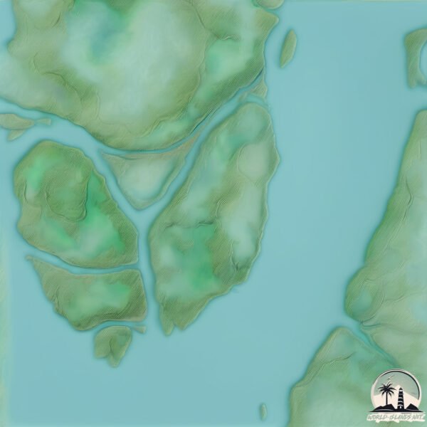
Size: 4.883 km²
Coastline: 11.9 km
Ocean: Pacific Ocean
Sea: Coral Sea
Continent: Oceania
Mangrove is a Small Island spanning 4.9 km² with a coastline of 11.9 km.
Archipel: –
Tectonic Plate: Australia – A major tectonic plate covering Australia, New Zealand, and parts of the Indian and Pacific Oceans, known for its relative stability and occasional seismic activity.
The geographic heart of the island is pinpointed at these coordinates:
Latitude: -22.24645977 / Longitude: 149.90626823
Climate and weather of Mangrove
Climate Zone: Tropical
Climate Details: Tropical Savanna, Wet
Temperature: Hot
Climate Characteristics: Defined by distinct wet and dry seasons with high temperatures year-round. Pronounced rainfall occurs during the wet season, while the dry season is marked by drought.
Topography and nature of Mangrove
Timezone: UTC+10:00
Timezone places: Australia/Sydney
Max. Elevation: 9 m
Mean Elevation: 4 m
Vegetation: Mangrove Forest
Tree Coverage: 75%
The mean elevation is 4 m. The highest elevation on the island reaches approximately 9 meters above sea level. The island is characterized by Plains: Flat, low-lying lands characterized by a maximum elevation of up to 200 meters. On islands, plains are typically coastal lowlands or central flat areas.
Dominating Vegetation: Mangrove Forest
Found in coastal areas and river deltas, these unique wetland ecosystems are adapted to saline conditions and are crucial for coastal protection and biodiversity. Mangrove has a tree cover of 75 %.
Vegetation: 3 vegetation zones – Moderately Diverse Island
These islands start to show a broader range of ecological niches. With three vegetation zones, they may offer a mix of ecosystems like coastal areas, inland woods, and perhaps a distinct wetland or dry area. This diversity supports a wider range of flora and fauna, making these islands more ecologically complex than those with minimal diversity.
Infrastructure and Travelling to Mangrove
Does the island have a public airport? no.
There is no public and scheduled airport on Mangrove. The nearest airport is Rockhampton Airport, located 139 km away.
Does the island have a major port? no.
There are no major ports on Mangrove. The closest major port is HAY POINT, approximately 125 km away.
The mean population of Mangrove is 0 per km². Mangrove is Uninhabited. The island belongs to Australia.
Continuing your journey, Allandale is the next notable island, situated merely km away.
The Mangrove Island - A hidden Island, True Serenity
A solo traveler embarks on a journey to The Mangrove Island in Noonu Atoll—not just a destination, but an experience that ...The Mangrove Island - A hidden Island, True Serenity
A solo traveler embarks on a journey to The Mangrove Island in Noonu ...
A solo traveler embarks on a journey to The Mangrove Island in Noonu Atoll—not just a destination, but an experience that ...
3 Days Solo MANGROVE ISLAND Survival | No Food or Shelter
I challenge myself to survive for three days without food or shelter ...
I challenge myself to survive for three days without food or shelter on a mangrove island inhabited by some of the deadliest ...
Life and Death of a Mangrove Island
In this video, Dr. Karen McKee describes some of her research on ...
In this video, Dr. Karen McKee describes some of her research on mangroves in Belize and what motivated her to study how ...
Island Survival With Hand Spear In Mangrove Forest
NEW MERCH at
https://youngbloods.co/ Surviving in a mangrove forest on remote islands with only my hand spear or bare hands ...
Inside the Mangrove Forest
Step into the remarkable world of mangrove forests, where the daily ...
Step into the remarkable world of mangrove forests, where the daily rhythm of the tides sets the pace of life. These coastal ...
What are Mangroves? 🌾 💧 🌴
Did you know that mangroves are amazing for various reasons? They keep ...
Did you know that mangroves are amazing for various reasons? They keep us safe, protect our land, and help nature out in ways ...
Mangrove Island, Paravoor Kerala 🌏🏄🏻♂️🍃#travel #trip #touristplace #kollam #kerala #mangrove
Surviving 24 Hours In A Mangrove Forest
I spend 24 hours in a remote mangrove forest living in a stick shelter ...
I spend 24 hours in a remote mangrove forest living in a stick shelter with only a knife to survive - Ep 323 Get YBS products at ...
Real 17 - Mangrove Flower Ft. Bracky (Official Audio) Solomon Island Music 2023
Welcome to my YouTube channel! If you enjoy my music, don't forget to ...
Welcome to my YouTube channel! If you enjoy my music, don't forget to hit the LIKE button and SUBSCRIBE so you never miss a ...
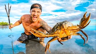
3 Days Eating ONLY What I CATCH With My Puppy (Mangrove Island)
I Got SOO Desperate By The END! I Try Survive 3 Days Catching GIANT ...
I Got SOO Desperate By The END! I Try Survive 3 Days Catching GIANT Mud Crabs With My Puppy For Food On Deadly Remote ...
World’s Largest Mangrove forest , Sunderbans #sunderbans #mangroveforest #westbengal #tiger
Octopus Crawling into a Hole - Exploring Mangrove Forests!
A fascinating moment as an octopus crawls into a hole in the wild ...
A fascinating moment as an octopus crawls into a hole in the wild mangrove forest! This rare sight highlights the ecological ...
Benefits of Mangrove Trees 👏
Mangrove forests are CRITICAL for protecting coastlines, endangered ...
Mangrove forests are CRITICAL for protecting coastlines, endangered and threatened species, and people's livelihoods.
Visit us and explore Jubail Mangrove Park. Experience kayaking and SUP, witness Abu Dhabi’s nature.
Must do in Langkawi | Snorkeling | Mangrove Tour Langkawi | Langkawi | Malaysia #langkawi #malaysia
I never expected this part of the journey to take my breath away. Our ...
I never expected this part of the journey to take my breath away. Our day began deep within the heart of Langkawi's legendary ...
Mangrove forest island#shorts #shortsvideo
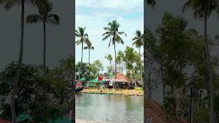
Mangrove forest island kannur #travel #kerala #nature.
Mangrove forest island kannur #travel #kerala #nature.
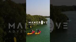
Mangrove tour | Langkawi
A mangrove tour in Langkawi typically includes exploring the mangrove ...
A mangrove tour in Langkawi typically includes exploring the mangrove forests by boat or kayak, where visitors can see a variety ...
Mangrove Island in Payyanur! | Boat Ride & Mangrove Walk 🌿 🚤 #TravelTaleswithsp
Join me as I explore the hidden beauty of Kavvayi Island in Payyanur, ...
Join me as I explore the hidden beauty of Kavvayi Island in Payyanur, North Kerala – a peaceful paradise filled with lush ...
Damas Island Mangrove Tour, Manuel Antonio Costa Rica
The Damas Island mangrove tour is an excellent way to see wildlife. ...
The Damas Island mangrove tour is an excellent way to see wildlife. This half day excursion from Manuel Antonio is super family ...
Catch And Cook In Mangrove Forest With Hand Spear
NEW MERCH!! -
https://youngbloods.co/ I get dropped on remote mangrove islands with only my hand spear or bare hands to ...
Princess Senses The Mangrove | Resort Overview
Princess Senses The Mangrove - Jamaica - Resort Overview Step into a ...
Princess Senses The Mangrove - Jamaica - Resort Overview Step into a world of serene luxury and natural beauty at The ...
Exploring the mangrove in Munroe Island 🖤🇮🇳 #kerala #varkala #india
Mangrove Tour Langkawi at Tanjung Rhu | Kilim Geoforest Park | Things to do in Langkawi
Langkawi Mangrove Tour one of the best highlights in our recent trip ...
Langkawi Mangrove Tour one of the best highlights in our recent trip to Langkawi. Touring around the Kilim Geoforest Park, ...
NEW | Princess Senses the Mangrove Jamaica (Full Tour & Review)
NEW | Princess Senses the Mangrove Jamaica (Full Tour & Review) ⭐ The ...
NEW | Princess Senses the Mangrove Jamaica (Full Tour & Review) ⭐ The BEST Place To Book Princess Senses the Mangrove: ...
Australia is classified as Developed region: nonG7: Developed economies outside of the Group of Seven, characterized by high income and advanced economic structures. The level of income is High income: OECD.
News – Latest Updates and Headlines from Mangrove
Stay informed with the most recent news and important headlines from Mangrove. Here’s a roundup of the latest developments.
Loading...
Please note: The data used here has been primarily extracted from satellite readings. Deviations from exact values may occur, particularly regarding the height of elevations and population density. Land area and coastline measurements refer to average values at mean high tide.