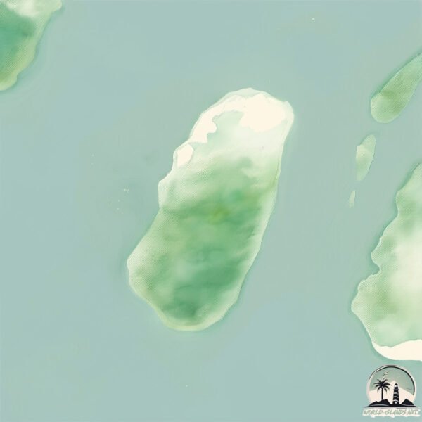
Welcome to Mangrove Forest, a Tropical island in the Bay of Bengal, part of the majestic Indian Ocean. This guide offers a comprehensive overview of what makes Mangrove Forest unique – from its geography and climate to its population, infrastructure, and beyond. Dive into the details:
Geography and size of Mangrove Forest
Size: 19.4 km²
Coastline: 22 km
Ocean: Indian Ocean
Sea: Bay of Bengal
Continent: Asia
Mangrove Forest is a Medium Island spanning 19 km² with a coastline of 22 km.
Archipel: –
Tectonic Plate: India – A major tectonic plate that initially moved northward at a rapid pace before colliding with the Eurasian Plate. This collision is responsible for the uplift of the Himalayas and the Tibetan Plateau.
The geographic heart of the island is pinpointed at these coordinates:
Latitude: 21.89279735 / Longitude: 90.73401166
Climate and weather of Mangrove Forest
Climate Zone: Tropical
Climate Details: Tropical Monsoon Climate
Temperature: Hot
Climate Characteristics: Characterized by heavy rainfall, high humidity, and uniformly high temperatures, but with a distinct short dry season. It features a seasonal reversal of prevailing wind directions.
Topography and nature of Mangrove Forest
Timezone: UTC+06:00
Timezone places: Asia/Dhaka
Max. Elevation: 11 m
Mean Elevation: 5 m
Vegetation: Agricultural Mosaic
Tree Coverage: 55%
The mean elevation is 5 m. The highest elevation on the island reaches approximately 11 meters above sea level. The island is characterized by Plains: Flat, low-lying lands characterized by a maximum elevation of up to 200 meters. On islands, plains are typically coastal lowlands or central flat areas.
Dominating Vegetation: Agricultural Mosaic
A mix of cropland and natural vegetation, often seen in rural landscapes where agricultural fields are interspersed with patches of natural habitats. Mangrove Forest has a tree cover of 55 %.
Vegetation: 10 vegetation zones – Very Highly Diverse Island
Islands in this range are ecological powerhouses, showcasing a wide array of vegetation zones. Each zone, from lush rainforests to arid scrublands, coastal mangroves to mountainous regions, contributes to a complex and interdependent ecosystem. These islands are often hotspots of biodiversity, supporting numerous species and intricate ecological processes.
Infrastructure and Travelling to Mangrove Forest
Does the island have a public airport? no.
There is no public and scheduled airport on Mangrove Forest. The nearest airport is Barisal Airport, located 109 km away.
Does the island have a major port? no.
There are no major ports on Mangrove Forest. The closest major port is CHITTAGONG, approximately 126 km away.
The mean population of Mangrove Forest is 723 per km². Mangrove Forest is Densely Populated. The island belongs to Bangladesh.
Continuing your journey, Char Nizam is the next notable island, situated merely km away.
Mangrove forest island#shorts #shortsvideo
Mangrove forest island kannur #travel #kerala #nature.Mangrove forest island#shorts #shortsvideo
Mangrove forest island kannur #travel #kerala #nature.
Mangrove forest island kannur #travel #kerala #nature.
Island Survival With Hand Spear In Mangrove Forest
NEW MERCH at
https://youngbloods.co/ Surviving in a mangrove forest on remote islands with only my hand spear or bare hands ...
Surviving 24 Hours In A Mangrove Forest
I spend 24 hours in a remote mangrove forest living in a stick shelter ...
I spend 24 hours in a remote mangrove forest living in a stick shelter with only a knife to survive - Ep 323 Get YBS products at ...
Catch And Cook In Mangrove Forest With Hand Spear
NEW MERCH!! -
https://youngbloods.co/ I get dropped on remote mangrove islands with only my hand spear or bare hands to ...
How mangrove forests protect the coast
Mangroves are important to people because they help stabilize ...
Mangroves are important to people because they help stabilize coastline ecosystem and prevent erosion. #Mangroves also ...
What are Mangroves? 🌾 💧 🌴
Did you know that mangroves are amazing for various reasons? They keep ...
Did you know that mangroves are amazing for various reasons? They keep us safe, protect our land, and help nature out in ways ...
Octopus Crawling into a Hole - Exploring Mangrove Forests!
A fascinating moment as an octopus crawls into a hole in the wild ...
A fascinating moment as an octopus crawls into a hole in the wild mangrove forest! This rare sight highlights the ecological ...
World’s Largest Mangrove forest , Sunderbans #sunderbans #mangroveforest #westbengal #tiger
Benefits of Mangrove Trees 👏
Mangrove forests are CRITICAL for protecting coastlines, endangered ...
Mangrove forests are CRITICAL for protecting coastlines, endangered and threatened species, and people's livelihoods.
3 Days Solo MANGROVE ISLAND Survival | No Food or Shelter
I challenge myself to survive for three days without food or shelter ...
I challenge myself to survive for three days without food or shelter on a mangrove island inhabited by some of the deadliest ...
Mangrove Tour Langkawi | Kilim Geoforest Park Tour | Langkawi | 4K
If you're heading to Langkawi, make sure not to miss out on the Kilm ...
If you're heading to Langkawi, make sure not to miss out on the Kilm Geoforest Mangrove Tour. This activity is an absolute ...
Visit us and explore Jubail Mangrove Park. Experience kayaking and SUP, witness Abu Dhabi’s nature.
The 5 Most Stunning Creatures of the Sundarbans Mangrove Forest
Welcome to the breathtaking Sundarbans, a UNESCO World Heritage Site ...
Welcome to the breathtaking Sundarbans, a UNESCO World Heritage Site and home to some of the most awe-inspiring wildlife on ...
Mangrove Island, Paravoor Kerala 🌏🏄🏻♂️🍃#travel #trip #touristplace #kollam #kerala #mangrove
Mangrove tour | Langkawi
A mangrove tour in Langkawi typically includes exploring the mangrove ...
A mangrove tour in Langkawi typically includes exploring the mangrove forests by boat or kayak, where visitors can see a variety ...
MANGROVE TOUR |LANGKAWI ITINERARY | VISA FREE | ISLAND ESCASPE #visafreeisland #malaysia #langkawi
The mangrove forests in Coco Beach resort, island Yao Yai, Phuket, Thailand
The island Yao Yai in the waters of Phuket is covered of mangroves. ...
The island Yao Yai in the waters of Phuket is covered of mangroves. These plants are the national natural wealth of Thailand.
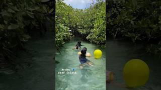
#aruba #reef #mangrove #forest #fish #island #life #shorts #travel #ideas #nature #relaxing #viral
Drone ascending, showing mangrove forest, Munda, New Georgia island, Solomon Islands.
Drone ascending, showing mangrove forest (Rhizophora mangle), Munda, ...
Drone ascending, showing mangrove forest (Rhizophora mangle), Munda, New Georgia island, Western Province, Solomon ...
Mangrove Forest, Uzi Island, Zanzibar
A lovezanzibar tour in the mangrove forest surrounding Uzi Island, Zanzibar.
A lovezanzibar tour in the mangrove forest surrounding Uzi Island, Zanzibar.
#aruba #travel #ideas #reef #nature #mangrove #forest #fish #relaxing #viral #island #life #fyp
Mangrove Forest in Karachi! | Tour & Investment Opportunity
A comprehensive tour of The Mangrove project by TPL Properties, ...
A comprehensive tour of The Mangrove project by TPL Properties, located at Creekside, Karachi, near Emaar, DHA Phase 8.
The benefits of Mangroves are immeasurable! 🌎🌱
#aruba #travel #ideas #nature #mangrove #forest #fish #relaxing #viral #island #life #fyp
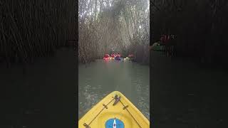
Deep Dive into The Mangrove Forests of Varkala - Kayaking..!
Call - 08590678894 Whatsapp: +91 85906 78894.
Call - 08590678894 Whatsapp: +91 85906 78894.
Bangladesh is classified as Least developed region: Countries that exhibit the lowest indicators of socioeconomic development, with the lowest Human Development Index ratings. The level of income is Low income.
News – Latest Updates and Headlines from Mangrove Forest
Stay informed with the most recent news and important headlines from Mangrove Forest. Here’s a roundup of the latest developments.
Loading...
Please note: The data used here has been primarily extracted from satellite readings. Deviations from exact values may occur, particularly regarding the height of elevations and population density. Land area and coastline measurements refer to average values at mean high tide.