Marcus Island
Welcome to Marcus Island, a Tropical island in the North Pacific Ocean, part of the majestic Pacific Ocean. This guide offers a comprehensive overview of what makes Marcus Island unique – from its geography and climate to its population, infrastructure, and beyond. Dive into the details:
- Geography and Size: Explore the island’s size and location.
- Climate and Weather: Weather patterns and temperature.
- Topography and Nature: Uncover the natural wonders of the island.
- Infrastructure and Travelling: Insights on reaching, staying, and making the most of your visit.
- News and Headlines: Latest News.
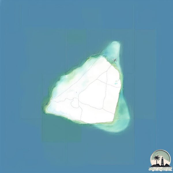
Geography and size of Marcus Island
Size: 1.481 km²
Coastline: 5.8 km
Ocean: Pacific Ocean
Sea: North Pacific Ocean
Continent: Oceania
Marcus Island is a Small Island spanning 1.5 km² with a coastline of 5.8 km.
Archipel: –
Tectonic Plate: Okinawa – Located in the East China Sea, near the Ryukyu Islands and Taiwan, it’s involved in the subduction zone between the Philippine Sea Plate and the Eurasian Plate.
The geographic heart of the island is pinpointed at these coordinates:
Latitude: 24.28765953 / Longitude: 153.98068479
Climate and weather of Marcus Island
Climate Zone: Tropical
Climate Details: Tropical Rainforest Climate
Temperature: Hot
Climate Characteristics: This climate is typified by heavy rainfall throughout the year, high humidity, and consistently high temperatures, leading to lush rainforests and rich biodiversity. Seasonal temperature variations are minimal.
Topography and nature of Marcus Island
Timezone: UTC+10:00
Timezone places: Australia/Sydney
Max. Elevation: -10 m
Mean Elevation: -124 m
Vegetation: Sparse Vegetation with Trees/Shrubs
Tree Coverage: 34%
The mean elevation is -124 m. Remarkably, this unique island barely emerges above the sea level, showcasing nature’s fascinating interplay with the ocean. The island is characterized by Plains: Flat, low-lying lands characterized by a maximum elevation of up to 200 meters. On islands, plains are typically coastal lowlands or central flat areas.
Dominating Vegetation: Sparse Vegetation with Trees/Shrubs
Areas where grasses and other herbaceous plants are prevalent, but with occasional presence of trees and shrubs. Often found in semi-arid regions or grasslands. Marcus Island has a tree cover of 34 %.
Vegetation: 2 vegetation zones – Low Diversity Island
Islands with two distinct vegetation zones offer slightly more ecological variety. These zones could be due to differences in elevation, moisture, or other environmental factors. While still limited in biodiversity, these islands may offer a contrast between the two zones, such as a coastline with mangroves and an inland area with grassland.
Infrastructure and Travelling to Marcus Island
Does the island have a public airport? no.
There is no public and scheduled airport on Marcus Island. The nearest airport is Saipan International Airport, located 1370 km away.
Does the island have a major port? no.
There are no major ports on Marcus Island. The closest major port is SAIPAN, approximately 1366 km away.
The mean population of Marcus Island is 48 per km². Marcus Island is Gently Populated. The island belongs to Japan.
Continuing your journey, Agrihan is the next notable island, situated merely km away.
Exploring the Wonders of Marcus Island


Japan is classified as Developed region: G7: Group of Seven – Major advanced economies, including Canada, France, Germany, Italy, Japan, the United Kingdom, and the United States. The level of income is High income: OECD.
News – Latest Updates and Headlines from Marcus Island
Stay informed with the most recent news and important headlines from Marcus Island. Here’s a roundup of the latest developments.
Please note: The data used here has been primarily extracted from satellite readings. Deviations from exact values may occur, particularly regarding the height of elevations and population density. Land area and coastline measurements refer to average values at mean high tide.