Mayang-do
Welcome to Mayang-do, a Continental island in the Japan Sea, part of the majestic Pacific Ocean. This guide offers a comprehensive overview of what makes Mayang-do unique – from its geography and climate to its population, infrastructure, and beyond. Dive into the details:
- Geography and Size: Explore the island’s size and location.
- Climate and Weather: Weather patterns and temperature.
- Topography and Nature: Uncover the natural wonders of the island.
- Infrastructure and Travelling: Insights on reaching, staying, and making the most of your visit.
- News and Headlines: Latest News.
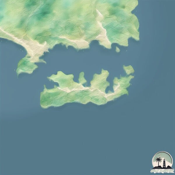
Geography and size of Mayang-do
Size: 8.933 km²
Coastline: 30.9 km
Ocean: Pacific Ocean
Sea: Japan Sea
Continent: Asia
Mayang-do is a Small Island spanning 8.9 km² with a coastline of 30.9 km.
Archipel: –
Tectonic Plate: Okhotsk – Located in the northwest Pacific Ocean, the Okhotsk Plate encompasses the Sea of Okhotsk, the Kamchatka Peninsula, and parts of Japan. It’s involved in complex interactions with the Pacific and North American plates, contributing to seismic activity in the region.
The geographic heart of the island is pinpointed at these coordinates:
Latitude: 39.99668723 / Longitude: 128.19473071
Climate and weather of Mayang-do
Climate Zone: Continental
Climate Details: Monsoon-Influenced Hot-Summer Humid Continental Climate
Temperature: Hot Summer
Climate Characteristics: Hot summers with monsoon rains, contrasting with dry, cold winters. Typical of east Asian continental edges.
Topography and nature of Mayang-do
Timezone: UTC+09:00
Timezone places: Asia/Tokyo
Max. Elevation: 57 m
Mean Elevation: 32 m
Vegetation: Deciduous Needleleaf Forest
Tree Coverage: 55%
The mean elevation is 32 m. The highest elevation on the island reaches approximately 57 meters above sea level. The island is characterized by Plains: Flat, low-lying lands characterized by a maximum elevation of up to 200 meters. On islands, plains are typically coastal lowlands or central flat areas.
Dominating Vegetation: Deciduous Needleleaf Forest
Consists of needleleaf trees that shed their needles annually. This type of forest is less common and can be found in certain cold, northern regions. Mayang-do has a tree cover of 55 %.
Vegetation: 9 vegetation zones – Very Highly Diverse Island
Islands in this range are ecological powerhouses, showcasing a wide array of vegetation zones. Each zone, from lush rainforests to arid scrublands, coastal mangroves to mountainous regions, contributes to a complex and interdependent ecosystem. These islands are often hotspots of biodiversity, supporting numerous species and intricate ecological processes.
Infrastructure and Travelling to Mayang-do
Does the island have a public airport? no.
There is no public and scheduled airport on Mayang-do. The nearest airport is Sondok Airport, located 81 km away.
Does the island have a major port? no.
There are no major ports on Mayang-do. The closest major port is CH’AHO, approximately 51 km away.
The mean population of Mayang-do is 675 per km². Mayang-do is Densely Populated. The island belongs to North Korea.
Continuing your journey, Ganghwado is the next notable island, situated merely km away.
North Korea is classified as Least developed region: Countries that exhibit the lowest indicators of socioeconomic development, with the lowest Human Development Index ratings. The level of income is Low income.
News – Latest Updates and Headlines from Mayang-do
Stay informed with the most recent news and important headlines from Mayang-do. Here’s a roundup of the latest developments.
Please note: The data used here has been primarily extracted from satellite readings. Deviations from exact values may occur, particularly regarding the height of elevations and population density. Land area and coastline measurements refer to average values at mean high tide.