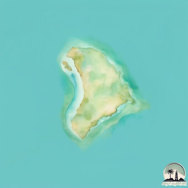
Welcome to Meringa Island, a Tropical island in the Arafura Sea, part of the majestic Indian Ocean. This guide offers a comprehensive overview of what makes Meringa Island unique – from its geography and climate to its population, infrastructure, and beyond. Dive into the details:
Geography and size of Meringa Island
Size: 0.159 km²
Coastline: 1.7 km
Ocean: Indian Ocean
Sea: Arafura Sea
Continent: Oceania
Meringa Island is a Tiny Island spanning 0.159 km² with a coastline of 1.7 km.
Archipel: –
Tectonic Plate: Australia – A major tectonic plate covering Australia, New Zealand, and parts of the Indian and Pacific Oceans, known for its relative stability and occasional seismic activity.
The geographic heart of the island is pinpointed at these coordinates:
Latitude: -13.4435762 / Longitude: 136.07200033
Climate and weather of Meringa Island
Climate Zone: Tropical
Climate Details: Tropical Savanna, Wet
Temperature: Hot
Climate Characteristics: Defined by distinct wet and dry seasons with high temperatures year-round. Pronounced rainfall occurs during the wet season, while the dry season is marked by drought.
Topography and nature of Meringa Island
Timezone: UTC+09:30
Timezone places: Australia/Adelaide
Max. Elevation: 2 m
Mean Elevation: 2 m
Vegetation: Evergreen Broadleaf Forest
Tree Coverage: 52%
The mean elevation is 2 m. The highest elevation on the island reaches approximately 2 meters above sea level. The island is characterized by Plains: Flat, low-lying lands characterized by a maximum elevation of up to 200 meters. On islands, plains are typically coastal lowlands or central flat areas.
Dominating Vegetation: Evergreen Broadleaf Forest
Characterized by dense, lush canopies of broadleaf trees that retain their leaves year-round. These forests are typically found in tropical and subtropical regions and are known for their high biodiversity. Meringa Island has a tree cover of 52 %.
Vegetation: 1 vegetation zones – Minimal Diversity Island
These islands exhibit the most basic level of ecological diversity, often characterized by a single dominant vegetation type. This could be due to extreme environmental conditions, limited land area, or significant human impact. They represent unique ecosystems where specific species have adapted to thrive in these singular environments.
Infrastructure and Travelling to Meringa Island
Does the island have a public airport? no.
There is no public and scheduled airport on Meringa Island. The nearest airport is Groote Eylandt Airport, located 73 km away.
Does the island have a major port? no.
There are no major ports on Meringa Island. The closest major port is MILNER BAY, approximately 60 km away.
The mean population of Meringa Island is 0 per km². Meringa Island is Uninhabited. The island belongs to Australia.
Continuing your journey, Woodah is the next notable island, situated merely km away.
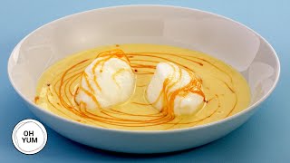
Floating Island Dessert with Microwave Meringue
Ile flottante recipe can be challenging. It means floating island and consists of a foaming meringue floating in a crème anglaise ...Floating Island Dessert with Microwave Meringue
Ile flottante recipe can be challenging. It means floating island and ...
Ile flottante recipe can be challenging. It means floating island and consists of a foaming meringue floating in a crème anglaise ...
Professional Baker Teaches You How To Make ILES FLOTANTES!
Floating islands or Iles Flotantes in French is made of little ...
Floating islands or Iles Flotantes in French is made of little meringue "islands" floating in crème anglaise and drizzled with ...
Traditional Merengue Music | Dominican Republic 🇩🇴
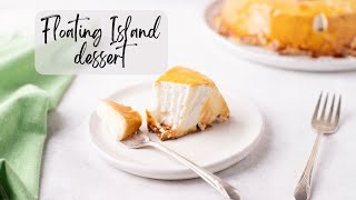
Îles Flottantes Recipe for Beginners (How to Make a Floating Island Dessert)
Making îles flottantes French dessert recipe for beginners. In this ...
Making îles flottantes French dessert recipe for beginners. In this recipe video, we'll show you how to make îles flottantes, AKA ...
Easy Floating Island Recipe | Tuesday’s Tips with Jacques Torres
In today's Tuesday Tips, I'm showing you how to make a simplified ...
In today's Tuesday Tips, I'm showing you how to make a simplified version of the classic French dessert Floating Island.
How To Make A Floating Island Dessert | Rachael's Sister Maria
Watch Rach's sister Maria show you how to make one of her favorite ...
Watch Rach's sister Maria show you how to make one of her favorite desserts—a meringue + custard combo called a 'Floating ...
FLOATING ISLAND
Floating Island Dessert - This beautifully decadent dessert features ...
Floating Island Dessert - This beautifully decadent dessert features silky meringue, creamy vanilla custard, and a rich caramel ...
Pro Chef Makes Floating Islands and Show-Stopping Pavlova | Then and Now | Better Homes & Gardens
Alexis deBoschnek demonstrates how to make strawberry floating islands ...
Alexis deBoschnek demonstrates how to make strawberry floating islands using a beautifully simple vintage recipe that can adapt ...
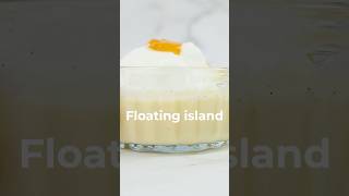
Strawberry floating island dessert!
Strawberry Floating Island or Île flottante is a simple yet very ...
Strawberry Floating Island or Île flottante is a simple yet very elegant and impressive dessert. Soft meringue islands float on a pool ...
Making Floating Island, a Victorian dessert recipe from 1899 (19th-century food history)
Be sure to find my books on Amazon!
Be sure to find my books on Amazon!
#shorts Fluffy Floating Island Cake
Meringue Drops 💧 Get the Recipe on @gronda
French Floating Island Dessert - Meringue Floating on custard covered in caramel -
Join my online French cooking classes : ...
😲 Did you know #Moringa Makes HEALTHLY (Green) Dumplings? #jamaicanfood
I RECOMMEND Get 100% Pure MORINGA products from PURA VIDA via Amazon: ...
Martha Stewart Makes Meringue 3 Ways | Martha Bakes S1E9 "Meringue"
Martha shares the secrets to foolproof meringue. Making meringue is ...
Martha shares the secrets to foolproof meringue. Making meringue is just a matter of using a few tricks - from using a copper bowl ...
Mouth-Watering Floating island | Sugar Free, Gluten Free, Keto, Carnivore
Today, we're recreating a classic dessert with a keto carnivore twist ...
Today, we're recreating a classic dessert with a keto carnivore twist — **Île Flottante** or "Floating Island" in English. Traditionally ...
❓❓Hangyodon made with meringue cream #sanrio #miniature
Satisfying step-tutorial for character meringue cookies Like & ...
Satisfying step-tutorial for character meringue cookies Like & Subscribe if you enjoy! A Meringue Tale✨ #meringue ...
Sea Dragon Lodge on Kangaroo Island
Efforts made to bridge differences
Efforts are made to overcome differences in the Indigenous cultural ...
Efforts are made to overcome differences in the Indigenous cultural dispute over the Hindmarsh Island bridge across the lower ...
Floating islands - Ile Flottante with Rhubarb
Illes Flottante 500g egg whites 300g sugar 2 vanilla pods - 250g milk ...
Illes Flottante 500g egg whites 300g sugar 2 vanilla pods - 250g milk 250g double cream 1 vanilla pod 40g sugar 3 yolks - 3 sticks ...
Floatin Island Dessert
This heavenly creation, also known as île flottante in French cuisine, ...
This heavenly creation, also known as île flottante in French cuisine, is a delicate treat that will transport your taste buds to new ...
Recipe 37 of 100: Chocolate Orange Mousse (with meringue)
Chocolate mousse was one of the first recipes I learned at cookery ...
Chocolate mousse was one of the first recipes I learned at cookery school. It's surprisingly simple and I promise you can make it.
Meringa Springs, Halls Gap, Australia
Meringa Springs, Halls Gap, Australia About Property: Situated 32 ...
Meringa Springs, Halls Gap, Australia About Property: Situated 32 minutes' drive from Halls Gap in the Victoria Region, Meringa ...
Mealz Studio Recipe - Floating Island
An egg? No ! A floating island of meringue and jam in disguise ! Fun ...
An egg? No ! A floating island of meringue and jam in disguise ! Fun and delicious, it's the Floating Island! Ingredients : 30g ...
Australia is classified as Developed region: nonG7: Developed economies outside of the Group of Seven, characterized by high income and advanced economic structures. The level of income is High income: OECD.
News – Latest Updates and Headlines from Meringa Island
Stay informed with the most recent news and important headlines from Meringa Island. Here’s a roundup of the latest developments.
Loading...
Please note: The data used here has been primarily extracted from satellite readings. Deviations from exact values may occur, particularly regarding the height of elevations and population density. Land area and coastline measurements refer to average values at mean high tide.