Welcome to Mhierb, a Dry island in the Red Sea, part of the majestic Indian Ocean. This guide offers a comprehensive overview of what makes Mhierb unique – from its geography and climate to its population, infrastructure, and beyond. Dive into the details:
Geography and size of Mhierb
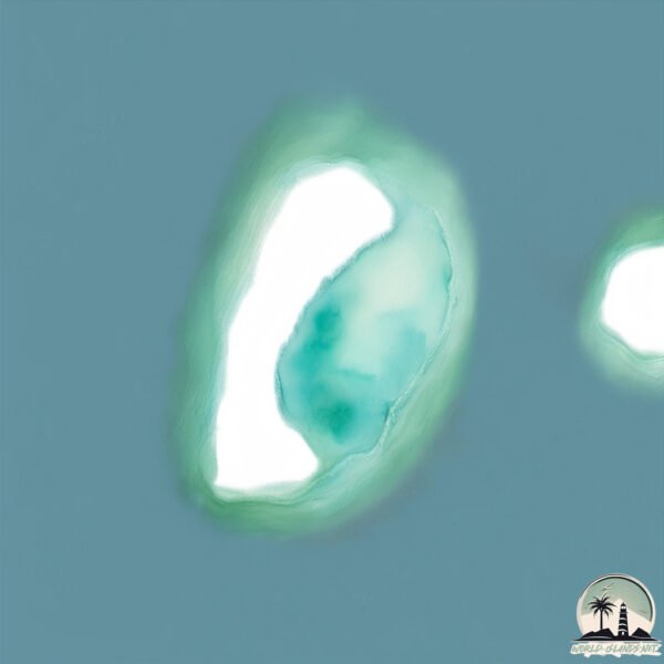
Size: 4.605 km²
Coastline: 9.2 km
Ocean: Indian Ocean
Sea: Red Sea
Continent: Africa
Mhierb is a Small Island spanning 4.6 km² with a coastline of 9.2 km.
Archipel: Dahlak Archipelago – Located in the Red Sea near Eritrea, known for their historical significance, coral reefs, and diverse marine life.
Tectonic Plate: Arabia – A major tectonic plate covering the Arabian Peninsula and parts of the Middle East. The plate is primarily continental and known for its collision with the Eurasian Plate, leading to the uplift of the Zagros Mountains.
The geographic heart of the island is pinpointed at these coordinates:
Latitude: 15.71200917 / Longitude: 40.65141476
Climate and weather of Mhierb
Climate Zone: Dry
Climate Details: Hot Deserts Climate
Temperature: Hot
Climate Characteristics: Dominated by extremely hot temperatures, this climate is marked by minimal rainfall and barren landscapes. Nights often experience drastic temperature drops.
Topography and nature of Mhierb
Timezone: UTC+03:00
Timezone places: Asia/Riyadh
Max. Elevation: 1 m
Mean Elevation: -1 m
Vegetation: Sparse Vegetation
Tree Coverage: 94%
The mean elevation is -1 m. The highest elevation on the island reaches approximately 1 meters above sea level. The island is characterized by Plains: Flat, low-lying lands characterized by a maximum elevation of up to 200 meters. On islands, plains are typically coastal lowlands or central flat areas.
Dominating Vegetation: Sparse Vegetation
These regions have limited plant growth, typically due to extreme conditions like aridity or poor soils. Vegetation is scattered and consists of hardy plant species. Mhierb has a tree cover of 94 %.
Vegetation: 3 vegetation zones – Moderately Diverse Island
These islands start to show a broader range of ecological niches. With three vegetation zones, they may offer a mix of ecosystems like coastal areas, inland woods, and perhaps a distinct wetland or dry area. This diversity supports a wider range of flora and fauna, making these islands more ecologically complex than those with minimal diversity.
Infrastructure and Travelling to Mhierb
Does the island have a public airport? no.
There is no public and scheduled airport on Mhierb. The nearest airport is Massawa International Airport, located 141 km away.
Does the island have a major port? no.
There are no major ports on Mhierb. The closest major port is MITSIWA HARBOR, approximately 131 km away.
The mean population of Mhierb is 5 per km². Mhierb is Gently Populated. The island belongs to Eritrea.
Continuing your journey, Segala is the next notable island, situated merely km away.
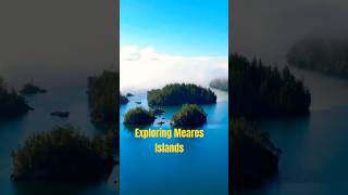
“Tofino Day! Exploring Meares Island
Today's stop: Tofino. I finally get to explore the legendary Meares Island, home to towering ancient cedars and one of the most ...“Tofino Day! Exploring Meares Island
Today's stop: Tofino. I finally get to explore the legendary Meares ...
Today's stop: Tofino. I finally get to explore the legendary Meares Island, home to towering ancient cedars and one of the most ...
What’s Hidden Deep on Meares Island? 🌲 | Tofino Travel Guide – Vancouver Island
Day 1 of my 18-day, 3500 km Vancouver Island road trip! The adventure ...
Day 1 of my 18-day, 3500 km Vancouver Island road trip! The adventure kicks off in Tofino, British Columbia, where I camped at ...
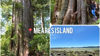
Vancouver Island(10) - Big Tree Trail Meares Island, Tofino 4K
Big Tree Trail is one of the top trails in Tofino. It is located in ...
Big Tree Trail is one of the top trails in Tofino. It is located in Meares Island, a 10 min water taxi (boat) from Tofino Harbor.
Downtown Tofino to Meares Island Boat Ride - British Columbia・4K HDR
07/22/23 10:00 AM 🌡️ 16℃ Located a short paddle or 15-minute boat ride ...
07/22/23 10:00 AM 🌡️ 16℃ Located a short paddle or 15-minute boat ride from downtown Tofino, Meares Island has one of the ...
Meares Island by Kayak from Tofino
The Tla-o-qui-aht declared Meares Island as Canada's first Tribal Park ...
The Tla-o-qui-aht declared Meares Island as Canada's first Tribal Park in 1984. The ancient forest on the island has some of the ...
Sunrise Meares Island Tofino, British Columbia.
Framelapse video. The ripple of the water at 21 seconds is a pack of ...
Framelapse video. The ripple of the water at 21 seconds is a pack of about 8 wild sea otters leaving the raft they had been playing ...
Meares Island- Massive Cedars on Big Tree Trail !!!!
An attraction for tourists visiting Tofino is the Big Tree Trail, the ...
An attraction for tourists visiting Tofino is the Big Tree Trail, the small section of Meares Island that contains a boardwalk that ...
Meares Island | Big Tree Trail #shorts #biggest #tree #island #trail #hiking #youtubeshorts #ytshort
We Explore Meares Island | Biggest Tree in Canada?🇨🇦
nature #naturelovers #trees #tofino #vancouverisland #youtube ...
nature #naturelovers #trees #tofino #vancouverisland #youtube #youtubevideo #youtubechannel.
Guide to Hiking Meares Island’s Big Tree Trail
Join us on the Big Tree Trail on Meares Island, home to some of the ...
Join us on the Big Tree Trail on Meares Island, home to some of the oldest and biggest trees in BC. Accessible by a water taxi this ...
Meares Island, Tofino, BC
Take a short boat trip from Tofino to Meares Island on the Pacific Rim ...
Take a short boat trip from Tofino to Meares Island on the Pacific Rim and hike the Big Tree Trail.
a unique tree On Meares Island
Meares Island is famous throughout the world as a place of old-growth ...
Meares Island is famous throughout the world as a place of old-growth forest with ancient cedars rising high into the sky. here: ...
Meares Island, British Columbia
I created this video to demonstrate the beauty I witnessed while ...
I created this video to demonstrate the beauty I witnessed while visiting Meares Island in British Columbia. It is breathtaking, and a ...
Tofino’s Big Tree Trail | 1,000-Year-Old Forest Walk
Discover the stunning old-growth forest of Meares Island with a ...
Discover the stunning old-growth forest of Meares Island with a peaceful walk along the Big Tree Trail. This scenic trail near Tofino ...
MEARES ISLAND TREE OF LIFE
This old cedar tree is probably over a thousand years old and can be ...
This old cedar tree is probably over a thousand years old and can be found just off the boardwalk trail on Meares Island, the home ...
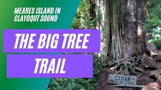
The Big Tree Trail On Meares Island In Clayoquot Sound
The Big Tree Trail on Meares Island is found in the UNESCO Clayoquot ...
The Big Tree Trail on Meares Island is found in the UNESCO Clayoquot Sound World Biosphere Reserve near Tofino, British ...
HIKING & PICNIC @ MEARES ISLAND IN TOFINO BC CANADA
July 25, 2020 Meares Island is one of the many islands surrounding the ...
July 25, 2020 Meares Island is one of the many islands surrounding the Village of Tofino, British Columbia, Canada. Its name was ...
Vancouver Island: My favourite things to do around Tofino and Ucluelet
The west coast of Vancouver Island is a wild place. Between the small ...
The west coast of Vancouver Island is a wild place. Between the small towns of Tofino and Ucluelet are the pristine beaches of ...
Eritrea is classified as Least developed region: Countries that exhibit the lowest indicators of socioeconomic development, with the lowest Human Development Index ratings. The level of income is Low income.
News – Latest Updates and Headlines from Mhierb
Stay informed with the most recent news and important headlines from Mhierb. Here’s a roundup of the latest developments.
Loading...
Please note: The data used here has been primarily extracted from satellite readings. Deviations from exact values may occur, particularly regarding the height of elevations and population density. Land area and coastline measurements refer to average values at mean high tide.