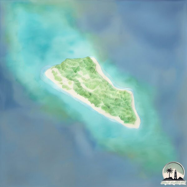
Minna-shima
Welcome to Minna-shima, a Tropical island in the Eastern China Sea, part of the majestic Pacific Ocean. This guide offers a comprehensive overview of what makes Minna-shima unique – from its geography and climate to its population, infrastructure, and beyond. Dive into the details:
- Geography and Size: Explore the island’s size and location.
- Climate and Weather: Weather patterns and temperature.
- Topography and Nature: Uncover the natural wonders of the island.
- Infrastructure and Travelling: Insights on reaching, staying, and making the most of your visit.
- News and Headlines: Latest News.
Geography and size of Minna-shima
Size: 2.249 km²
Coastline: 7.9 km
Ocean: Pacific Ocean
Sea: Eastern China Sea
Continent: Asia
Minna-shima is a Small Island spanning 2.2 km² with a coastline of 7.9 km.
Archipel: Ryukyu Islands – A chain of Japanese islands stretching southwest from Kyushu to Taiwan, known for their unique Okinawan culture and subtropical climate.
Tectonic Plate: Yangtze – A minor tectonic plate in East Asia, often considered a part of the Eurasian Plate. It’s primarily continental and covers the Yangtze River area in China, playing a significant role in the region’s geological stability.
The geographic heart of the island is pinpointed at these coordinates:
Latitude: 24.75403463 / Longitude: 124.69567824
Climate and weather of Minna-shima
Climate Zone: Tropical
Climate Details: Tropical Rainforest Climate
Temperature: Hot
Climate Characteristics: This climate is typified by heavy rainfall throughout the year, high humidity, and consistently high temperatures, leading to lush rainforests and rich biodiversity. Seasonal temperature variations are minimal.
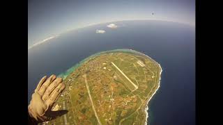
Topography and nature of Minna-shima
Timezone: UTC+09:00
Timezone places: Asia/Tokyo
Max. Elevation: 8 m
Mean Elevation: 5 m
Vegetation: Sparse Vegetation
Tree Coverage: 31%
The mean elevation is 5 m. The highest elevation on the island reaches approximately 8 meters above sea level. The island is characterized by Plains: Flat, low-lying lands characterized by a maximum elevation of up to 200 meters. On islands, plains are typically coastal lowlands or central flat areas.
Dominating Vegetation: Sparse Vegetation
These regions have limited plant growth, typically due to extreme conditions like aridity or poor soils. Vegetation is scattered and consists of hardy plant species. Minna-shima has a tree cover of 31 %.
Vegetation: 5 vegetation zones – Highly Diverse Island
With five different vegetation zones, these islands offer a rich tapestry of ecosystems. The variety could include dense forests, open meadows, wetlands, coastal zones, and more. This level of diversity supports an intricate web of life, with each zone playing a vital role in the overall ecological health and balance of the island.
Infrastructure and Travelling to Minna-shima
Does the island have a public airport? no.
There is no public and scheduled airport on Minna-shima. The nearest airport is Tarama Airport, located 11 km away.
Does the island have a major port? no.
There are no major ports on Minna-shima. The closest major port is HIRARA KO, approximately 64 km away.
The mean population of Minna-shima is 54 per km². Minna-shima is Gently Populated. The island belongs to Japan.
Continuing your journey, Tarama Jima is the next notable island, situated merely km away.
Places that don't feel real: Okinawa, Japan #travel #explore #nature #adventure #japan


Japan is classified as Developed region: G7: Group of Seven – Major advanced economies, including Canada, France, Germany, Italy, Japan, the United Kingdom, and the United States. The level of income is High income: OECD.
News – Latest Updates and Headlines from Minna-shima
Stay informed with the most recent news and important headlines from Minna-shima. Here’s a roundup of the latest developments.
Please note: The data used here has been primarily extracted from satellite readings. Deviations from exact values may occur, particularly regarding the height of elevations and population density. Land area and coastline measurements refer to average values at mean high tide.