Miscou
Welcome to Miscou, a Continental island in the Gulf of St. Lawrence, part of the majestic Atlantic Ocean. This guide offers a comprehensive overview of what makes Miscou unique – from its geography and climate to its population, infrastructure, and beyond. Dive into the details:
- Geography and Size: Explore the island’s size and location.
- Climate and Weather: Weather patterns and temperature.
- Topography and Nature: Uncover the natural wonders of the island.
- Infrastructure and Travelling: Insights on reaching, staying, and making the most of your visit.
- News and Headlines: Latest News.
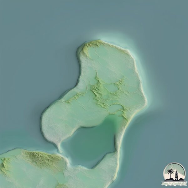
Geography and size of Miscou
Size: 73.8 km²
Coastline: 53.2 km
Ocean: Atlantic Ocean
Sea: Gulf of St. Lawrence
Continent: North America
Miscou is a Medium Island spanning 74 km² with a coastline of 53 km.
Archipel: –
Tectonic Plate: North America – Covers North America and parts of the Atlantic and Arctic Oceans, characterized by diverse geological features and varying levels of seismic activity.
The geographic heart of the island is pinpointed at these coordinates:
Latitude: 47.95716519 / Longitude: -64.5310188
Climate and weather of Miscou
Climate Zone: Continental
Climate Details: Warm-Summer Humid Continental Climate
Temperature: Warm Summer
Climate Characteristics: Features warm summers and cold winters with consistent precipitation, common in higher latitudes.
Topography and nature of Miscou
Timezone: UTC-04:00
Timezone places: America/La_Paz
Max. Elevation: 9 m
Mean Elevation: 2 m
Vegetation: Open Woodland
Tree Coverage: 60%
The mean elevation is 2 m. The highest elevation on the island reaches approximately 9 meters above sea level. The island is characterized by Plains: Flat, low-lying lands characterized by a maximum elevation of up to 200 meters. On islands, plains are typically coastal lowlands or central flat areas.
Dominating Vegetation: Open Woodland
Characterized by sparsely distributed trees with open canopy allowing sunlight to penetrate, supporting grasses and shrubs underneath. Often found in drier or transitional environments. Miscou has a tree cover of 60 %.
Vegetation: 11 vegetation zones – Exceptionally Diverse Island
Islands with more than ten vegetation zones are among the most ecologically rich and varied in the world. These islands are akin to miniature continents, boasting an incredible array of ecosystems. The sheer range of habitats, from high peaks to deep valleys, rainforests to deserts, creates a mosaic of life that is unparalleled. They are crucial for conservation and ecological studies.
Infrastructure and Travelling to Miscou
Does the island have a public airport? no.
There is no public and scheduled airport on Miscou. The nearest airport is Gaspé (Michel-Pouliot) Airport, located 84 km away.
Does the island have a major port? no.
There are no major ports on Miscou. The closest major port is SHIPPEGAN, approximately 20 km away.
The mean population of Miscou is 8 per km². Miscou is Gently Populated. The island belongs to Canada.
Continuing your journey, Lameque is the next notable island, situated merely km away.
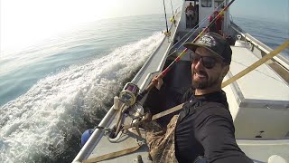
BLUEFIN TUNA fishing in Miscou, New Brunswick. One trip I cannot check off my bucket list!


Canada is classified as Developed region: G7: Group of Seven – Major advanced economies, including Canada, France, Germany, Italy, Japan, the United Kingdom, and the United States. The level of income is High income: OECD.
News – Latest Updates and Headlines from Miscou
Stay informed with the most recent news and important headlines from Miscou. Here’s a roundup of the latest developments.
Please note: The data used here has been primarily extracted from satellite readings. Deviations from exact values may occur, particularly regarding the height of elevations and population density. Land area and coastline measurements refer to average values at mean high tide.