Mono
Welcome to Mono, a Tropical island in the Solomon Sea, part of the majestic Pacific Ocean. This guide offers a comprehensive overview of what makes Mono unique – from its geography and climate to its population, infrastructure, and beyond. Dive into the details:
- Geography and Size: Explore the island’s size and location.
- Climate and Weather: Weather patterns and temperature.
- Topography and Nature: Uncover the natural wonders of the island.
- Infrastructure and Travelling: Insights on reaching, staying, and making the most of your visit.
- News and Headlines: Latest News.
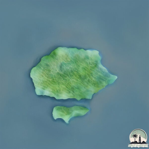
Geography and size of Mono
Size: 67.4 km²
Coastline: 34.3 km
Ocean: Pacific Ocean
Sea: Solomon Sea
Continent: Oceania
Mono is a Medium Island spanning 67 km² with a coastline of 34 km.
Archipel: Melanesia – A subregion of Oceania in the southwestern Pacific Ocean, including countries like Fiji, Solomon Islands, and Vanuatu, known for their diverse cultures and languages.
Tectonic Plate: Banda Sea – A small plate in the eastern Indonesian region, known for complex interactions with the Australian and Pacific plates, leading to notable seismic and volcanic activity.
The geographic heart of the island is pinpointed at these coordinates:
Latitude: -7.36408616 / Longitude: 155.56383064
Climate and weather of Mono
Climate Zone: Tropical
Climate Details: Tropical Rainforest Climate
Temperature: Hot
Climate Characteristics: This climate is typified by heavy rainfall throughout the year, high humidity, and consistently high temperatures, leading to lush rainforests and rich biodiversity. Seasonal temperature variations are minimal.
Topography and nature of Mono
Timezone: UTC+11:00
Timezone places: Pacific/Guadalcanal
Max. Elevation: 310 m
Mean Elevation: 137 m
Vegetation: Evergreen Broadleaf Forest
Tree Coverage: 84%
The mean elevation is 137 m. The highest elevation on the island reaches approximately 310 meters above sea level. The island is characterized by Hills: Gently sloping landforms with rounded tops, having a maximum elevation between 200 and 500 meters. Hills contribute to a varied landscape on islands.
Dominating Vegetation: Evergreen Broadleaf Forest
Characterized by dense, lush canopies of broadleaf trees that retain their leaves year-round. These forests are typically found in tropical and subtropical regions and are known for their high biodiversity. Mono has a tree cover of 84 %.
Vegetation: 7 vegetation zones – Very Highly Diverse Island
Islands in this range are ecological powerhouses, showcasing a wide array of vegetation zones. Each zone, from lush rainforests to arid scrublands, coastal mangroves to mountainous regions, contributes to a complex and interdependent ecosystem. These islands are often hotspots of biodiversity, supporting numerous species and intricate ecological processes.
Infrastructure and Travelling to Mono
Does the island have a public airport? no.
There is no public and scheduled airport on Mono. The nearest airport is Mono Airport, located 2 km away.
Does the island have a major port? no.
There are no major ports on Mono. The closest major port is KIETA, approximately 124 km away.
The mean population of Mono is 10 per km². Mono is Gently Populated. The island belongs to Solomon Islands.
Continuing your journey, Magusaiai is the next notable island, situated merely km away.
Monkey Island | 60 Minutes


Solomon Islands is classified as Least developed region: Countries that exhibit the lowest indicators of socioeconomic development, with the lowest Human Development Index ratings. The level of income is Lower middle income.
News – Latest Updates and Headlines from Mono
Stay informed with the most recent news and important headlines from Mono. Here’s a roundup of the latest developments.
- The 33 Best Blue Lands in Magic Ranked - Draftsimon 23 March 2026
The 33 Best Blue Lands in Magic Ranked Draftsim
- NO MAN CAN LIVE AS AN ISLAND – 18 February 2026 - heraldgoa.inon 18 February 2026
NO MAN CAN LIVE AS AN ISLAND – 18 February 2026 heraldgoa.in
- The bulldozer that broke Japan’s World War II island defenses - msn.comon 22 December 2025
The bulldozer that broke Japan’s World War II island defenses msn.com
- Former Mono mayor and Dufferin County warden passes away - Orangeville Citizen |on 18 December 2025
Former Mono mayor and Dufferin County warden passes away Orangeville Citizen |
- Mono considers option to reduce reliance on water sources with trace levels of arsenic - Orangeville Citizen |on 20 November 2025
Mono considers option to reduce reliance on water sources with trace levels of arsenic Orangeville Citizen |
- The 15 Most Beautiful Hidden Gems Across the US - WorldAtlason 31 August 2025
The 15 Most Beautiful Hidden Gems Across the US WorldAtlas
- Stone Island SS26 Blends Mono Lake’s Raw Beauty with Technical Utility - stupidDOPEon 28 June 2025
Stone Island SS26 Blends Mono Lake’s Raw Beauty with Technical Utility stupidDOPE
- Stone Island Blends Nature, Utility and Fabric Innovation for SS26 - hypebeast.comon 27 June 2025
Stone Island Blends Nature, Utility and Fabric Innovation for SS26 hypebeast.com
- Wilson Island Earthquakes Archive: Past Quakes in 2024 - Volcano Discoveryon 3 June 2025
Wilson Island Earthquakes Archive: Past Quakes in 2024 Volcano Discovery
- Taro Island Earthquakes Archive: Past Quakes in 2025 - Volcano Discoveryon 29 April 2025
Taro Island Earthquakes Archive: Past Quakes in 2025 Volcano Discovery
Please note: The data used here has been primarily extracted from satellite readings. Deviations from exact values may occur, particularly regarding the height of elevations and population density. Land area and coastline measurements refer to average values at mean high tide.