Munro Island
Welcome to Munro Island, a Tropical island in the Laccadive Sea, part of the majestic Indian Ocean. This guide offers a comprehensive overview of what makes Munro Island unique – from its geography and climate to its population, infrastructure, and beyond. Dive into the details:
- Geography and Size: Explore the island’s size and location.
- Climate and Weather: Weather patterns and temperature.
- Topography and Nature: Uncover the natural wonders of the island.
- Infrastructure and Travelling: Insights on reaching, staying, and making the most of your visit.
- News and Headlines: Latest News.
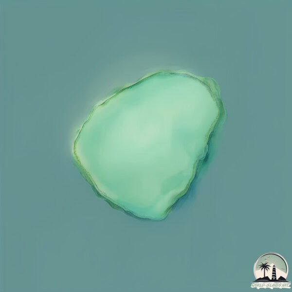
Geography and size of Munro Island
Size: 0.269 km²
Coastline: 1.9 km
Ocean: Indian Ocean
Sea: Laccadive Sea
Continent: Asia
Munro Island is a Tiny Island spanning 0.269 km² with a coastline of 1.9 km.
Archipel: –
Tectonic Plate: India – A major tectonic plate that initially moved northward at a rapid pace before colliding with the Eurasian Plate. This collision is responsible for the uplift of the Himalayas and the Tibetan Plateau.
The geographic heart of the island is pinpointed at these coordinates:
Latitude: 9.61787209 / Longitude: 76.38489261
Climate and weather of Munro Island
Climate Zone: Tropical
Climate Details: Tropical Monsoon Climate
Temperature: Hot
Climate Characteristics: Characterized by heavy rainfall, high humidity, and uniformly high temperatures, but with a distinct short dry season. It features a seasonal reversal of prevailing wind directions.
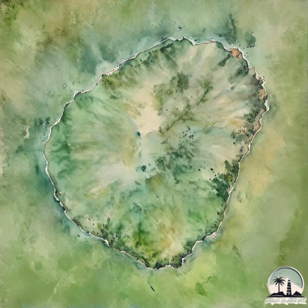
Topography and nature of Munro Island
Timezone: UTC+05:30
Timezone places: Asia/Kolkata
Max. Elevation: -44 m
Mean Elevation: -58 m
Vegetation: Open Woodland
Tree Coverage: 34%
The mean elevation is -58 m. Remarkably, this unique island barely emerges above the sea level, showcasing nature’s fascinating interplay with the ocean. The island is characterized by Plains: Flat, low-lying lands characterized by a maximum elevation of up to 200 meters. On islands, plains are typically coastal lowlands or central flat areas.
Dominating Vegetation: Open Woodland
Characterized by sparsely distributed trees with open canopy allowing sunlight to penetrate, supporting grasses and shrubs underneath. Often found in drier or transitional environments. Munro Island has a tree cover of 34 %.
Vegetation: 2 vegetation zones – Low Diversity Island
Islands with two distinct vegetation zones offer slightly more ecological variety. These zones could be due to differences in elevation, moisture, or other environmental factors. While still limited in biodiversity, these islands may offer a contrast between the two zones, such as a coastline with mangroves and an inland area with grassland.
Infrastructure and Travelling to Munro Island
Does the island have a public airport? no.
There is no public and scheduled airport on Munro Island. The nearest airport is Cochin International Airport, located 59 km away.
Does the island have a major port? no.
There are no major ports on Munro Island. The closest major port is KOCHI (COCHIN), approximately 42 km away.
The mean population of Munro Island is 2145 per km². Munro Island is Densely Populated. The island belongs to India.
Continuing your journey, Vypīn Island is the next notable island, situated merely km away.
Kerala's Hidden Gem | Kollam | Munroe Island | Kerala Itinerary


India is classified as Emerging region: BRIC: Brazil, Russia, India, and China – Economies noted for their rapid growth and increasing influence on global affairs. The level of income is Lower middle income.
News – Latest Updates and Headlines from Munro Island
Stay informed with the most recent news and important headlines from Munro Island. Here’s a roundup of the latest developments.
Please note: The data used here has been primarily extracted from satellite readings. Deviations from exact values may occur, particularly regarding the height of elevations and population density. Land area and coastline measurements refer to average values at mean high tide.