Welcome to Naru Shima, a Temperate island in the Japan Sea, part of the majestic Pacific Ocean. This guide offers a comprehensive overview of what makes Naru Shima unique – from its geography and climate to its population, infrastructure, and beyond. Dive into the details:
Geography and size of Naru Shima
Size: 23.9 km²
Coastline: 75.4 km
Ocean: Pacific Ocean
Sea: Japan Sea
Continent: Asia
Naru Shima is a Medium Island spanning 24 km² with a coastline of 75 km.
Archipel: Japan – An East Asian archipelago comprising four main islands and numerous smaller ones, known for its rich history, technological advances, and distinct culture.
Tectonic Plate: Amur – A minor tectonic plate in the region of the Amur River at the border of Russia and China, involved in complex interactions with the Pacific and Eurasian plates.
The geographic heart of the island is pinpointed at these coordinates:
Latitude: 32.84939405 / Longitude: 128.92809076
Climate and weather of Naru Shima
Climate Zone: Temperate
Climate Details: Humid Subtropical Climate
Temperature: Hot Summer
Climate Characteristics: With continuous rainfall and hot summers, this climate is common in some coastal regions, supporting diverse vegetation.
Topography and nature of Naru Shima
Timezone: UTC+09:00
Timezone places: Asia/Tokyo
Max. Elevation: 159 m
Mean Elevation: 61 m
Vegetation: Evergreen Needleleaf Forest
Tree Coverage: 91%
The mean elevation is 61 m. The highest elevation on the island reaches approximately 159 meters above sea level. The island is characterized by Plains: Flat, low-lying lands characterized by a maximum elevation of up to 200 meters. On islands, plains are typically coastal lowlands or central flat areas.
Dominating Vegetation: Evergreen Needleleaf Forest
Dominated by evergreen coniferous trees such as pines and firs, which retain their needle-like leaves throughout the year. These forests are often found in cooler climates. Naru Shima has a tree cover of 91 %.
Vegetation: 6 vegetation zones – Very Highly Diverse Island
Islands in this range are ecological powerhouses, showcasing a wide array of vegetation zones. Each zone, from lush rainforests to arid scrublands, coastal mangroves to mountainous regions, contributes to a complex and interdependent ecosystem. These islands are often hotspots of biodiversity, supporting numerous species and intricate ecological processes.
Infrastructure and Travelling to Naru Shima
Does the island have a public airport? no.
There is no public and scheduled airport on Naru Shima. The nearest airport is Fukue Airport, located 19 km away.
Does the island have a major port? no.
There are no major ports on Naru Shima. The closest major port is AOKATA, approximately 17 km away.
The mean population of Naru Shima is 87 per km². Naru Shima is Gently Populated. The island belongs to Japan.
Continuing your journey, Wakamatsu Jima is the next notable island, situated merely km away.
[8K]World Cultural Heritage Site Villages on Naru Island (CanonOfficial)
Canon, with the cooperation of Nagasaki Prefecture's Goto City, has produced an ultra-high-resolution 8K video showcasing the ...[8K]World Cultural Heritage Site Villages on Naru Island (CanonOfficial)
Canon, with the cooperation of Nagasaki Prefecture's Goto City, has ...
Canon, with the cooperation of Nagasaki Prefecture's Goto City, has produced an ultra-high-resolution 8K video showcasing the ...
長崎の癒しビーチ「奈留島・舅ヶ島海水浴場」空撮動画 / Naru Island Trip
五島列島の奈留島にある舅ヶ島海水浴場をドローンで撮影しました。 ビーチがいい感じで湾になっていて、海岸線の曲線がキレイ ...
五島列島の奈留島にある舅ヶ島海水浴場をドローンで撮影しました。 ビーチがいい感じで湾になっていて、海岸線の曲線がキレイ ...
Naru Island, JAPAN
五島列島 #奈留島 #goto #gotoislands #geopark #drone #nagasaki #japan.
五島列島 #奈留島 #goto #gotoislands #geopark #drone #nagasaki #japan.
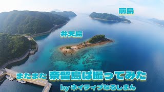
またまた奈留島ば撮ってみた④ byネイティブなるしまん2025 #奈留島 #五島列島 #ドローン
奈木〜東風泊まで ローカルネタぶっ込みました #奈留島 #五島列島 #djifpv ©音読さん 音楽: Good Vibes ミュージシャン: ...
奈木〜東風泊まで ローカルネタぶっ込みました #奈留島 #五島列島 #djifpv ©音読さん 音楽: Good Vibes ミュージシャン: ...
またまた奈留島ば撮ってみた② byネイティブなるしまん2025 #奈留島 #五島列島
ブレ補正効いてません スマソ ©音読さん 音楽: Dont Close Your Eyes ミュージシャン: Josh Woodward ...
ブレ補正効いてません スマソ ©音読さん 音楽: Dont Close Your Eyes ミュージシャン: Josh Woodward URL: ...
【五島列島】奈留島のコスパ最強宿で過ごす自分だけの島時間♪(長崎旅行/Nagasaki/Gotoislands/Naruisland/Japan) #3
今回は五島列島/奈留島編になります。 長崎から西へ100km、大小152の島々からなる五島列島。その中のほぼ中央に位置する奈留 ...
今回は五島列島/奈留島編になります。 長崎から西へ100km、大小152の島々からなる五島列島。その中のほぼ中央に位置する奈留 ...
[8K]世界文化遺産 奈留島の江上集落 (CanonOfficial)
キヤノンは長崎県五島市と協働で、2018年に世界文化遺産に登録された「長崎と天草地方の潜伏キリシタン関連遺産」を紹介する ...
キヤノンは長崎県五島市と協働で、2018年に世界文化遺産に登録された「長崎と天草地方の潜伏キリシタン関連遺産」を紹介する ...
奈留島(NARUSHIMA)2012.Aug
2012年8月 五島列島 奈留島の記憶 音楽(ギター): CHON46 今年、両親の実家へ訪れた時の映像です。 長崎から船を ...
2012年8月 五島列島 奈留島の記憶 音楽(ギター): CHON46 今年、両親の実家へ訪れた時の映像です。 長崎から船を ...
奈留島らしい桜🌸
五島列島 #奈留島 #奈留 #さくら #桜 #島暮らし #離島 #離島暮らし #桜ポートレート #桜好き #桜好きな人と繋がりたい #自然体験 ...
五島列島 #奈留島 #奈留 #さくら #桜 #島暮らし #離島 #離島暮らし #桜ポートレート #桜好き #桜好きな人と繋がりたい #自然体験 ...
長崎の癒しビーチ「奈留島・宮の浜海水浴場」空撮動画 / Naru Island Trip, Goto Islands Trip
五島列島・奈留島にある「宮ノ浜海水浴場」でドローンを撮影。しました。 シャワー施設があるので、急に海に入りたくなっても ...
五島列島・奈留島にある「宮ノ浜海水浴場」でドローンを撮影。しました。 シャワー施設があるので、急に海に入りたくなっても ...
奈留島ば撮ってみた① byネイティブなるしまん2024 #奈留島 #五島列島 #ドローン #djifpv #mavicair2
奈留島出身ならではの懐かしい風景を撮りました。コメントよろしくお願いします。 音楽: When I'm Gone ミュージシャン: ...
奈留島出身ならではの懐かしい風景を撮りました。コメントよろしくお願いします。 音楽: When I'm Gone ミュージシャン: ...
奈留島兜崎
2022年5月に長崎県五島列島の奈留島で撮影しました。 It was taken in May 2022 on Narushima ...
2022年5月に長崎県五島列島の奈留島で撮影しました。 It was taken in May 2022 on Narushima Island in the Goto Archipelago, ...
またまた奈留島ば撮ってみた① byネイティブなるしまん2025 #奈留島 #五島列島
カメラのブレ補正効いてません スマソ.
カメラのブレ補正効いてません スマソ.
Narujima Main Street
Ride through the main street of Narujima island, part of the Goto ...
Ride through the main street of Narujima island, part of the Goto Islands, off the south west coast of Japan, October 2011 Path is ...
奈留島ば撮ってみた③ 完結編 byネイティブなるしまん2024 #奈留島 #奈留高校 #五島列島 #ドローン#djifpv #mavicair2
奈留島ネイティブならではの思い入れ映像です。
奈留島ネイティブならではの思い入れ映像です。
【Egami Village on Naru Island】
What is the value of the sites as World Heritage? We introduce you to ...
What is the value of the sites as World Heritage? We introduce you to the sites in four minutes. We hope you enjoy it.
《奈留島そらあみ》
この島で生きてきた先人たちの見てきた景色を想う。 先人の生きる術を学び、この島で生きていく。 #五島 #奈留島 #そらあみ.
この島で生きてきた先人たちの見てきた景色を想う。 先人の生きる術を学び、この島で生きていく。 #五島 #奈留島 #そらあみ.
Goto Islands:Unveiling Japan's Secret Paradise.
Just off the coast of Kyushu, the Goto Islands are a cluster of over ...
Just off the coast of Kyushu, the Goto Islands are a cluster of over 150 islands scattered across the deep blue sea west of ...
またまた奈留島ば撮ってみた③ byネイティブなるしまん2025 #奈留島 #五島列島
画質悪くてすんません 次こそは! 音楽: Unlike Us ミュージシャン: You Are Us (from Audiio)
画質悪くてすんません 次こそは! 音楽: Unlike Us ミュージシャン: You Are Us (from Audiio)
9 Hidden Places in Naru
Naru is one of the Goto Islands in Nagasaki, Japan. It's remote but ...
Naru is one of the Goto Islands in Nagasaki, Japan. It's remote but magical. This is definitely a spot to escape from all the muss ...
295 Churches on Goto Islands in Nagasaki Prefecture / Travels of Scenic Japan / Tabiator
Churches in the islands where many hidden Christians lived in Nagasaki ...
Churches in the islands where many hidden Christians lived in Nagasaki Prefecture. I was going to visit several islands and visit ...
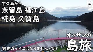
奈留島福江島ハマジンチョウ探しと、椛島、久賀島
オッサンの島旅。 宇久島から、奈留島へ行ってハマジンチョウ探し。 椛島、久賀島へ行った後、福江島の荒川のハマジンチョウへ ...
オッサンの島旅。 宇久島から、奈留島へ行ってハマジンチョウ探し。 椛島、久賀島へ行った後、福江島の荒川のハマジンチョウへ ...
Remote islands in Japan) 五島 奈留千畳敷 "1,000 Tatami mats sized huge flat rock" in NARU of GOTO islands
HP:http://hiroki2016.tsuyaku-annaishi.com/en Guide's ...
HP:http://hiroki2016.tsuyaku-annaishi.com/en Guide's Blog:http://hiroki2016.tsuyaku-annaishi.com/en/blogs Blog on GOTO ...
【2024年】11月7日(木)五島列島奈留島の絶景と島民の絆が生んだ秘境に舞うアート!奈留島のもり食堂の動画はこちらですhttps://youtu.be/oGrsia11EwE:
Japan is classified as Developed region: G7: Group of Seven – Major advanced economies, including Canada, France, Germany, Italy, Japan, the United Kingdom, and the United States. The level of income is High income: OECD.
News – Latest Updates and Headlines from Naru Shima
Stay informed with the most recent news and important headlines from Naru Shima. Here’s a roundup of the latest developments.
Loading...
Please note: The data used here has been primarily extracted from satellite readings. Deviations from exact values may occur, particularly regarding the height of elevations and population density. Land area and coastline measurements refer to average values at mean high tide.
![[8K]World Cultural Heritage Site Villages on Naru Island (CanonOfficial)](https://i.ytimg.com/vi/r1Z7_Wrm234/mqdefault.jpg)


![[8K]世界文化遺産 奈留島の江上集落 (CanonOfficial)](https://i.ytimg.com/vi/cxTBb4bHwp4/mqdefault.jpg)