Navassa
Welcome to Navassa, a Tropical island in the Caribbean Sea, part of the majestic Atlantic Ocean. This guide offers a comprehensive overview of what makes Navassa unique – from its geography and climate to its population, infrastructure, and beyond. Dive into the details:
- Geography and Size: Explore the island’s size and location.
- Climate and Weather: Weather patterns and temperature.
- Topography and Nature: Uncover the natural wonders of the island.
- Infrastructure and Travelling: Insights on reaching, staying, and making the most of your visit.
- News and Headlines: Latest News.
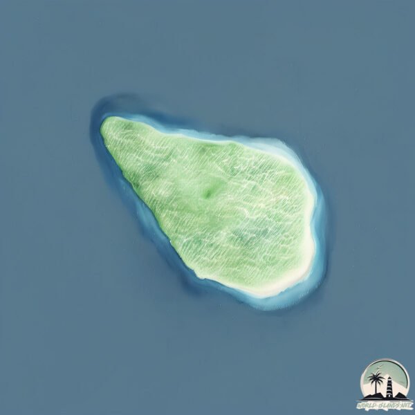
Geography and size of Navassa
Size: 4.778 km²
Coastline: 8.7 km
Ocean: Atlantic Ocean
Sea: Caribbean Sea
Continent: North America
Navassa is a Small Island spanning 4.8 km² with a coastline of 8.7 km.
Archipel: Greater Antilles – A major island group in the Caribbean, including Cuba, Jamaica, Hispaniola, and Puerto Rico, known for their rich history and diverse cultures.
Tectonic Plate: North America – Covers North America and parts of the Atlantic and Arctic Oceans, characterized by diverse geological features and varying levels of seismic activity.
The geographic heart of the island is pinpointed at these coordinates:
Latitude: 18.40343211 / Longitude: -75.01359881
Climate and weather of Navassa
Climate Zone: Tropical
Climate Details: Tropical Monsoon Climate
Temperature: Hot
Climate Characteristics: Characterized by heavy rainfall, high humidity, and uniformly high temperatures, but with a distinct short dry season. It features a seasonal reversal of prevailing wind directions.
Topography and nature of Navassa
Timezone: UTC-05:00
Timezone places: America/New_York
Max. Elevation: 71 m
Mean Elevation: 37 m
Vegetation: Cultivated Land
Tree Coverage: 40%
The mean elevation is 37 m. The highest elevation on the island reaches approximately 71 meters above sea level. The island is characterized by Plains: Flat, low-lying lands characterized by a maximum elevation of up to 200 meters. On islands, plains are typically coastal lowlands or central flat areas.
Dominating Vegetation: Cultivated Land
Areas dedicated to agricultural activities, growing crops like grains, vegetables, and fruits. These lands are usually human-modified landscapes. Navassa has a tree cover of 40 %.
Vegetation: 6 vegetation zones – Very Highly Diverse Island
Islands in this range are ecological powerhouses, showcasing a wide array of vegetation zones. Each zone, from lush rainforests to arid scrublands, coastal mangroves to mountainous regions, contributes to a complex and interdependent ecosystem. These islands are often hotspots of biodiversity, supporting numerous species and intricate ecological processes.
Infrastructure and Travelling to Navassa
Does the island have a public airport? no.
There is no public and scheduled airport on Navassa. The nearest airport is Jérémie Airport, located 97 km away.
Does the island have a major port? no.
There are no major ports on Navassa. The closest major port is PORT ANTONIO, approximately 160 km away.
The mean population of Navassa is per km². Navassa is . The island belongs to United States of America.
Continuing your journey, Grande Cayemite is the next notable island, situated merely km away.
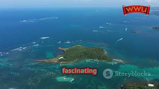
Navassa Island: The Mysterious Caribbean Outpost


United States of America is classified as Developed region: G7: Group of Seven – Major advanced economies, including Canada, France, Germany, Italy, Japan, the United Kingdom, and the United States. The level of income is High income: OECD.
News – Latest Updates and Headlines from Navassa
Stay informed with the most recent news and important headlines from Navassa. Here’s a roundup of the latest developments.
Please note: The data used here has been primarily extracted from satellite readings. Deviations from exact values may occur, particularly regarding the height of elevations and population density. Land area and coastline measurements refer to average values at mean high tide.