Ngerekebesang
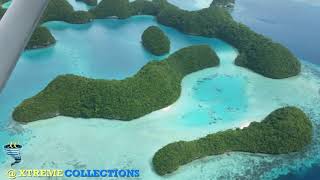
Welcome to Ngerekebesang, a Tropical island in the North Pacific Ocean, part of the majestic Pacific Ocean. This guide offers a comprehensive overview of what makes Ngerekebesang unique – from its geography and climate to its population, infrastructure, and beyond. Dive into the details:
- Geography and Size: Explore the island’s size and location.
- Climate and Weather: Weather patterns and temperature.
- Topography and Nature: Uncover the natural wonders of the island.
- Infrastructure and Travelling: Insights on reaching, staying, and making the most of your visit.
- News and Headlines: Latest News.
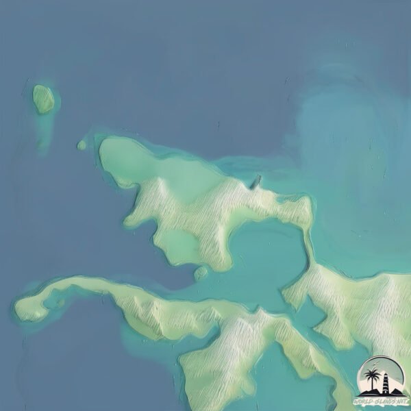
Geography and size of Ngerekebesang
Size: 2.443 km²
Coastline: 8.9 km
Ocean: Pacific Ocean
Sea: North Pacific Ocean
Continent: Oceania
Ngerekebesang is a Small Island spanning 2.4 km² with a coastline of 8.9 km.
Archipel: Micronesia – A region in the western Pacific Ocean comprising thousands of small islands, known for their unique cultures, languages, and marine ecosystems.
Tectonic Plate: North America – Covers North America and parts of the Atlantic and Arctic Oceans, characterized by diverse geological features and varying levels of seismic activity.
The geographic heart of the island is pinpointed at these coordinates:
Latitude: 7.35428317 / Longitude: 134.45041236
Climate and weather of Ngerekebesang
Climate Zone: Tropical
Climate Details: Tropical Rainforest Climate
Temperature: Hot
Climate Characteristics: This climate is typified by heavy rainfall throughout the year, high humidity, and consistently high temperatures, leading to lush rainforests and rich biodiversity. Seasonal temperature variations are minimal.
Topography and nature of Ngerekebesang
Timezone: UTC+09:00
Timezone places: Asia/Tokyo
Max. Elevation: 32 m
Mean Elevation: 21 m
Vegetation: Evergreen Broadleaf Forest
Tree Coverage: 82%
The mean elevation is 21 m. The highest elevation on the island reaches approximately 32 meters above sea level. The island is characterized by Plains: Flat, low-lying lands characterized by a maximum elevation of up to 200 meters. On islands, plains are typically coastal lowlands or central flat areas.
Dominating Vegetation: Evergreen Broadleaf Forest
Characterized by dense, lush canopies of broadleaf trees that retain their leaves year-round. These forests are typically found in tropical and subtropical regions and are known for their high biodiversity. Ngerekebesang has a tree cover of 82 %.
Vegetation: 5 vegetation zones – Highly Diverse Island
With five different vegetation zones, these islands offer a rich tapestry of ecosystems. The variety could include dense forests, open meadows, wetlands, coastal zones, and more. This level of diversity supports an intricate web of life, with each zone playing a vital role in the overall ecological health and balance of the island.
Infrastructure and Travelling to Ngerekebesang
Does the island have a public airport? no.
There is no public and scheduled airport on Ngerekebesang. The nearest airport is Babelthuap Airport, located 9 km away.
Does the island have a major port? no.
There are no major ports on Ngerekebesang. The closest major port is MALAKAL HARBOR, approximately 1 km away.
The mean population of Ngerekebesang is 144 per km². Ngerekebesang is Moderately Inhabited. The island belongs to Palau.
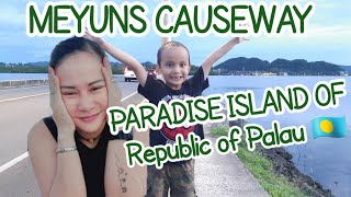
Continuing your journey, Koror is the next notable island, situated merely km away.
Visit Koror Palau | Rock Islands | Jellyfish Lake Snorkel & the Milky Way | GOPRO 4K #palau


Palau is classified as Developing region: Regions characterized by lower income levels, with economies in the process of industrialization and modernization. The level of income is Upper middle income.
News – Latest Updates and Headlines from Ngerekebesang
Stay informed with the most recent news and important headlines from Ngerekebesang. Here’s a roundup of the latest developments.
Please note: The data used here has been primarily extracted from satellite readings. Deviations from exact values may occur, particularly regarding the height of elevations and population density. Land area and coastline measurements refer to average values at mean high tide.