Nigu Yu
Welcome to Nigu Yu, a Temperate island in the Eastern China Sea, part of the majestic Pacific Ocean. This guide offers a comprehensive overview of what makes Nigu Yu unique – from its geography and climate to its population, infrastructure, and beyond. Dive into the details:
- Geography and Size: Explore the island’s size and location.
- Climate and Weather: Weather patterns and temperature.
- Topography and Nature: Uncover the natural wonders of the island.
- Infrastructure and Travelling: Insights on reaching, staying, and making the most of your visit.
- News and Headlines: Latest News.
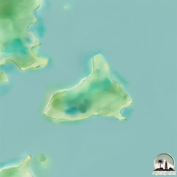
Geography and size of Nigu Yu
Size: 0.968 km²
Coastline: 4.8 km
Ocean: Pacific Ocean
Sea: Eastern China Sea
Continent: Asia
Nigu Yu is a Tiny Island spanning 0.968 km² with a coastline of 4.8 km.
Archipel: –
Tectonic Plate: Yangtze – A minor tectonic plate in East Asia, often considered a part of the Eurasian Plate. It’s primarily continental and covers the Yangtze River area in China, playing a significant role in the region’s geological stability.
The geographic heart of the island is pinpointed at these coordinates:
Latitude: 26.55763348 / Longitude: 120.15256393
Climate and weather of Nigu Yu
Climate Zone: Temperate
Climate Details: Humid Subtropical Climate
Temperature: Hot Summer
Climate Characteristics: With continuous rainfall and hot summers, this climate is common in some coastal regions, supporting diverse vegetation.
Topography and nature of Nigu Yu
Timezone: UTC+08:00
Timezone places: Australia/Perth
Max. Elevation: 29 m
Mean Elevation: 25 m
Vegetation: Evergreen Needleleaf Forest
Tree Coverage: 56%
The mean elevation is 25 m. The highest elevation on the island reaches approximately 29 meters above sea level. The island is characterized by Plains: Flat, low-lying lands characterized by a maximum elevation of up to 200 meters. On islands, plains are typically coastal lowlands or central flat areas.
Dominating Vegetation: Evergreen Needleleaf Forest
Dominated by evergreen coniferous trees such as pines and firs, which retain their needle-like leaves throughout the year. These forests are often found in cooler climates. Nigu Yu has a tree cover of 56 %.
Vegetation: 4 vegetation zones – Diverse Island
Four distinct vegetation zones mark these islands as ecologically diverse. They might feature varied landscapes such as forests, beaches, grasslands, and rocky areas. Such diversity reflects the island’s complex ecological interactions and varied habitats, which can support a rich array of wildlife and plant species.
Infrastructure and Travelling to Nigu Yu
Does the island have a public airport? no.
There is no public and scheduled airport on Nigu Yu. The nearest airport is Matsu Beigan Airport, located 40 km away.
Does the island have a major port? no.
There are no major ports on Nigu Yu. The closest major port is FUZHOU, approximately 107 km away.
The mean population of Nigu Yu is 304 per km². Nigu Yu is Moderately Inhabited. The island belongs to China.
Continuing your journey, Fuying Dao is the next notable island, situated merely km away.
ELkay & Shelon ft Alahbasta- Nauraku(official Audio)2025


![Sean Rii, Karyon, Sharzkii - Taungule [My Love] (Official Music Video)](https://i.ytimg.com/vi/eJoMuypbSzQ/mqdefault.jpg)


![Girl Blo Bali ~ Boyderaz [Prod By Morgz] 2023 Vanuatu Music🇻🇺](https://i.ytimg.com/vi/ka-FK1FDZ0k/mqdefault.jpg)


![Ruth Wamuyu - NI GUKENA (Official Video) [Skiza Code: 8567993]](https://i.ytimg.com/vi/GgpSwsiCkls/mqdefault.jpg)


China is classified as Emerging region: BRIC: Brazil, Russia, India, and China – Economies noted for their rapid growth and increasing influence on global affairs. The level of income is Upper middle income.
News – Latest Updates and Headlines from Nigu Yu
Stay informed with the most recent news and important headlines from Nigu Yu. Here’s a roundup of the latest developments.
Please note: The data used here has been primarily extracted from satellite readings. Deviations from exact values may occur, particularly regarding the height of elevations and population density. Land area and coastline measurements refer to average values at mean high tide.