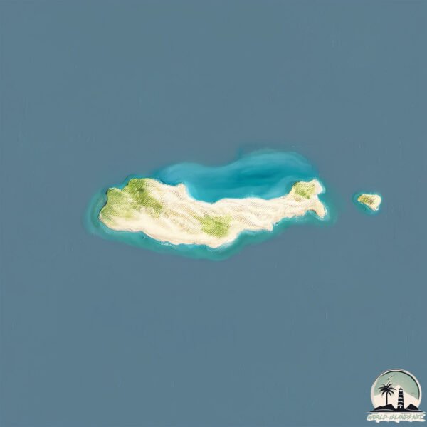
Nisí Chrysí
Welcome to Nisí Chrysí, a Temperate island in the Mediterranean Sea – Eastern Basin, part of the majestic Atlantic Ocean. This guide offers a comprehensive overview of what makes Nisí Chrysí unique – from its geography and climate to its population, infrastructure, and beyond. Dive into the details:
- Geography and Size: Explore the island’s size and location.
- Climate and Weather: Weather patterns and temperature.
- Topography and Nature: Uncover the natural wonders of the island.
- Infrastructure and Travelling: Insights on reaching, staying, and making the most of your visit.
- News and Headlines: Latest News.
Geography and size of Nisí Chrysí
Size: 5.147 km²
Coastline: 13.4 km
Ocean: Atlantic Ocean
Sea: Mediterranean Sea – Eastern Basin
Continent: Europe
Nisí Chrysí is a Small Island spanning 5.1 km² with a coastline of 13.4 km.
Archipel: –
Tectonic Plate: Aegean Sea – Located in the eastern Mediterranean, this microplate is characterized by seismic and volcanic activity due to its interaction with the Eurasian and African Plates.
The geographic heart of the island is pinpointed at these coordinates:
Latitude: 34.87307235 / Longitude: 25.70350624
Climate and weather of Nisí Chrysí
Climate Zone: Temperate
Climate Details: Hot-Summer Mediterranean Climate
Temperature: Hot Summer
Climate Characteristics: Characterized by hot, dry summers and mild, wet winters, typical of coastal areas with abundant sunshine.
Topography and nature of Nisí Chrysí
Timezone: UTC+02:00
Timezone places: Europe/Mariehamn
Max. Elevation: 8 m
Mean Elevation: -4 m
Vegetation: Agricultural Mosaic
Tree Coverage: 12%
The mean elevation is -4 m. The highest elevation on the island reaches approximately 8 meters above sea level. The island is characterized by Plains: Flat, low-lying lands characterized by a maximum elevation of up to 200 meters. On islands, plains are typically coastal lowlands or central flat areas.
Dominating Vegetation: Agricultural Mosaic
A mix of cropland and natural vegetation, often seen in rural landscapes where agricultural fields are interspersed with patches of natural habitats. Nisí Chrysí has a tree cover of 12 %.
Vegetation: 5 vegetation zones – Highly Diverse Island
With five different vegetation zones, these islands offer a rich tapestry of ecosystems. The variety could include dense forests, open meadows, wetlands, coastal zones, and more. This level of diversity supports an intricate web of life, with each zone playing a vital role in the overall ecological health and balance of the island.
Infrastructure and Travelling to Nisí Chrysí
Does the island have a public airport? no.
There is no public and scheduled airport on Nisí Chrysí. The nearest airport is Sitia Airport, located 55 km away.
Does the island have a major port? no.
There are no major ports on Nisí Chrysí. The closest major port is AYIOS NIKOLAOS, approximately 35 km away.
The mean population of Nisí Chrysí is 242 per km². Nisí Chrysí is Moderately Inhabited. The island belongs to Greece.
Continuing your journey, Nisí Día is the next notable island, situated merely km away.
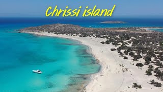
Apollon Cruises - Daily Trips to Chrissi Island


Greece is classified as Developed region: nonG7: Developed economies outside of the Group of Seven, characterized by high income and advanced economic structures. The level of income is High income: OECD.
News – Latest Updates and Headlines from Nisí Chrysí
Stay informed with the most recent news and important headlines from Nisí Chrysí. Here’s a roundup of the latest developments.
Please note: The data used here has been primarily extracted from satellite readings. Deviations from exact values may occur, particularly regarding the height of elevations and population density. Land area and coastline measurements refer to average values at mean high tide.