Nisí Día
Welcome to Nisí Día, a Temperate island in the Aegean Sea, part of the majestic Atlantic Ocean. This guide offers a comprehensive overview of what makes Nisí Día unique – from its geography and climate to its population, infrastructure, and beyond. Dive into the details:
- Geography and Size: Explore the island’s size and location.
- Climate and Weather: Weather patterns and temperature.
- Topography and Nature: Uncover the natural wonders of the island.
- Infrastructure and Travelling: Insights on reaching, staying, and making the most of your visit.
- News and Headlines: Latest News.
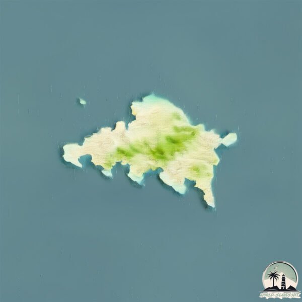
Geography and size of Nisí Día
Size: 12.1 km²
Coastline: 26.9 km
Ocean: Atlantic Ocean
Sea: Aegean Sea
Continent: Europe
Nisí Día is a Medium Island spanning 12 km² with a coastline of 27 km.
Archipel: –
Tectonic Plate: Anatolia – A tectonic microplate covering most of Turkey, it’s squeezed between the Eurasian Plate to the north and the African Plate to the south, known for significant seismic activity.
The geographic heart of the island is pinpointed at these coordinates:
Latitude: 35.446831 / Longitude: 25.21900334
Climate and weather of Nisí Día
Climate Zone: Temperate
Climate Details: Hot-Summer Mediterranean Climate
Temperature: Hot Summer
Climate Characteristics: Characterized by hot, dry summers and mild, wet winters, typical of coastal areas with abundant sunshine.
Topography and nature of Nisí Día
Timezone: UTC+02:00
Timezone places: Europe/Mariehamn
Max. Elevation: 209 m
Mean Elevation: 85 m
Vegetation: Agricultural Mosaic
Tree Coverage: 44%
The mean elevation is 85 m. The highest elevation on the island reaches approximately 209 meters above sea level. The island is characterized by Hills: Gently sloping landforms with rounded tops, having a maximum elevation between 200 and 500 meters. Hills contribute to a varied landscape on islands.
Dominating Vegetation: Agricultural Mosaic
A mix of cropland and natural vegetation, often seen in rural landscapes where agricultural fields are interspersed with patches of natural habitats. Nisí Día has a tree cover of 44 %.
Vegetation: 6 vegetation zones – Very Highly Diverse Island
Islands in this range are ecological powerhouses, showcasing a wide array of vegetation zones. Each zone, from lush rainforests to arid scrublands, coastal mangroves to mountainous regions, contributes to a complex and interdependent ecosystem. These islands are often hotspots of biodiversity, supporting numerous species and intricate ecological processes.
Infrastructure and Travelling to Nisí Día
Does the island have a public airport? no.
There is no public and scheduled airport on Nisí Día. The nearest airport is Heraklion International Nikos Kazantzakis Airport, located 11 km away.
Does the island have a major port? no.
There are no major ports on Nisí Día. The closest major port is IRAKLION, approximately 11 km away.
The mean population of Nisí Día is 70 per km². Nisí Día is Gently Populated. The island belongs to Greece.
Continuing your journey, Crete is the next notable island, situated merely km away.
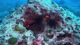
Dia Island : The Best Boat Tour from Heraklion, Crete


Greece is classified as Developed region: nonG7: Developed economies outside of the Group of Seven, characterized by high income and advanced economic structures. The level of income is High income: OECD.
News – Latest Updates and Headlines from Nisí Día
Stay informed with the most recent news and important headlines from Nisí Día. Here’s a roundup of the latest developments.
Please note: The data used here has been primarily extracted from satellite readings. Deviations from exact values may occur, particularly regarding the height of elevations and population density. Land area and coastline measurements refer to average values at mean high tide.