Welcome to Nisí Sífnos, a Temperate island in the Aegean Sea, part of the majestic Atlantic Ocean. This guide offers a comprehensive overview of what makes Nisí Sífnos unique – from its geography and climate to its population, infrastructure, and beyond. Dive into the details:
Geography and size of Nisí Sífnos
Size: 77.3 km²
Coastline: 69.9 km
Ocean: Atlantic Ocean
Sea: Aegean Sea
Continent: Europe
Nisí Sífnos is a Medium Island spanning 77 km² with a coastline of 70 km.
Archipel: Cyclades – A group of islands in the Aegean Sea, part of Greece, known for their iconic white-washed architecture, beautiful beaches, and rich history.
Tectonic Plate: Aegean Sea – Located in the eastern Mediterranean, this microplate is characterized by seismic and volcanic activity due to its interaction with the Eurasian and African Plates.
The geographic heart of the island is pinpointed at these coordinates:
Latitude: 36.97159511 / Longitude: 24.70222778
Climate and weather of Nisí Sífnos
Climate Zone: Temperate
Climate Details: Hot-Summer Mediterranean Climate
Temperature: Hot Summer
Climate Characteristics: Characterized by hot, dry summers and mild, wet winters, typical of coastal areas with abundant sunshine.
Topography and nature of Nisí Sífnos
Timezone: UTC+02:00
Timezone places: Europe/Mariehamn
Max. Elevation: 521 m
Mean Elevation: 189 m
Vegetation: Agricultural Mosaic
Tree Coverage: 24%
The mean elevation is 189 m. The highest elevation on the island reaches approximately 521 meters above sea level. The island is characterized by Plateau: Elevated flatlands rising sharply above the surrounding area, with a maximum elevation over 500 meters but a mean elevation less than 300 meters, forming unique highland areas on islands.
Dominating Vegetation: Agricultural Mosaic
A mix of cropland and natural vegetation, often seen in rural landscapes where agricultural fields are interspersed with patches of natural habitats. Nisí Sífnos has a tree cover of 24 %.
Vegetation: 12 vegetation zones – Exceptionally Diverse Island
Islands with more than ten vegetation zones are among the most ecologically rich and varied in the world. These islands are akin to miniature continents, boasting an incredible array of ecosystems. The sheer range of habitats, from high peaks to deep valleys, rainforests to deserts, creates a mosaic of life that is unparalleled. They are crucial for conservation and ecological studies.
Infrastructure and Travelling to Nisí Sífnos
Does the island have a public airport? no.
There is no public and scheduled airport on Nisí Sífnos. The nearest airport is Milos Airport, located 34 km away.
Does the island have a major port? no.
There are no major ports on Nisí Sífnos. The closest major port is MILOS, approximately 35 km away.
The mean population of Nisí Sífnos is 34 per km². Nisí Sífnos is Gently Populated. The island belongs to Greece.
Continuing your journey, Nisí Polýaigos is the next notable island, situated merely km away.
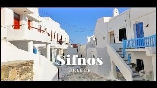
Discover SIFNOS: The Perfect Greek Island
Sifnos is a small, picturesque island in the western Cyclades, known for its beautiful beaches, traditional villages, and delicious ...Discover SIFNOS: The Perfect Greek Island
Sifnos is a small, picturesque island in the western Cyclades, known ...
Sifnos is a small, picturesque island in the western Cyclades, known for its beautiful beaches, traditional villages, and delicious ...
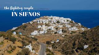
Sifnos Island Review: Why It's the Perfect Greek Island Escape
In this exciting video, join us as we take you on an unforgettable ...
In this exciting video, join us as we take you on an unforgettable journey to Sifnos Island, the hidden gem of the Greek Isles.
TOP 10 Things to do in Sifnos Island, Greece 2024!
TOP 10 Things to do in Sifnos Island, Greece 2024! Book your Antiparos ...
TOP 10 Things to do in Sifnos Island, Greece 2024! Book your Antiparos and Despotiko Tour Tickets below ...
Where to Stay on Sifnos Island, Greece - Best Hotels & Areas
Sifnos, Greece travel guide to where to stay including the best ...
Sifnos, Greece travel guide to where to stay including the best hotels, where to eat, and things to do in Kamares, Apollonia, Kastro, ...
A glimpse of Sifnos Island... enchanting!
A glimpse of Sifnos Island... enchanting!
http://www.sifnos.gr : instagram.com/goguette_in_greece #sifnos #visitsifnosisland ...
3 Days in Sifnos: Greek Island Food Paradise | Travel Diary ep 22
Is Sifnos the BEST Greek Island for Foodies? I put the culinary ...
Is Sifnos the BEST Greek Island for Foodies? I put the culinary capital of the Cyclades to the test on a 3-day solo trip, and ...
Sifnos island 4K, top beaches & sights, Cyclades Greece travel guide | Σίφνος, καλύτερες παραλίες
Sifnos, the silent power of the Cyclades ...
Sifnos, the silent power of the Cyclades ...
The Ultimate Sifnos Travel Guide | Greece 2025
The Ultimate Sifnos Greece Travel Guide | Hidden Gem in the Cyclades ...
The Ultimate Sifnos Greece Travel Guide | Hidden Gem in the Cyclades Dreaming of an authentic Greek island escape? Sifnos ...
sifnos vlog 2025 | greek island beach hopping, local food & why you should visit 🇬🇷
Hey guys! Welcome to my Sifnos, Greece vlog Me and Ariana spent 3 days ...
Hey guys! Welcome to my Sifnos, Greece vlog Me and Ariana spent 3 days on this little Cycladic island, but honestly it felt so ...
Sifnos Island Retreat: A Relaxing Getaway | Greece Travel
This was my second trip to Sifnos and I fell in love a bit more. The ...
This was my second trip to Sifnos and I fell in love a bit more. The food is amazing and so are all the stunning villages. It was also ...
Sifnos Greece Travel Guide: 16 BEST Things To Do In Sifnos
This Sifnos travel guide shares the best things to do in Sifnos. ...
This Sifnos travel guide shares the best things to do in Sifnos. -------------- How to travel more and visit your dream destinations ...
Η Σίφνος στο 4k Heritage TV
Οι γραφικοί οικισμοί και οι εκκλησίες της Σίφνου "πρωταγωνιστούν" σε ...
Οι γραφικοί οικισμοί και οι εκκλησίες της Σίφνου "πρωταγωνιστούν" σε ένα μοναδικό επεισόδιο από το 4k Heritage TV το ...
Sifnos Trails, hike on an authentic Greek Island!
Sifnos Trails is the name of the hiking trails network of the island ...
Sifnos Trails is the name of the hiking trails network of the island of Sifnos in the Aegean Sea, Greece. The total length of the ...
Sifnos (Greece) - Two-Day Travel Guide to Cyclades’ Best-Kept Secret (4K)
Embark with us on a ferry to discover Sifnos, a breathtaking Greek ...
Embark with us on a ferry to discover Sifnos, a breathtaking Greek island where whitewashed villages cling to cliffs, turquoise ...
Calm day at the beach... on Sifnos Island!
Calm day at the beach... on Sifnos Island!
http://www.sifnos.gr : Veronika (instagram.com/verogualdani) #sifnos #visitsifnosisland ...
Sifnos Greece: The Hidden Gem Island That Deserves a Spot on Your Itinerary
Planning a trip to Greece? Don't overlook Sifnos Island - a true ...
Planning a trip to Greece? Don't overlook Sifnos Island - a true hidden gem in the Cyclades. In this video, I'm sharing why Sifnos ...
Went to Sifnos just to stay here and it did not disappoint! It’s owned by the sweetest Greek family
Went to Sifnos just to stay here and it did not disappoint! It's owned ...
Went to Sifnos just to stay here and it did not disappoint! It's owned by the sweetest Greek family (father daughter duo!) who make ...
Exploring Kamares on Sifnos Island!
Exploring Kamares on Sifnos Island!
http://www.sifnos.gr : instagram.com/goguette_in_greece #sifnos #visitsifnosisland #visitsifnos ...
Sifnos Island: Greece’s BEST KEPT Secret!!!
We found the HIDDEN GEM of the Greek Cyclades. Sifnos, Greece is a ...
We found the HIDDEN GEM of the Greek Cyclades. Sifnos, Greece is a lesser known island to give you that authentic Greek ...
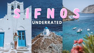
Explore Sifnos! The most Underrated Stunning Island in Greece in 8K
Sifnos is a small beautiful island in the western Cyclades, known for ...
Sifnos is a small beautiful island in the western Cyclades, known for amazing beaches, traditional villages, delicious local cuisine ...
Sifnos Island, incredible spot
Exploring every incredible spot of Sifnos Island!
http://www.sifnos.gr : instagram.com/goguette_in_greece #sifnos #visitsifnosisland ...
An amazing spot at Sifnos island, in Kamares, is the relatively new beach bar 📍Paralia
An amazing spot at Sifnos island, in Kamares, is the relatively new ...
An amazing spot at Sifnos island, in Kamares, is the relatively new beach bar Paralia. . Delicious coffee, nice sandwiches ...
Is this the most underrated island in Greece? Sifnos Travel Vlog
For our first stop in Greece, we decided to stay at the most ...
For our first stop in Greece, we decided to stay at the most underrated island in Greece: Sifnos! To be honest, we didn't expect ...
🇬🇷 Why Sifnos, Greece Should Be Your Next Travel Destination: A Family-Friendly Travel Guide
This time we chose to explore one of the most underrated islands in ...
This time we chose to explore one of the most underrated islands in Greece: Sifnos! To be honest, we didn't know what to expect, ...
Greece is a Dream: My Perfect 3-Island Itinerary (Santorini, Milos, Sifnos)
Join me on an unforgettable Greece 2026 adventure as I island-hop ...
Join me on an unforgettable Greece 2026 adventure as I island-hop through the stunning Cyclades, visiting Santorini, Milos, and ...
Greece is classified as Developed region: nonG7: Developed economies outside of the Group of Seven, characterized by high income and advanced economic structures. The level of income is High income: OECD.
News – Latest Updates and Headlines from Nisí Sífnos
Stay informed with the most recent news and important headlines from Nisí Sífnos. Here’s a roundup of the latest developments.
Loading...
Please note: The data used here has been primarily extracted from satellite readings. Deviations from exact values may occur, particularly regarding the height of elevations and population density. Land area and coastline measurements refer to average values at mean high tide.