Nisída Ammoulianí
Welcome to Nisída Ammoulianí, a Dry island in the Aegean Sea, part of the majestic Atlantic Ocean. This guide offers a comprehensive overview of what makes Nisída Ammoulianí unique – from its geography and climate to its population, infrastructure, and beyond. Dive into the details:
- Geography and Size: Explore the island’s size and location.
- Climate and Weather: Weather patterns and temperature.
- Topography and Nature: Uncover the natural wonders of the island.
- Infrastructure and Travelling: Insights on reaching, staying, and making the most of your visit.
- News and Headlines: Latest News.
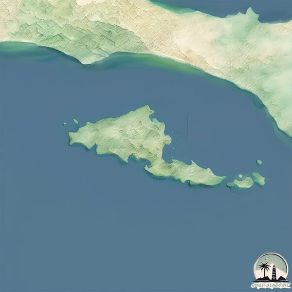
Geography and size of Nisída Ammoulianí
Size: 7.158 km²
Coastline: 19.5 km
Ocean: Atlantic Ocean
Sea: Aegean Sea
Continent: Europe
Nisída Ammoulianí is a Small Island spanning 7.2 km² with a coastline of 19.5 km.
Archipel: –
Tectonic Plate: Anatolia – A tectonic microplate covering most of Turkey, it’s squeezed between the Eurasian Plate to the north and the African Plate to the south, known for significant seismic activity.
The geographic heart of the island is pinpointed at these coordinates:
Latitude: 40.32519235 / Longitude: 23.9138204
Climate and weather of Nisída Ammoulianí
Climate Zone: Dry
Climate Details: Cold Semi-Arid (Steppe) Climate
Temperature: Cold
Climate Characteristics: Characterized by hot summers and cold winters, this climate is typically found on the edges of continental zones. It receives sufficient precipitation to avoid desert conditions.
Topography and nature of Nisída Ammoulianí
Timezone: UTC+02:00
Timezone places: Europe/Mariehamn
Max. Elevation: 45 m
Mean Elevation: 20 m
Vegetation: Evergreen Needleleaf Forest
Tree Coverage: 56%
The mean elevation is 20 m. The highest elevation on the island reaches approximately 45 meters above sea level. The island is characterized by Plains: Flat, low-lying lands characterized by a maximum elevation of up to 200 meters. On islands, plains are typically coastal lowlands or central flat areas.
Dominating Vegetation: Evergreen Needleleaf Forest
Dominated by evergreen coniferous trees such as pines and firs, which retain their needle-like leaves throughout the year. These forests are often found in cooler climates. Nisída Ammoulianí has a tree cover of 56 %.
Vegetation: 8 vegetation zones – Very Highly Diverse Island
Islands in this range are ecological powerhouses, showcasing a wide array of vegetation zones. Each zone, from lush rainforests to arid scrublands, coastal mangroves to mountainous regions, contributes to a complex and interdependent ecosystem. These islands are often hotspots of biodiversity, supporting numerous species and intricate ecological processes.
Infrastructure and Travelling to Nisída Ammoulianí
Does the island have a public airport? no.
There is no public and scheduled airport on Nisída Ammoulianí. The nearest airport is Kavala Alexander the Great International Airport, located 100 km away.
Does the island have a major port? no.
There are no major ports on Nisída Ammoulianí. The closest major port is STRATONI, approximately 21 km away.
The mean population of Nisída Ammoulianí is 66 per km². Nisída Ammoulianí is Gently Populated. The island belongs to Greece.
Continuing your journey, Thasos is the next notable island, situated merely km away.
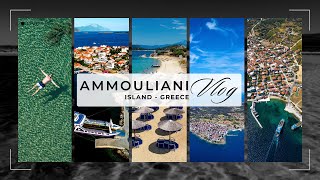
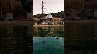
Ammouliani island in Halkidiki, Greece


![Island Ammouliani, Greece - by drone [4K]. #greekislands](https://i.ytimg.com/vi/wSgb_ifkMek/mqdefault.jpg)


Greece is classified as Developed region: nonG7: Developed economies outside of the Group of Seven, characterized by high income and advanced economic structures. The level of income is High income: OECD.
News – Latest Updates and Headlines from Nisída Ammoulianí
Stay informed with the most recent news and important headlines from Nisída Ammoulianí. Here’s a roundup of the latest developments.
Please note: The data used here has been primarily extracted from satellite readings. Deviations from exact values may occur, particularly regarding the height of elevations and population density. Land area and coastline measurements refer to average values at mean high tide.