Nisída Arkoí
Welcome to Nisída Arkoí, a Temperate island in the Aegean Sea, part of the majestic Atlantic Ocean. This guide offers a comprehensive overview of what makes Nisída Arkoí unique – from its geography and climate to its population, infrastructure, and beyond. Dive into the details:
- Geography and Size: Explore the island’s size and location.
- Climate and Weather: Weather patterns and temperature.
- Topography and Nature: Uncover the natural wonders of the island.
- Infrastructure and Travelling: Insights on reaching, staying, and making the most of your visit.
- News and Headlines: Latest News.
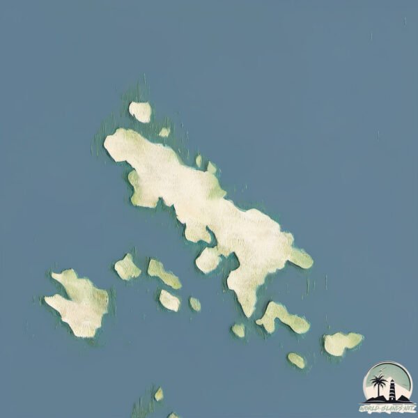
Geography and size of Nisída Arkoí
Size: 7.102 km²
Coastline: 24 km
Ocean: Atlantic Ocean
Sea: Aegean Sea
Continent: Europe
Nisída Arkoí is a Small Island spanning 7.1 km² with a coastline of 24 km.
Archipel: –
Tectonic Plate: Aegean Sea – Located in the eastern Mediterranean, this microplate is characterized by seismic and volcanic activity due to its interaction with the Eurasian and African Plates.
The geographic heart of the island is pinpointed at these coordinates:
Latitude: 37.38612143 / Longitude: 26.73400205
Climate and weather of Nisída Arkoí
Climate Zone: Temperate
Climate Details: Hot-Summer Mediterranean Climate
Temperature: Hot Summer
Climate Characteristics: Characterized by hot, dry summers and mild, wet winters, typical of coastal areas with abundant sunshine.
Topography and nature of Nisída Arkoí
Timezone: UTC+02:00
Timezone places: Europe/Mariehamn
Max. Elevation: 72 m
Mean Elevation: 33 m
Vegetation: Shrubland
Tree Coverage: 41%
The mean elevation is 33 m. The highest elevation on the island reaches approximately 72 meters above sea level. The island is characterized by Plains: Flat, low-lying lands characterized by a maximum elevation of up to 200 meters. On islands, plains are typically coastal lowlands or central flat areas.
Dominating Vegetation: Shrubland
Dominated by shrubs and small bushes, these areas are typical in dry, rocky, or sandy environments, as well as in regions with poor soil fertility. Nisída Arkoí has a tree cover of 41 %.
Vegetation: 8 vegetation zones – Very Highly Diverse Island
Islands in this range are ecological powerhouses, showcasing a wide array of vegetation zones. Each zone, from lush rainforests to arid scrublands, coastal mangroves to mountainous regions, contributes to a complex and interdependent ecosystem. These islands are often hotspots of biodiversity, supporting numerous species and intricate ecological processes.
Infrastructure and Travelling to Nisída Arkoí
Does the island have a public airport? no.
There is no public and scheduled airport on Nisída Arkoí. The nearest airport is Leros Airport, located 21 km away.
Does the island have a major port? no.
There are no major ports on Nisída Arkoí. The closest major port is LAKKI, approximately 28 km away.
The mean population of Nisída Arkoí is 67 per km². Nisída Arkoí is Gently Populated. The island belongs to Greece.
Continuing your journey, Nisí Leipsoí is the next notable island, situated merely km away.
One Single Student on the Island of Arkoi | Teacher Maria Seeks New Pupils | Oneindia News


Greece is classified as Developed region: nonG7: Developed economies outside of the Group of Seven, characterized by high income and advanced economic structures. The level of income is High income: OECD.
News – Latest Updates and Headlines from Nisída Arkoí
Stay informed with the most recent news and important headlines from Nisída Arkoí. Here’s a roundup of the latest developments.
Please note: The data used here has been primarily extracted from satellite readings. Deviations from exact values may occur, particularly regarding the height of elevations and population density. Land area and coastline measurements refer to average values at mean high tide.