Nisída Stamfáni
Welcome to Nisída Stamfáni, a Temperate island in the Ionian Sea, part of the majestic Atlantic Ocean. This guide offers a comprehensive overview of what makes Nisída Stamfáni unique – from its geography and climate to its population, infrastructure, and beyond. Dive into the details:
- Geography and Size: Explore the island’s size and location.
- Climate and Weather: Weather patterns and temperature.
- Topography and Nature: Uncover the natural wonders of the island.
- Infrastructure and Travelling: Insights on reaching, staying, and making the most of your visit.
- News and Headlines: Latest News.
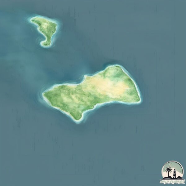
Geography and size of Nisída Stamfáni
Size: 1.193 km²
Coastline: 5.1 km
Ocean: Atlantic Ocean
Sea: Ionian Sea
Continent: Europe
Nisída Stamfáni is a Small Island spanning 1.2 km² with a coastline of 5.1 km.
Archipel: –
Tectonic Plate: Aegean Sea – Located in the eastern Mediterranean, this microplate is characterized by seismic and volcanic activity due to its interaction with the Eurasian and African Plates.
The geographic heart of the island is pinpointed at these coordinates:
Latitude: 37.24621802 / Longitude: 21.01249235
Climate and weather of Nisída Stamfáni
Climate Zone: Temperate
Climate Details: Hot-Summer Mediterranean Climate
Temperature: Hot Summer
Climate Characteristics: Characterized by hot, dry summers and mild, wet winters, typical of coastal areas with abundant sunshine.
Topography and nature of Nisída Stamfáni
Timezone: UTC+01:00
Timezone places: Europe/Paris
Max. Elevation: 6 m
Mean Elevation: -5 m
Vegetation: Evergreen Broadleaf Forest
Tree Coverage: 75%
The mean elevation is -5 m. The highest elevation on the island reaches approximately 6 meters above sea level. The island is characterized by Plains: Flat, low-lying lands characterized by a maximum elevation of up to 200 meters. On islands, plains are typically coastal lowlands or central flat areas.
Dominating Vegetation: Evergreen Broadleaf Forest
Characterized by dense, lush canopies of broadleaf trees that retain their leaves year-round. These forests are typically found in tropical and subtropical regions and are known for their high biodiversity. Nisída Stamfáni has a tree cover of 75 %.
Vegetation: 2 vegetation zones – Low Diversity Island
Islands with two distinct vegetation zones offer slightly more ecological variety. These zones could be due to differences in elevation, moisture, or other environmental factors. While still limited in biodiversity, these islands may offer a contrast between the two zones, such as a coastline with mangroves and an inland area with grassland.
Infrastructure and Travelling to Nisída Stamfáni
Does the island have a public airport? no.
There is no public and scheduled airport on Nisída Stamfáni. The nearest airport is Zakynthos International Airport Dionysios Solomos, located 57 km away.
Does the island have a major port? no.
There are no major ports on Nisída Stamfáni. The closest major port is KATAKOLON, approximately 55 km away.
The mean population of Nisída Stamfáni is 1873 per km². Nisída Stamfáni is Densely Populated. The island belongs to Greece.
Continuing your journey, Zakinthos is the next notable island, situated merely km away.
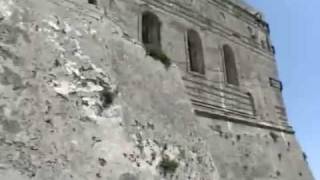
Strofades Monastery Stamfani Island


Greece is classified as Developed region: nonG7: Developed economies outside of the Group of Seven, characterized by high income and advanced economic structures. The level of income is High income: OECD.
News – Latest Updates and Headlines from Nisída Stamfáni
Stay informed with the most recent news and important headlines from Nisída Stamfáni. Here’s a roundup of the latest developments.
Please note: The data used here has been primarily extracted from satellite readings. Deviations from exact values may occur, particularly regarding the height of elevations and population density. Land area and coastline measurements refer to average values at mean high tide.